Tennessee Physical Map
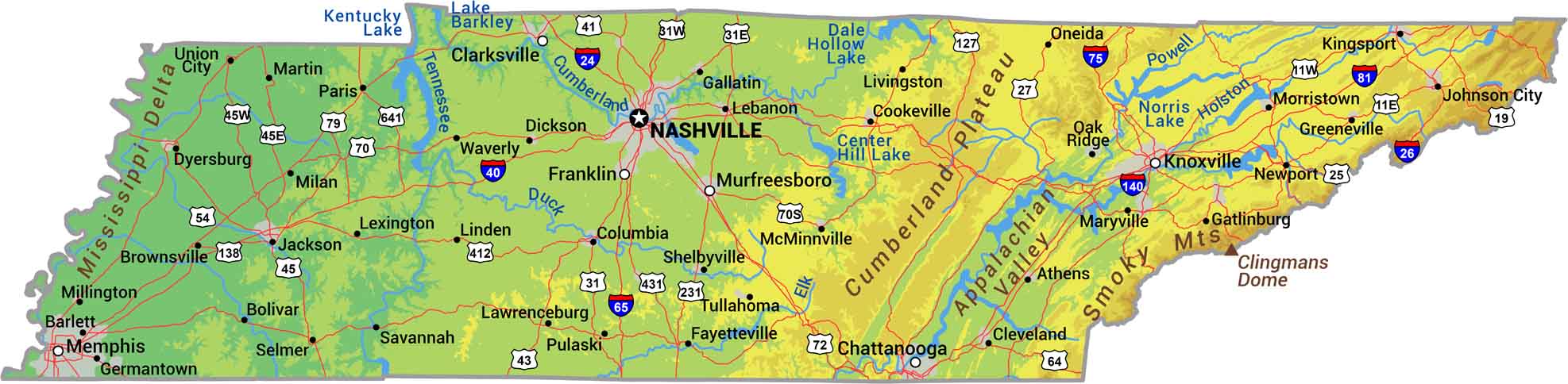
Tennessee drops from mountains to river. The Smokies rise in the east, hills roll through the middle, and the west flattens along the Mississippi. Our physical map of Tennessee shows its terrain falling from Appalachian peaks to the Mississippi Delta.
Map Information
On the Map
Physical State Maps
Select any state map below to view its physical map.


Tennessee State Maps
Here are our state maps of Tennessee.


