Home » State Maps » New Jersey Physical Map

New Jersey Physical Map

New Jersey Physical Map

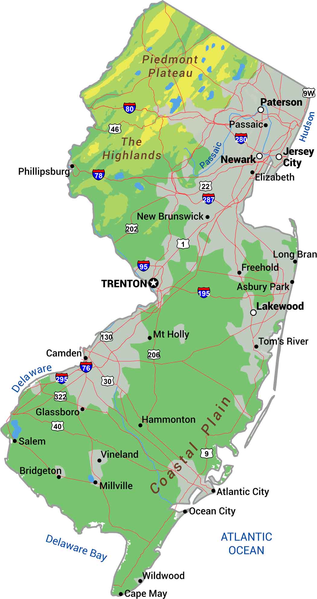
New Jersey keeps it fairly straightforward in our physical map. It runs from mountains to shore in under 150 miles. The Appalachian ridges and valleys fill the northwest corner. The middle is Piedmont, while the southeast is the Atlantic Coastal Plain.

Map Information

  • State of New Jersey
  • Physical Map of New Jersey
  • Free for personal and commercial purpose. Attribution is required. How to attribute?

On the Map

New Jersey Location Map
Physical Features: Piedmont Plateau, The Highlands, Coastal Plain State Capital: Trenton Major Cities: Jersey City, Lakewood, Newark, Paterson Cities and Towns: Asbury Park, Atlantic City, Bridgeton, Camden, Cape May, Elizabeth, Freehold, Glassboro, Hammonton, Long Branch, Millville, Mt Holly, New Brunswick, Ocean City, Passaic, Phillipsburg, Salem, Tom’s River, Vineland, Wildwood Interstate Highways: I-76, I-78, I-80, I-95, I-195, I-280, I-287, I-295 US Routes: US-1, US-9, US-9W, US-22, US-30, US-40, US-46, US-130, US-202, US-206, US-322 Rivers and Streams: Delaware River, Hudson River, Passaic River

References

  1. Shuttle Radar Topography Mission Elevation
  2. National Map TopoBuilder Application

Leave a Reply

Your email address will not be published. Required fields are marked *