Virginia Physical Map
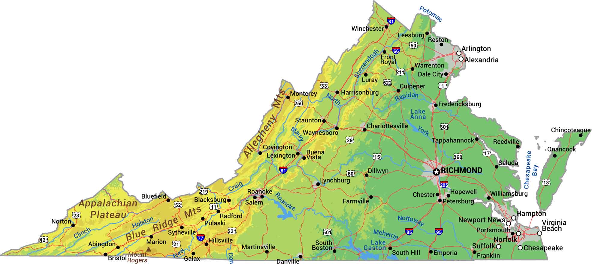
Our physical map shows the state of Virginia that climbs from tidewater to mountain peaks. You’ll see the Appalachians and Blue Ridge rise through the west. Barrier islands line the Atlantic as it drops to the Coastal Plain and Chesapeake Bay.
Map Information
On the Map
Physical State Maps
Select any state map below to view its physical map.


Virginia State Maps
Spanning coasts and mountains, here are our maps of Virginia.


