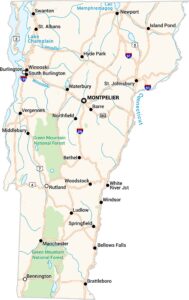
Vermont Physical Map
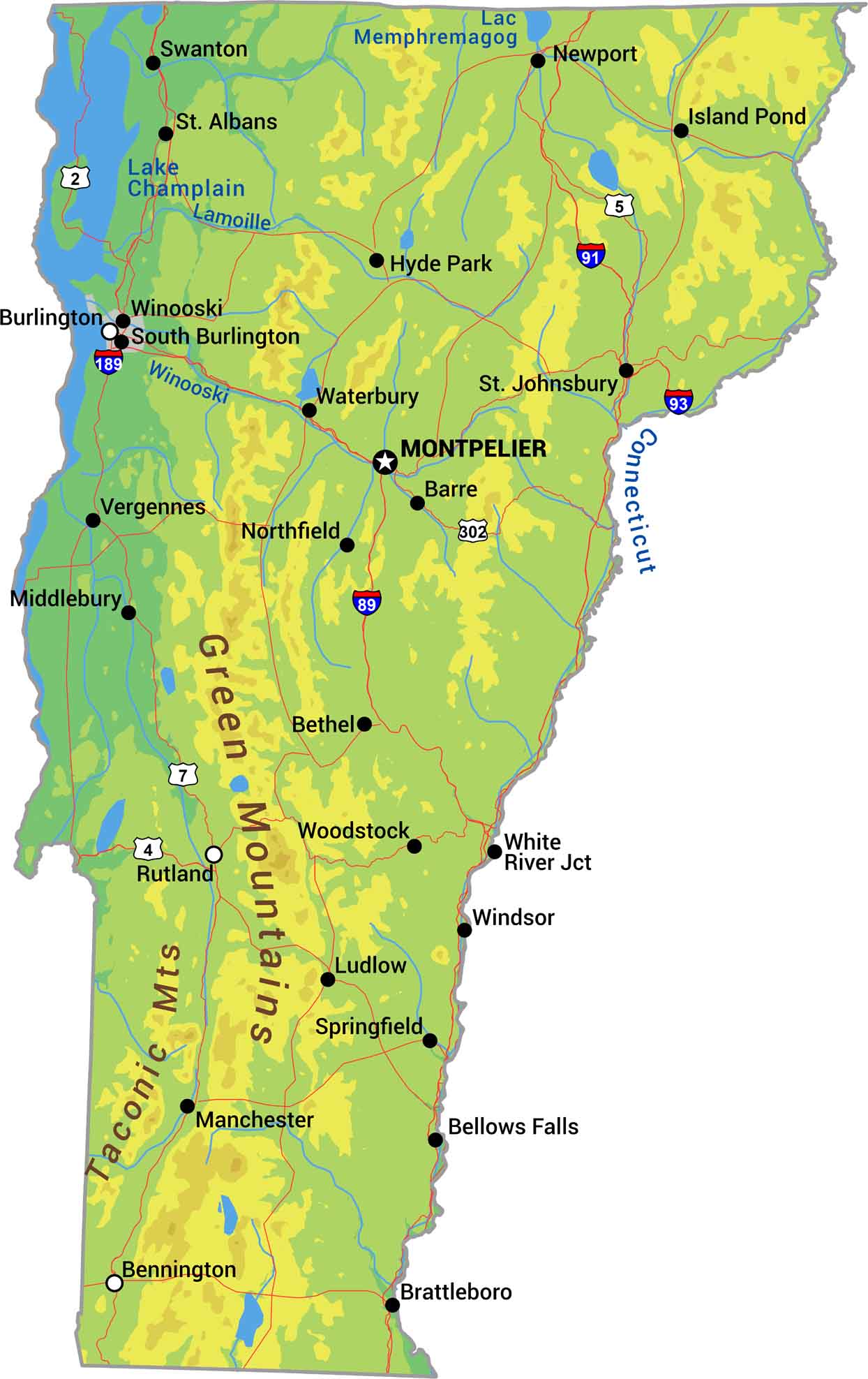
Vermont is the state of the Green Mountains. Its peaks define the state with forests covering most of the terrain between valleys. Lake Champlain forms a massive water border, and rivers like the Connecticut form the eastern border. Our Vermont physical map shows rolling highlands into New England’s most mountainous small state.
Map Information
On the Map
Physical State Maps
Select any state map below to view its physical map.


Vermont State Maps
Explore maps from the Green Mountain State.