Home » State Maps » Oklahoma Population Map

Oklahoma Population Map

Oklahoma Population Density Map

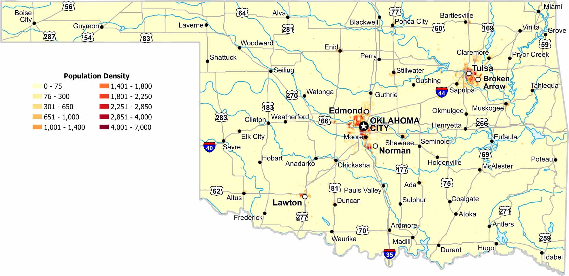
Population density in Oklahoma centers on a handful of cities. Our map shows long stretches of lightly populated plains between them as open land dominates much of the state.

Map Information

  • Population Density Map of Oklahoma
  • Data provided by NASA SEDAC Gridded Population of the World
  • Free for personal and commercial purpose. Attribution is required. How to attribute?

On the Map

Oklahoma Location Map
State Capital: Oklahoma City Major Cities: Broken Arrow, Edmond, Lawton, Norman, Tulsa Cities and Towns: Ada, Altus, Alva, Anadarko, Antlers, Ardmore, Atoka, Bartlesville, Blackwell, Boise City, Chickasha, Claremore, Clinton, Coalgate, Cushing, Duncan, Durant, Elk City, Enid, Eufaula, Frederick, Grove, Guthrie, Guymon, Henryetta, Hobart, Holdenville, Hugo, Idabel, Laverne, Madill, McAlester, Miami, Moore, Muskogee, Okmulgee, Pauls Valley, Perry, Ponca City, Poteau, Pryor Creek, Sapulpa, Sayre, Seiling, Seminole, Shattuck, Shawnee, Stillwater, Sulphur, Tahlequah, Vinita, Watonga, Waurika, Weatherford, Woodward Interstate Highways: I-35, I-40, I-44 US Routes: US-54, US-56, US-59, US-60, US-62, US-64, US-66, US-69, US-70, US-75, US-77, US-81, US-83, US-169, US-177, US-183, US-259, US-266, US-270, US-271, US-277, US-281, US-283, US-287, US-377, US-385, US-412

Leave a Reply

Your email address will not be published. Required fields are marked *