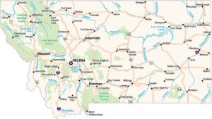
Montana Physical Map
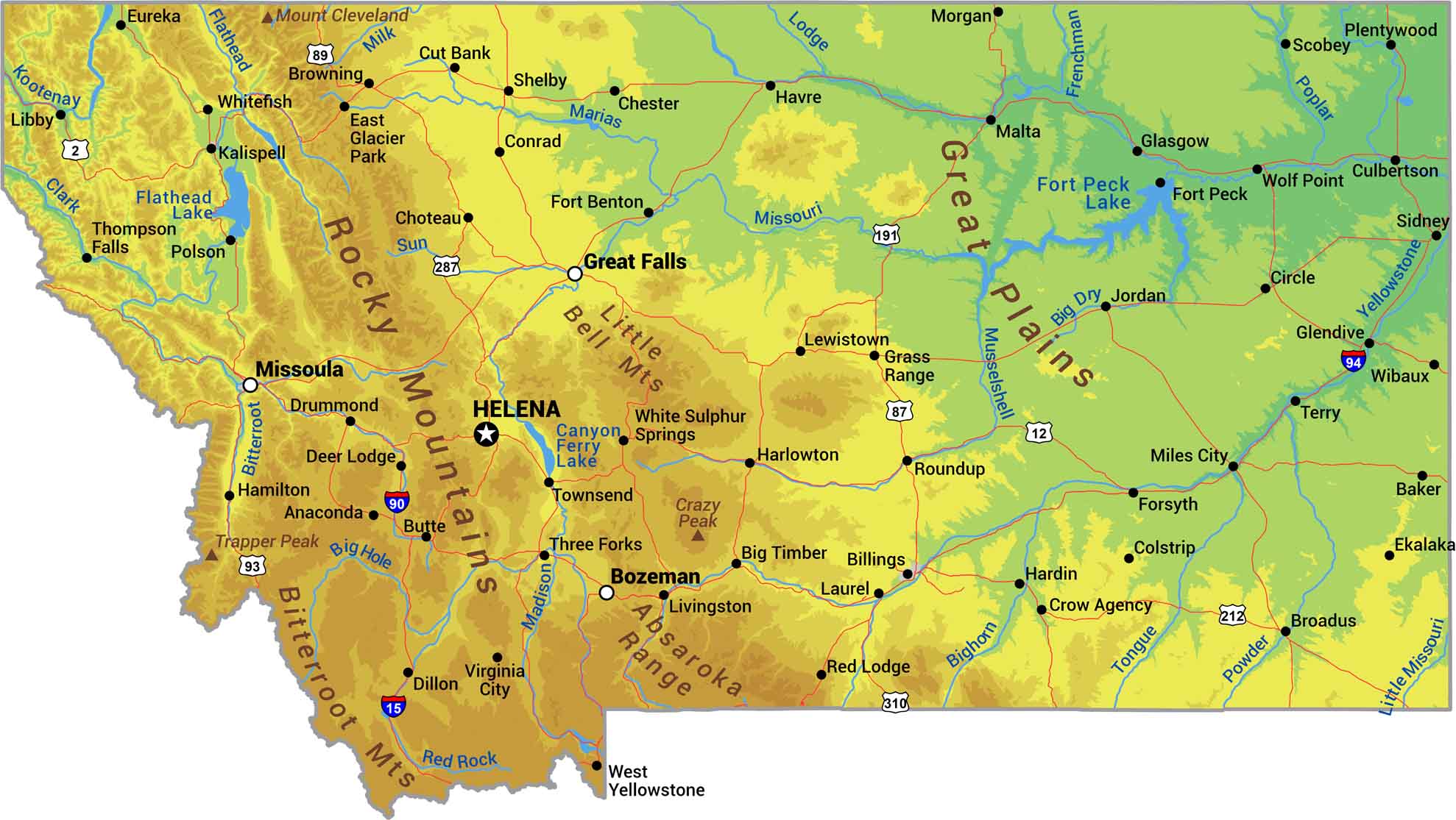
Our physical map of Montana shows a state split by the Rockies. The western third is pure mountain territory including the Bitterroots, Absarokas, and peaks of Glacier National Park. East of the Continental Divide, the land drops into Great Plains grassland that rolls toward the Dakotas.
Map Information
On the Map
Physical State Maps
Select any state map below to view its physical map.


Montana State Maps
Wander through this wide-open state with our map collection.