Capitol Hill Map, Seattle
Our map of Capitol Hill highlights one of Seattle’s most exciting neighborhoods. You’ll find the main streets and local parks.
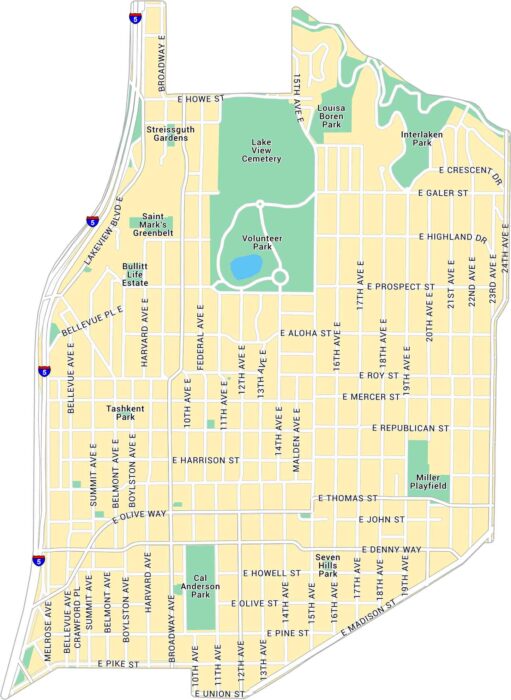
Our map of Capitol Hill highlights one of Seattle’s most exciting neighborhoods. You’ll find the main streets and local parks.
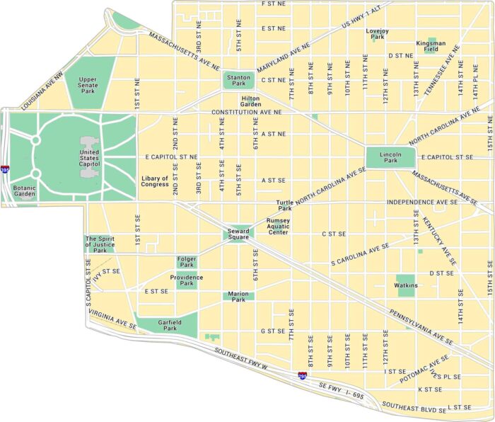
Our map of Capitol Hill focuses on the streets surrounding the U.S. Capitol. It includes major roads, parks, and the major attractions.
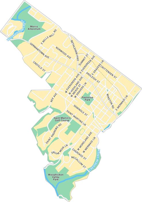
Our map of Chestnut Hill highlights the business district in northwest Philadelphia. You’ll also find local parks and city streets.
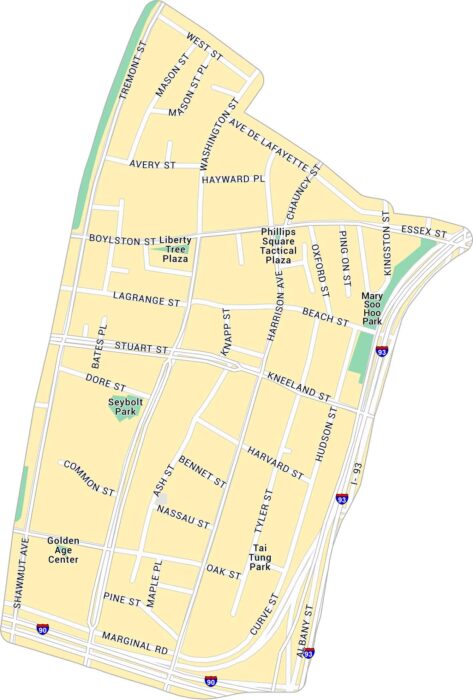
Take a look at our map of Chinatown, one of Boston’s most historic neighborhoods. It details the compact streets, highways, and parks.
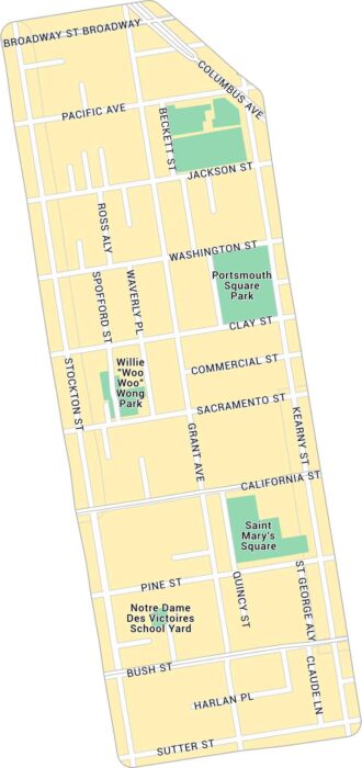
Our map of Chinatown in San Francisco highlights the narrow streets. It shows main routes and local parks.
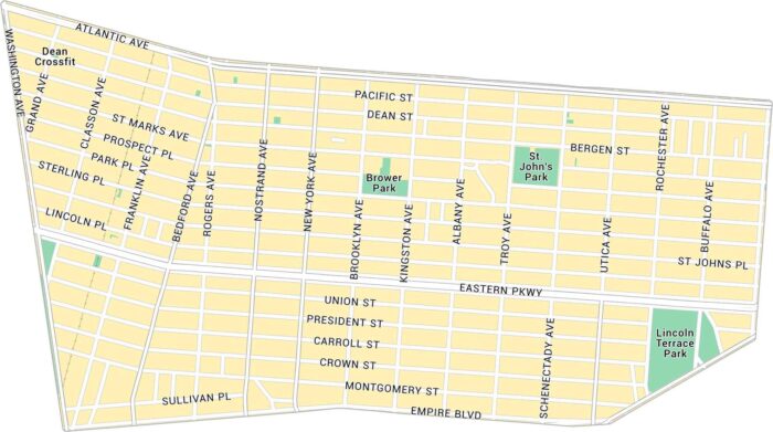
Here’s our map of Crown Heights covering this lively part of central Brooklyn. You’ll see main avenues and local parks.
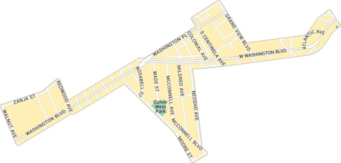
Our map of Culver West shows the streets and parks tucked into the west side of Culver City. It includes neighborhood roads and green spaces.
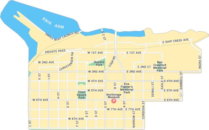
Anchorage is in southern Alaska along the Cook Inlet. Our map of Downtown Anchorage gives a close look at the streets near the waterfront.
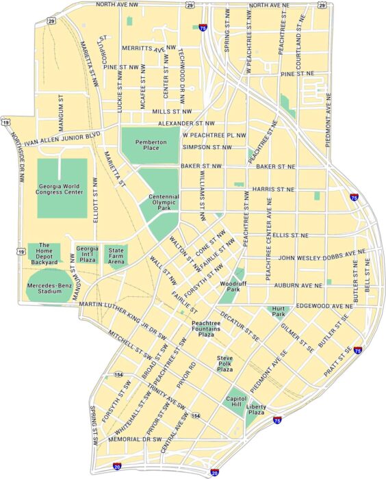
Here’s our map of Downtown Atlanta showing the State Capitol and Centennial Park. You’ll find interstates, streets, and green spaces.
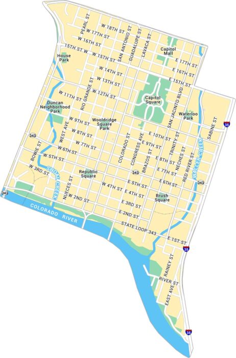
Austin lies in central Texas. Our map of Downtown Austin brings the Capitol, riverfront, and Sixth Street area into view.
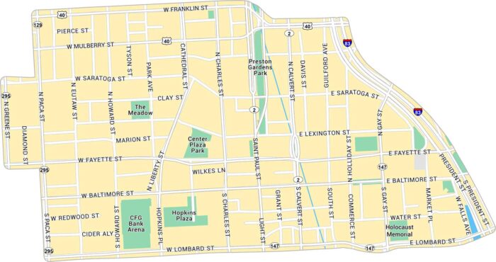
Baltimore sits on the Chesapeake Bay, a major hub in Maryland’s coastal region. This map includes interstates, parks, and local roads.
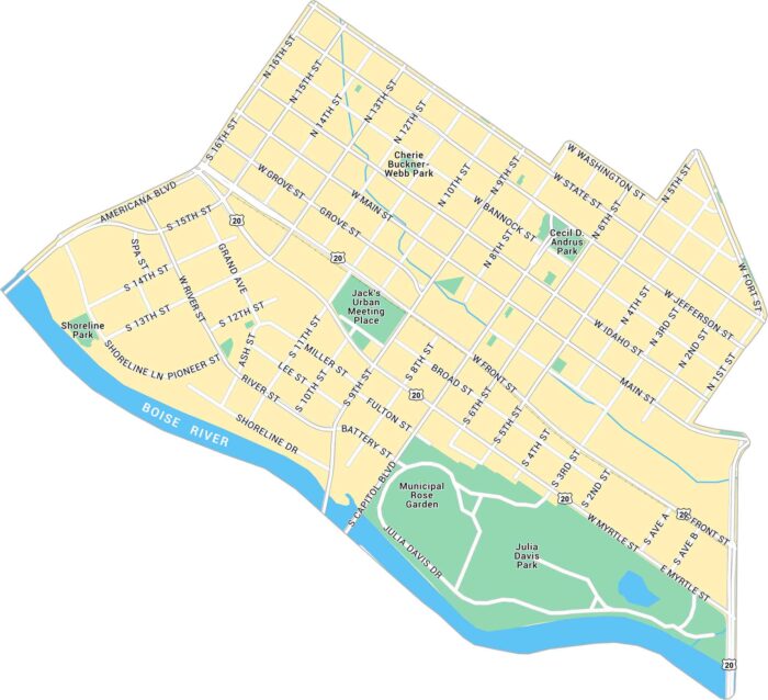
Our map of Downtown Boise highlights from Boise River to the Capitol and city center. You’ll find the main roads, local parks and highways.
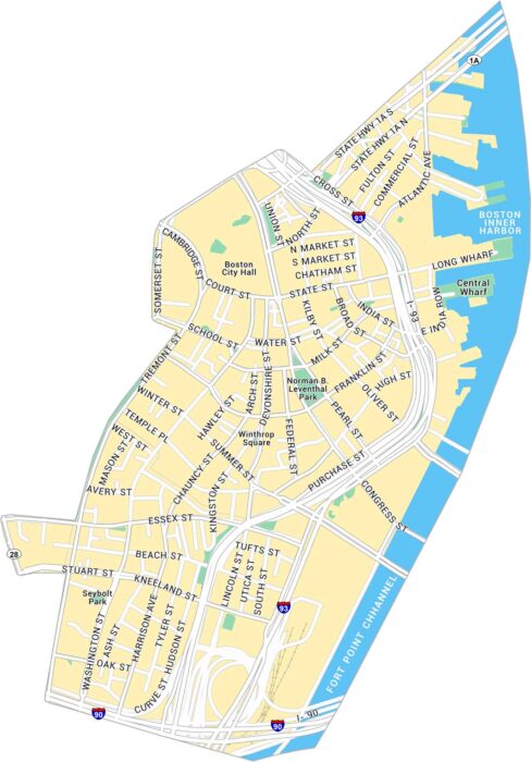
See how Downtown Boston fits together with this detailed map. It covers historic streets, waterfront areas, and local parks.
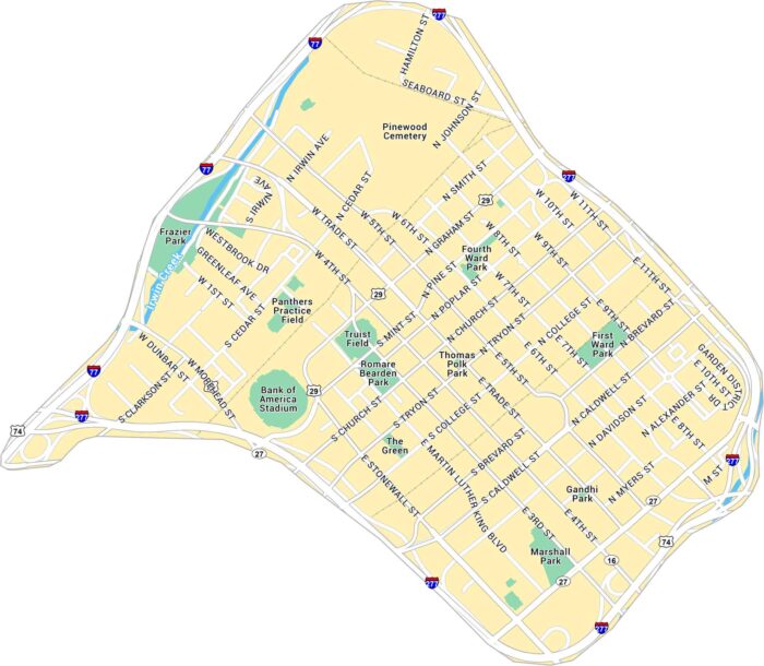
Our map of Downtown Charlotte outlines the blocks around Trade and Tryon Street. It includes main roads, green spaces, and highways.
Here’s our map of Downtown Chattanooga located near the Tennessee River. It highlights key roads, local parks, and state highways.