Downtown Austin Map
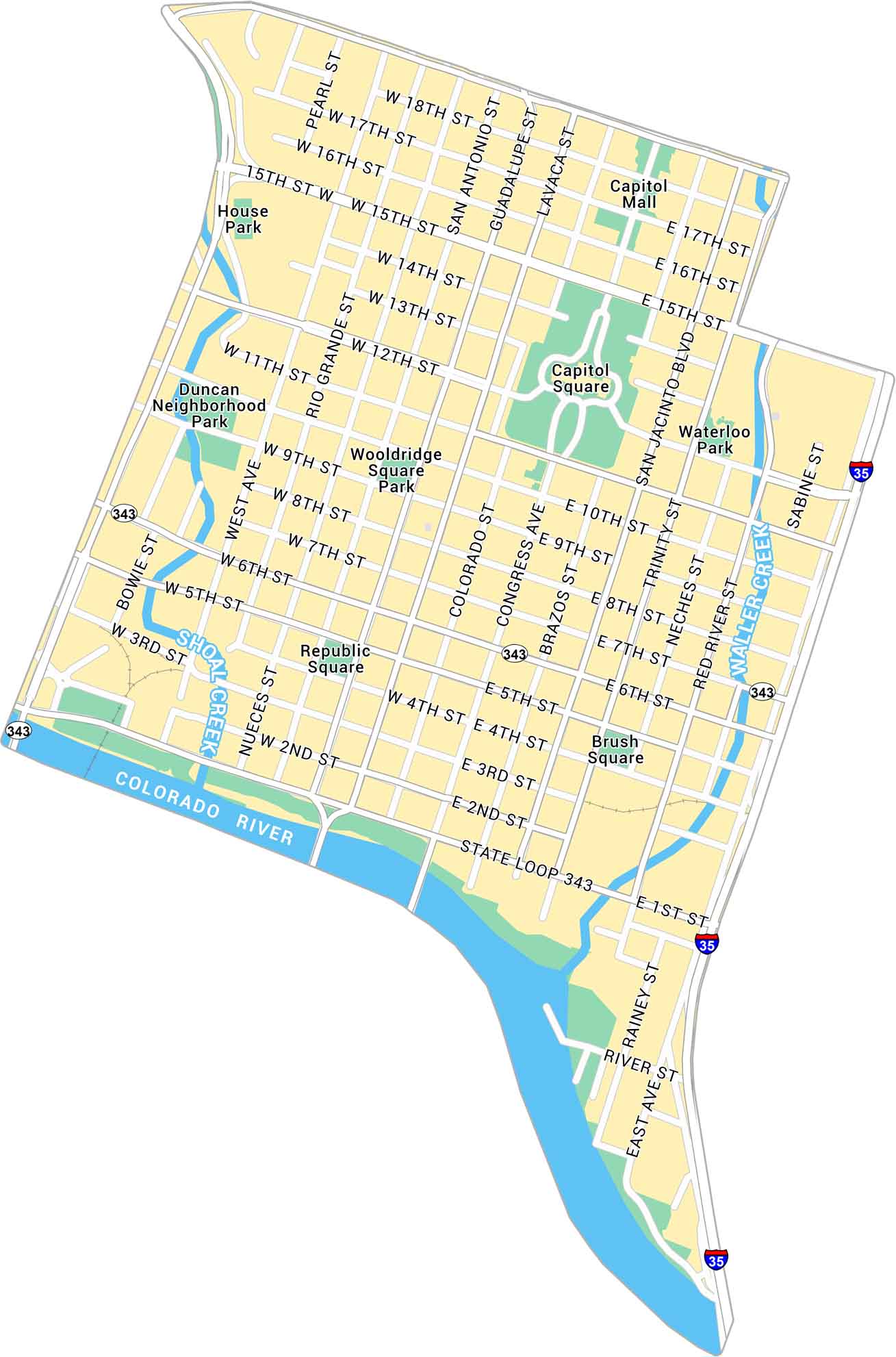
Austin lies in central Texas, between rolling hills and the Colorado River. Our map of Downtown Austin brings the Capitol, riverfront, and Sixth Street area into view.
Map Information
On the Map
Interstates/Highways: I-35, State Loop 343 Major Roads: Congress Ave, San Jacinto Blvd, Guadalupe St, Lavaca St, Brazos St, Colorado St, Trinity St, Neches St, Red River St, Sabine St, Rainey St, West Ave, Rio Grande St, Nueces St, San Antonio St, 6th St, 11th St, 15th St, Cesar Chavez St, MLK Jr Blvd Major Rivers: Colorado River, Shoal Creek, Waller Creek Parks: Wooldridge Square Park, Duncan Neighborhood Park, Waterloo Park Landmarks: Capitol Square, Republic Square, Brush Square, House Park, Capitol MallCity Maps of Texas
Explore our map collection of Texas cities.


