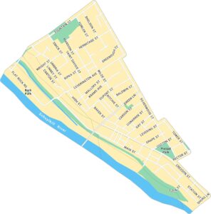
Chestnut Hill Map, Philadelphia
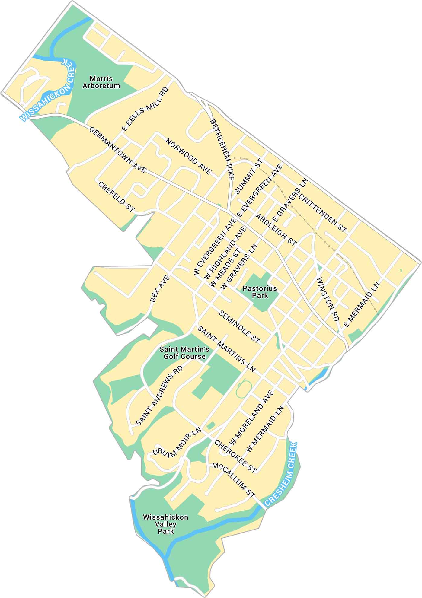
Our map of Chestnut Hill highlights the business district in northwest Philadelphia. You’ll also find local parks and streets connecting to Mount Airy and Wissahickon Valley Park.
Map Information
Philadelphia Neighborhood Maps
See our neighborhood maps for a closer look of the city.
On the Map
Major Roads: Germantown Ave, Bethlehem Pike, Bells Mill Rd, Norwood Ave, Evergreen Ave, Highland Ave, Gravers Ln, Crefeld St, Rex Ave, Seminole St, Saint Martins Ln, Moreland Ave, Mermaid Ln, Cherokee St, McCallum St, Winston Rd, Crittenden St, Ardleigh St, Summit St, Meade St Creeks/Rivers: Wissahickon Creek, Cresheim Creek Parks: Pastorius Park, Wissahickon Valley Park Landmarks: Saint Martin’s Golf Course, Morris ArboretumCity Maps of Pennsylvania
Here is our city map collection for all of Pennsylvania.


