Downtown Chattanooga Map
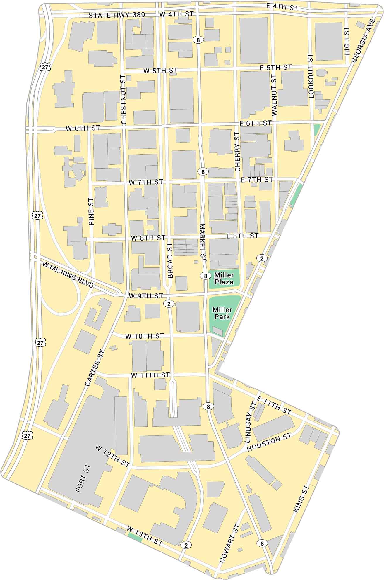
Here’s our map of Downtown Chattanooga located near the Tennessee River. It highlights key roads, local parks, and state highways.
Map Information
On the Map
Interstates/Highways: I-27, US Hwy 2, State Hwy 389, US Hwy 8 Major Roads: ML King Blvd, Market St, Broad St, Carter St, Georgia Ave, Chestnut St, Pine St, Lookout St, Walnut St, Cherry St, High St, 4th St, 5th St, 6th St, 7th St, 8th St, 9th St, 10th St, 11th St, 12th St Parks: Miller Plaza, Miller ParkCity Maps of Tennessee
Explore our Tennessee map collection


