Downtown Atlanta Map
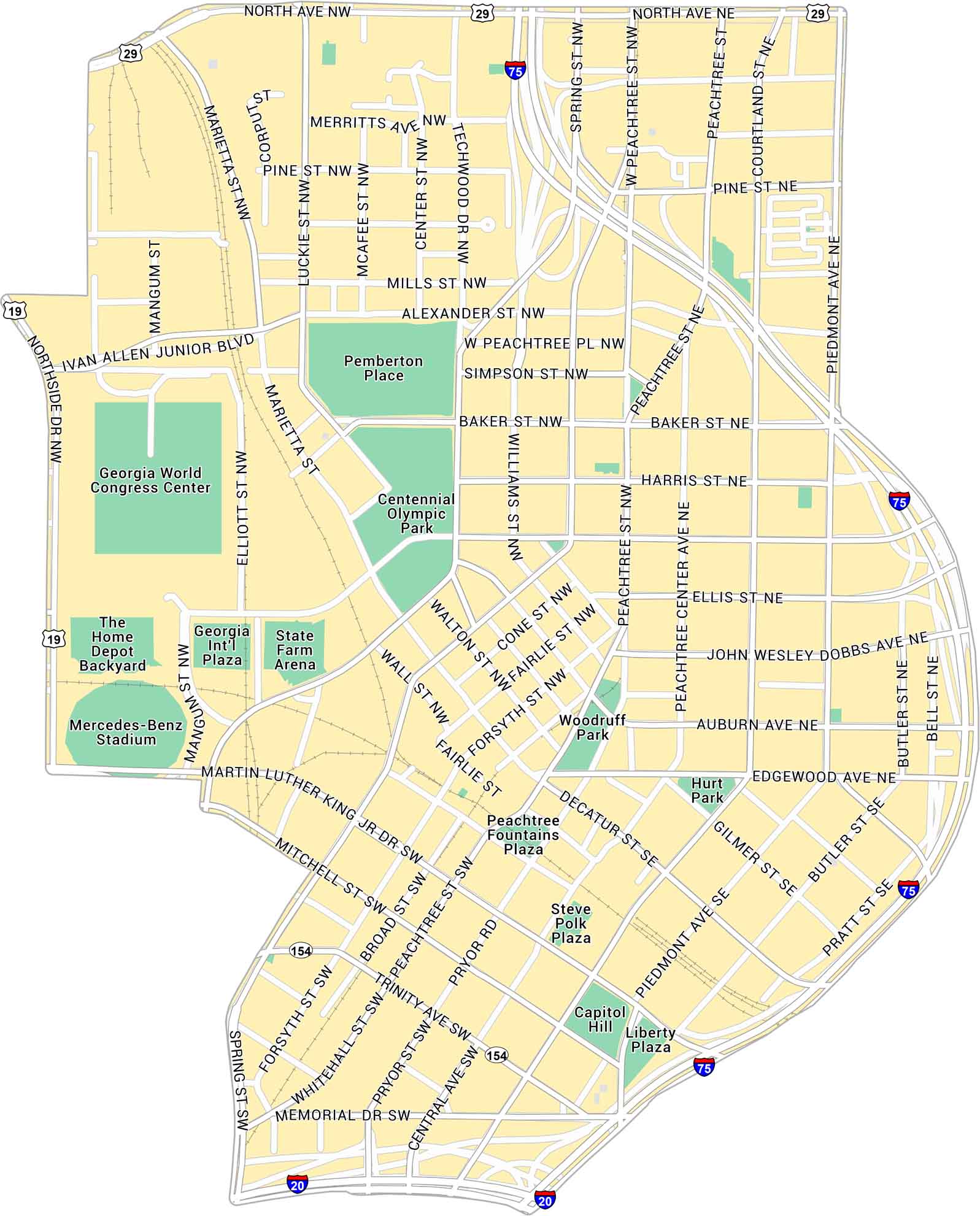
Here’s our map of Downtown Atlanta showing the blocks around the State Capitol and Centennial Park. You’ll find interstates, city streets, and green spaces spread through the urban core.
Map Information
On the Map
Interstates/Highways: I-75, I-20, US Hwy 29, State Rte 19, State Rte 154 Major Roads: Peachtree St, Piedmont Ave, North Ave, Ivan Allen Junior Blvd, Martin Luther King Jr Dr, Marietta St, Spring St, West Peachtree St, Courtland St, Centennial Olympic Park Dr, Luckie St, Techwood Dr, Wall St, Forsyth St, Broad St, Mitchell St, Memorial Dr, Central Ave, Pryor Rd, Trinity Ave Major Rivers: Parks: Centennial Olympic Park, Pemberton Place, Woodruff Park, Hurt Park, Liberty Plaza Landmarks: Georgia World Congress Center, Mercedes-Benz Stadium, State Farm Arena, The Home Depot Backyard, Georgia Int’l Plaza, Peachtree Fountains Plaza, Steve Polk Plaza, Capitol HillGeorgia City Maps
Get to know Atlanta and Georgia’s urban areas


