Downtown Charlotte Map
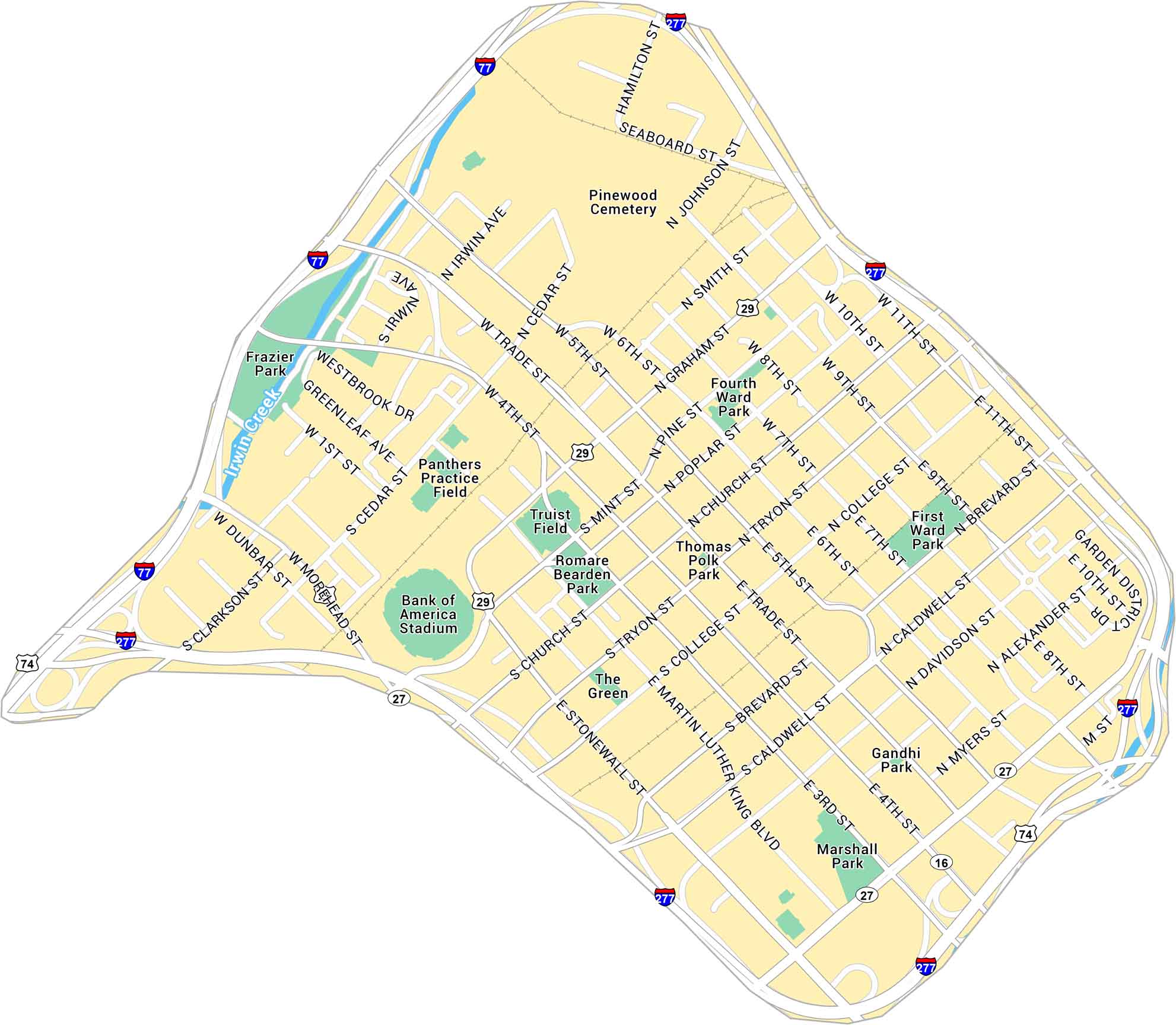
Our map of Downtown Charlotte outlines the blocks around Trade and Tryon Street. It includes main roads, green spaces, and surrounding highways.
Map Information
On the Map
Interstates/Highways: I-77, I-277, US Hwy 29, US Hwy 74, State Rte 16, State Rte 27 Major Roads: Trade St, Tryon St, Morehead St, Martin Luther King Blvd, Graham St, College St, Church St, Caldwell St, Davidson St, Mint St, 4th St, 5th St, 6th St, 11th St, McDowell St, Alexander St, Myers St, Brevard St, Poplar St, Cedar St Creeks/Rivers: Irwin Creek Parks: Romare Bearden Park, Fourth Ward Park, First Ward Park, Frazier Park, Marshall Park, Thomas Polk Park, Gandhi Park Landmarks: Bank of America Stadium, Truist Field, Pinewood Cemetery, The Green, Panthers Practice FieldCity Maps of North Carolina
Journey through North Carolina with our city maps


