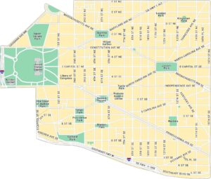
Capitol Hill Map, Washington DC

Our map of Capitol Hill focuses on the streets surrounding the U.S. Capitol. It includes major roads, parks, and the major attractions in the area.
Map Information
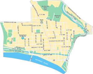
Washington DC Neighborhood Maps
See our neighborhood maps for a closer look of the city.
On the Map
Interstates/Highways: I-395, I-295, I-695 Major Roads: Pennsylvania Ave, Massachusetts Ave, Independence Ave, Constitution Ave, Maryland Ave, Louisiana Ave, Southeast Fwy, Southeast Blvd, North Carolina Ave, South Carolina Ave, Kentucky Ave, Potomac Ave, Virginia Ave, 1st St, 2nd St, 3rd St, 4th St, 5th St, 6th St, 7th St Parks: Lincoln Park, Stanton Park, Folger Park, Garfield Park, Marion Park, Providence Park, Turtle Park, Upper Senate Park, Spirit of Justice Park, Lovejoy Park, Kingsman Field Landmarks: United States Capitol, Botanic Garden, Library of Congress, Rumsey Aquatic Center, Hilton Garden, WatkinsDistrict of Columbia Maps
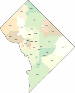
Select any District of Columbia map below to view its layout.