Capitol Hill Map, Seattle
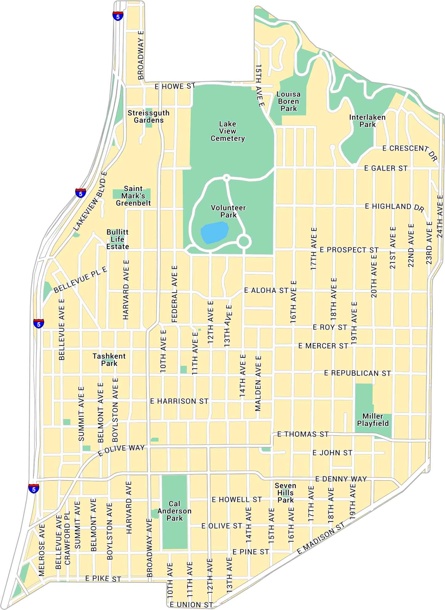
Our map of Capitol Hill highlights one of Seattle’s most exciting neighborhoods. You’ll find the main streets, local parks, and routes that link the hilltop to downtown and Lake Union.
Map Information
Seattle Neighborhood Maps
See our neighborhood maps for a closer look of the city.

On the Map
Interstates/Highways: I-5 Major Roads: Broadway, Madison St, Olive Way, Pike St, Union St, Denny Way, John St, Thomas St, Harrison St, Republican St, Mercer St, Roy St, Aloha St, Galer St, 10th Ave, 12th Ave, 15th Ave, 19th Ave, 23rd Ave, 24th Ave Parks: Volunteer Park, Cal Anderson Park, Miller Playfield, Interlaken Park, Louisa Boren Park, Seven Hills Park, Tashkent Park, Saint Mark’s Greenbelt, Streissguth Gardens Landmarks: Lake View Cemetery, Bullitt Life EstateCity Maps of Washington
Check out our city maps of Washington


