Arkansas Physical Map
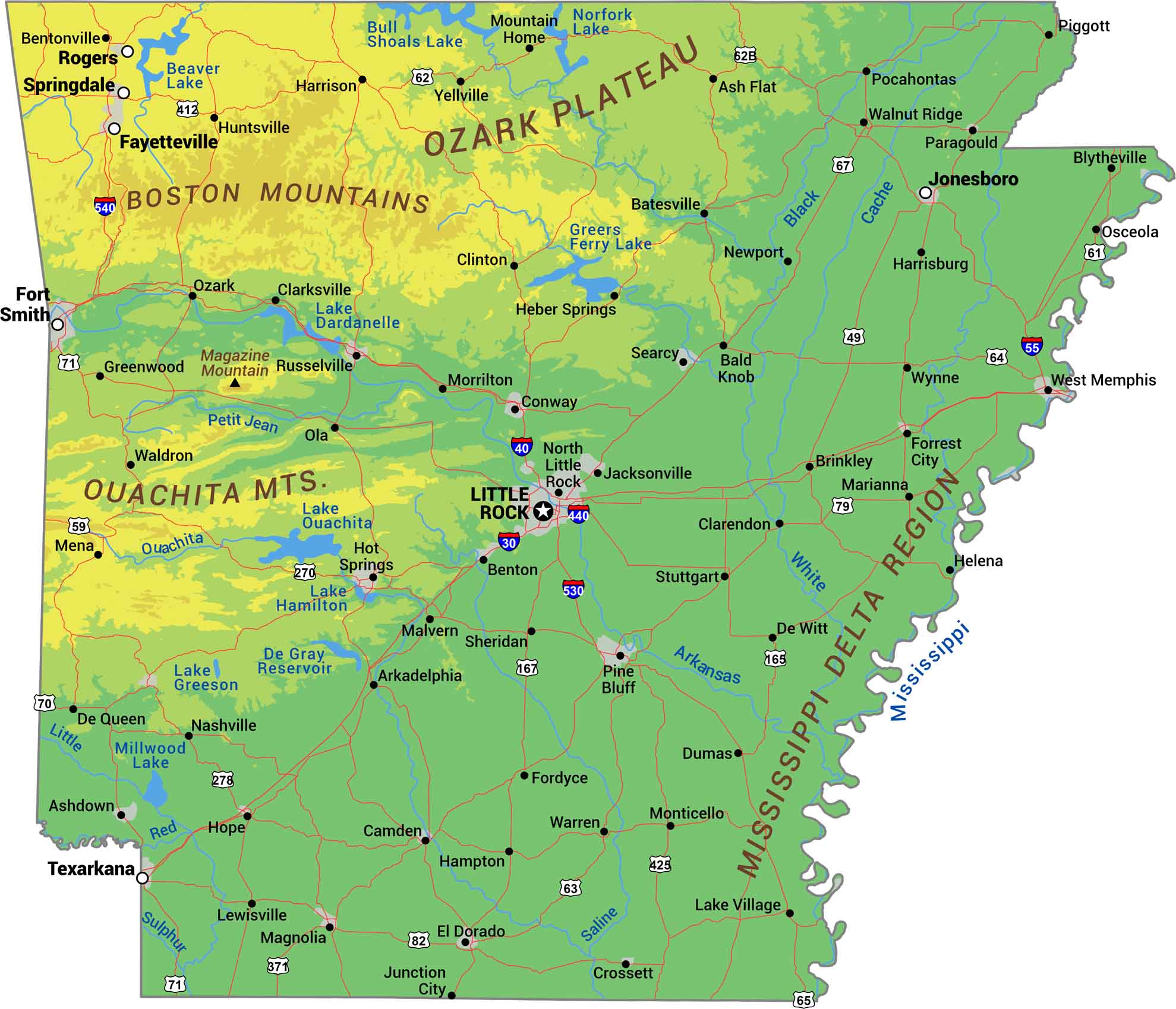
Our Arkansas physical map displays its shift from mountains to delta. The Ozark Plateau and Ouachita Mountains hold the north and west. Eastern Arkansas flattens into the Mississippi Delta, some of the richest farmland in America. Rivers like the Arkansas and White cut through it all, shaping everything from forests to floodplains.
Map Information
On the Map
Physical State Maps
Select any state map below to view its physical map.


