Texas Outline Map
Texas has sharp angles, long borders, and a wide curve along the Gulf Coast. The outline is large and very recognizable for US states.
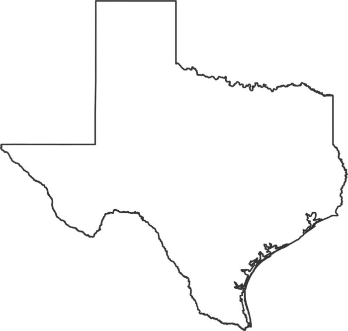
Texas has sharp angles, long borders, and a wide curve along the Gulf Coast. The outline is large and very recognizable for US states.
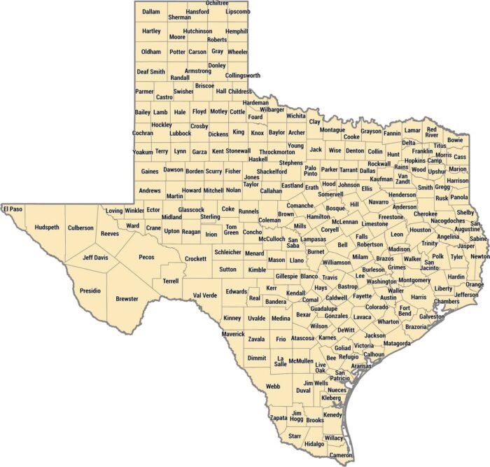
Nothing explains Texas’ size better than a county map. With 254 counties, Texas has more than any other state by far.
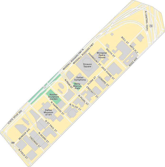
Our Dallas Arts District map focuses on the stretch near Klyde Warren Park. You’ll see the museums, concert halls, and nearby city streets.
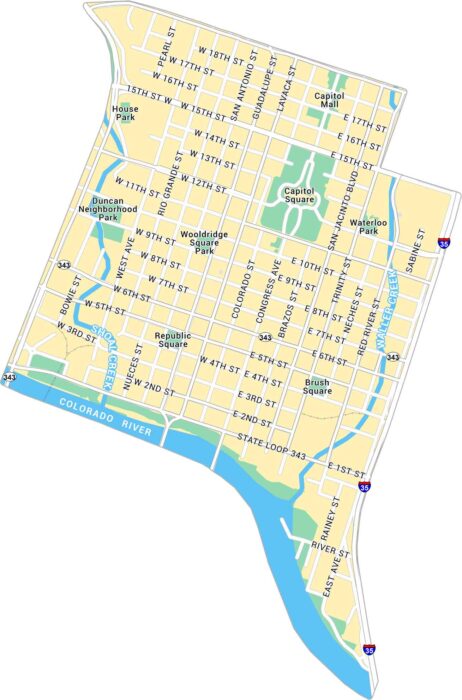
Austin lies in central Texas. Our map of Downtown Austin brings the Capitol, riverfront, and Sixth Street area into view.
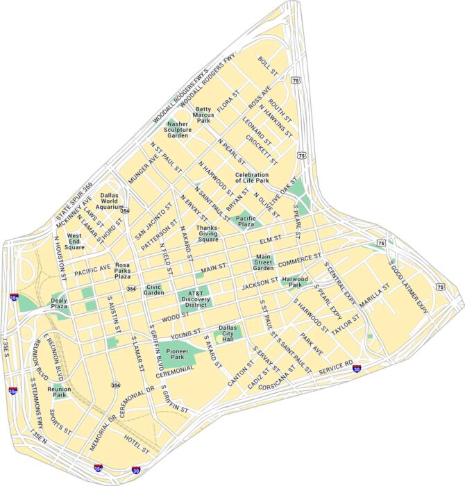
Our map of Downtown Dallas gives you a full look at the city’s core. You’ll find parks, railways and all the main routes through downtown.
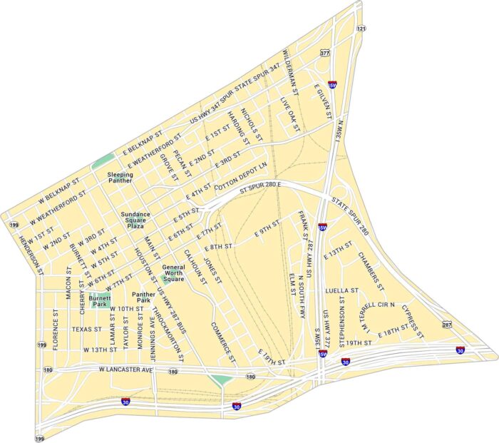
Explore Downtown Fort Worth with this detailed map. You can spot Sundance Square and all the streets leading toward the Stockyards.
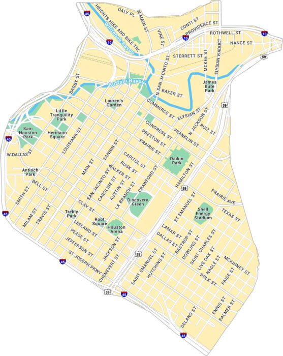
This map of Downtown Houston shows freeways and light rail lines. From Discovery Green to Buffalo Bayou, you can see it all on our map.
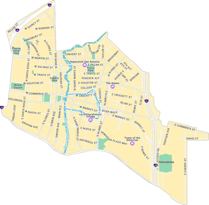
Our map of Downtown San Antonio shows the area surrounding the River Walk and Alamo Plaza. It shows streets, parks, and the river loops.
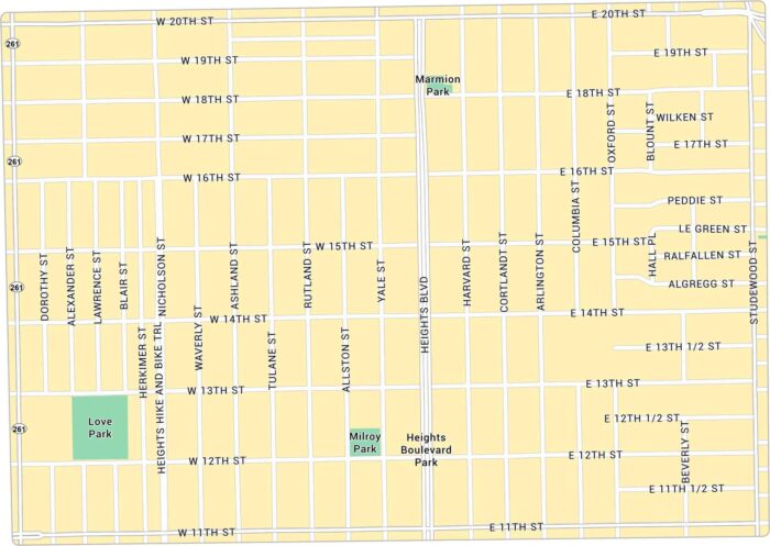
Houston Heights rises just above downtown with a bit of a small-town feel. Our map lays out its green corners and main routes.
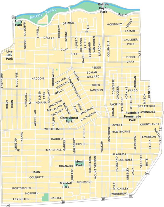
Our map of Montrose shows the central Houston neighborhood west of downtown. It highlights main streets and local parks.
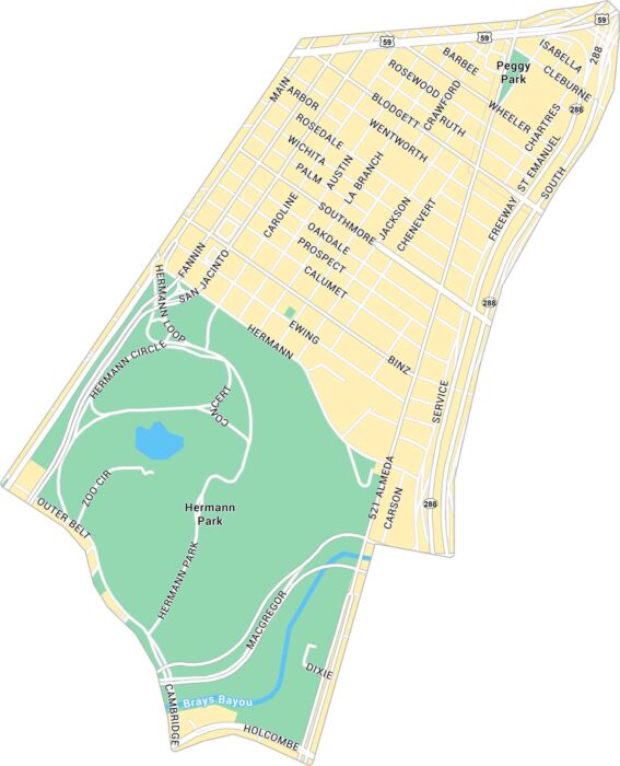
Our map of the Museum District shows this neighborhood near Hermann Park. It highlights all the major streets connecting through the district.
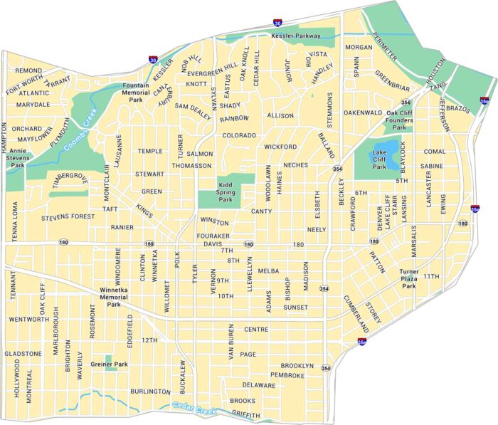
Our map of Oak Cliff shows the large, historic area just southwest of downtown Dallas. It highlights major roads, parks, and neighborhoods.
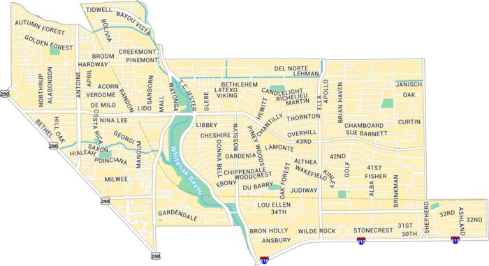
Oak Forest is located in northwest Houston. As you can see on our map of Oak Forest, it’s a residential area with the White Oak Bayou in it.
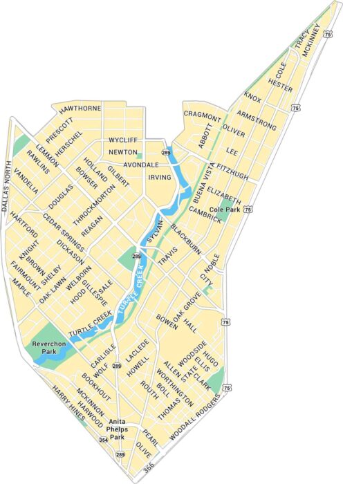
Oak Lawn sits just northwest of downtown Dallas. Our map of Oak Lawn shows its road network and Turtle Creek.
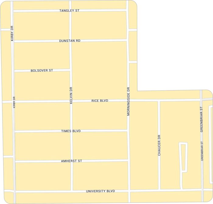
Rice Village sits west of Rice University. Our map highlights its network of roads. You can find it between Kirby Drive and University Blvd.