Oak Lawn Map, Dallas
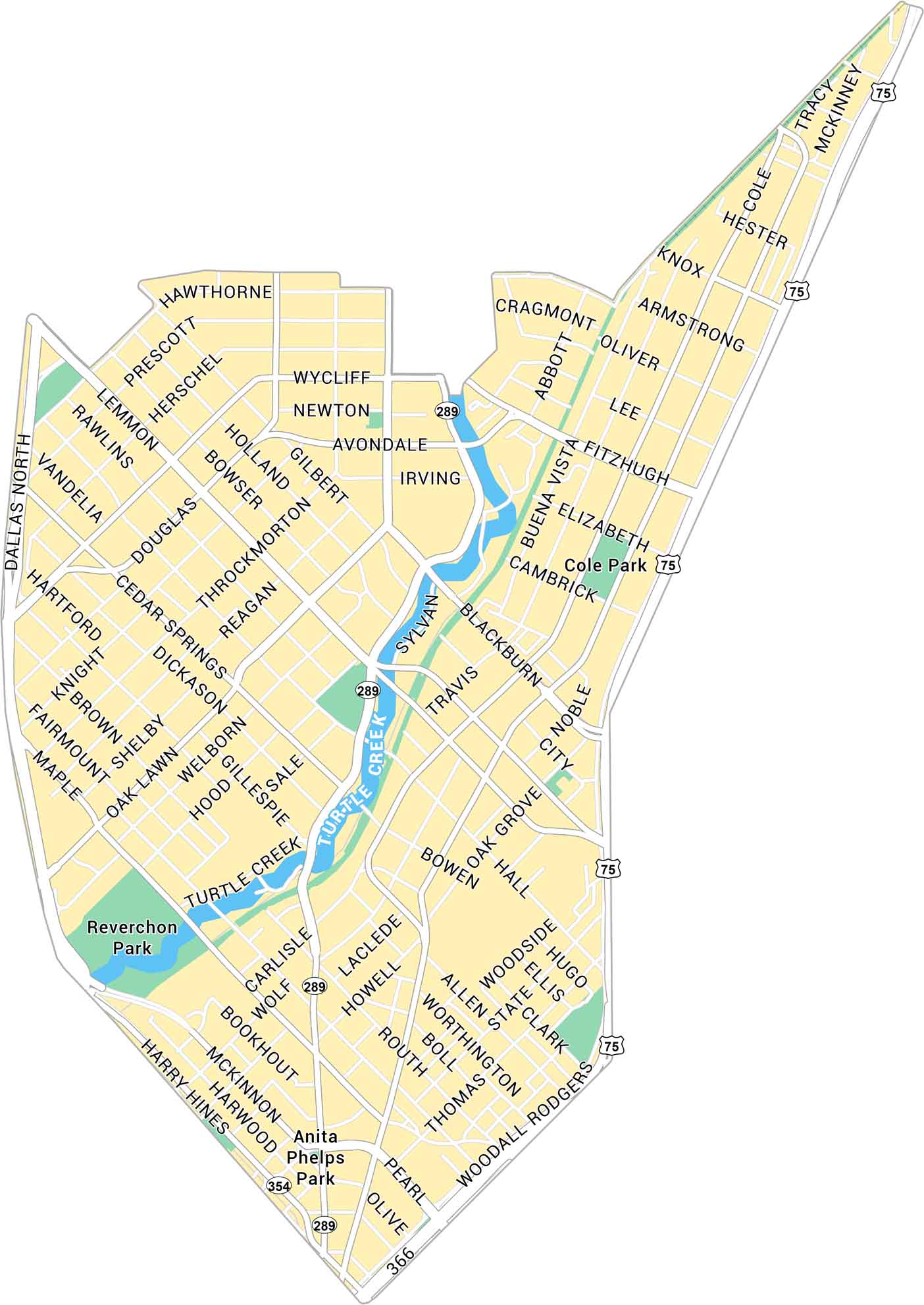
Oak Lawn sits just northwest of downtown Dallas. It’s a busy area with parks, main roads, and streets connecting across the city. Our map of Oak Lawn shows its road network and Turtle Creek.
Map Information
Dallas Neighborhood Maps
See our neighborhood maps for a closer look of the city.
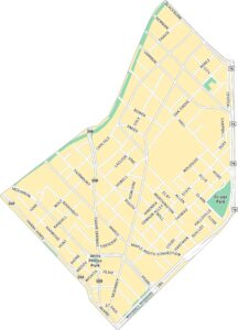
On the Map
Interstates/Highways: US Hwy 75, Woodall Rodgers Fwy, State Spur 366, US Hwy 354, State Rte 289 Major Roads: Oak Lawn Ave, Cedar Springs Rd, Lemmon Ave, Turtle Creek Blvd, Maple Ave, Harry Hines Blvd, Blackburn St, Fitzhugh Ave, Wycliff Ave, Congress Ave, Hall St, Bowen St, Knight St, Douglas Ave, Reagan St, Throckmorton St, Rawlins St, Welborn St, Gillespie St, Sale St Major Rivers: Turtle Creek Parks: Reverchon Park, Cole Park, Anita Phelps ParkCity Maps of Texas
Explore our map collection of Texas cities.


