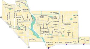
Montrose Map, Houston
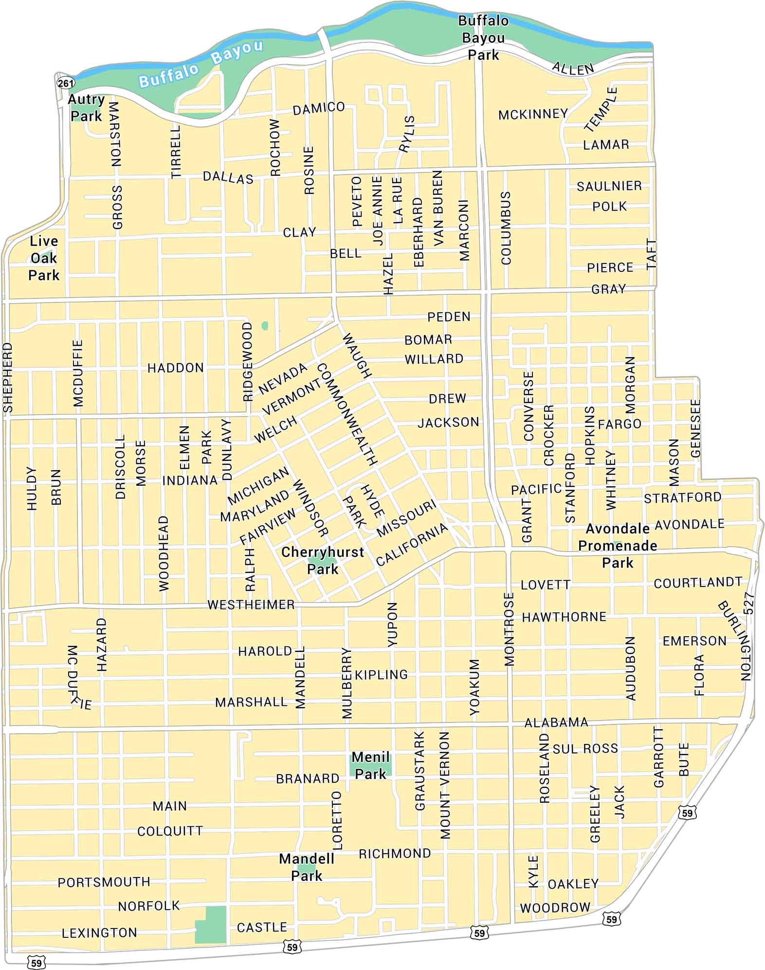
Our map of Montrose shows the central Houston neighborhood west of downtown. It highlights main streets and local parks within this busy corridor. Buffalo Bayou forms the northern edge of the neighborhood.
Map Information
Houston Neighborhood Maps
See our neighborhood maps for a closer look of the city.
On the Map
Interstates/Highways: US Hwy 59 Major Roads: Westheimer Rd, Montrose Blvd, Richmond Ave, Alabama St, Main St, Shepherd Dr, Waugh Dr, Commonwealth St, Yoakum Blvd, Graustark St, Woodhead St, Dunlavy St, Mandell St, Mulberry St, Yupon St, Mt Vernon St, Roseland St, Taft St, Stanford St, Genesee St Major Rivers: Buffalo Bayou Landmarks: Buffalo Bayou Park, Autry Park, Live Oak Park, Cherryhurst Park, Menil Park, Mandell Park, Avondale Promenade ParkCity Maps of Texas
Explore our map collection of Texas cities.


