Ohio Lakes and Rivers Map
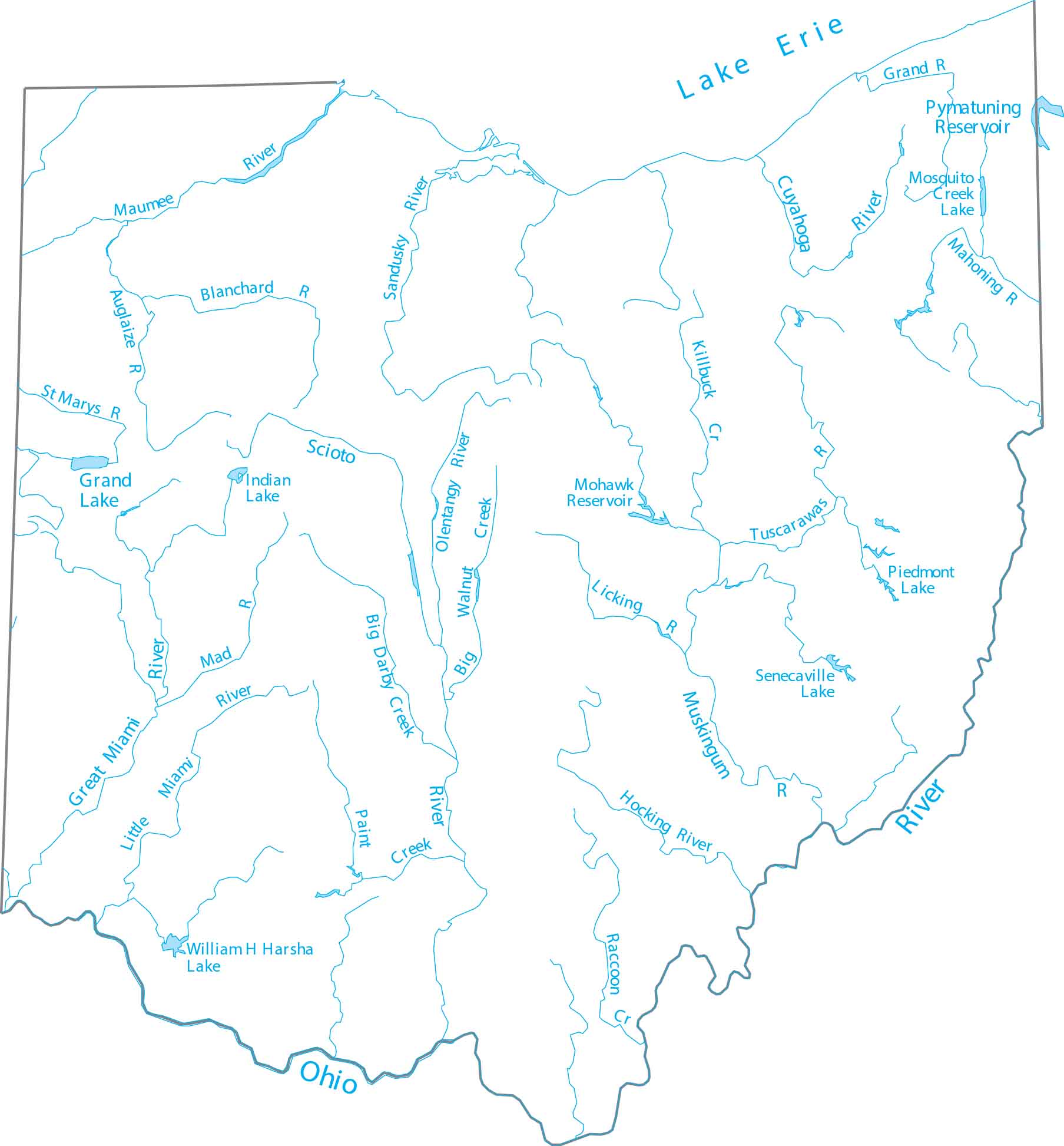
See how the state’s water moves between the Great Lakes basin and the Mississippi watershed. Our map highlights the Scioto and Miami rivers flowing toward the south. Ohio is bounded by the Ohio River to the south and Lake Erie in the north.
Map Information
On the Map
Lakes and Rivers State Maps
Select any state map below to view its lakes and rivers map.


Ohio State Maps
Check out our maps covering farmland or any of Ohio’s major cities.


