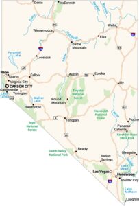
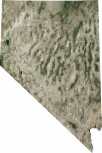
Nevada Physical Map
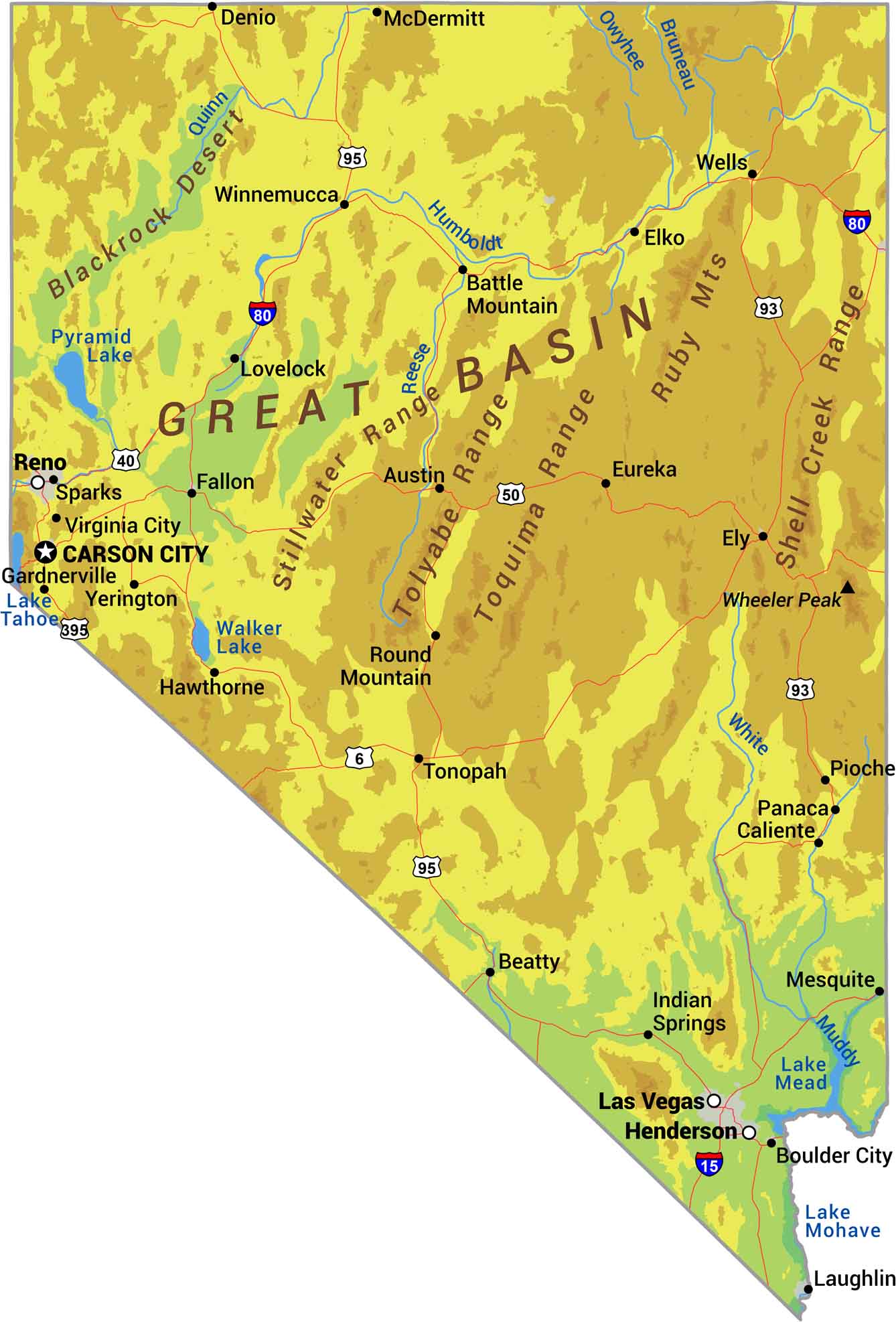
Picture basin and range. That’s Nevada. Over 150 mountain ranges run north to south with flat valleys between them, repeating across the entire state. Elevations swing from below sea level to over 13,000 feet. Our physical map of Nevada shows one of America’s driest, most mountainous states.
Map Information
On the Map
Physical State Maps
Select any state map below to view its physical map.


Nevada State Maps
Click on one of our maps of the Silver State.