Home » State Maps » New York Population Map

New York Population Map

New York Population Density Map

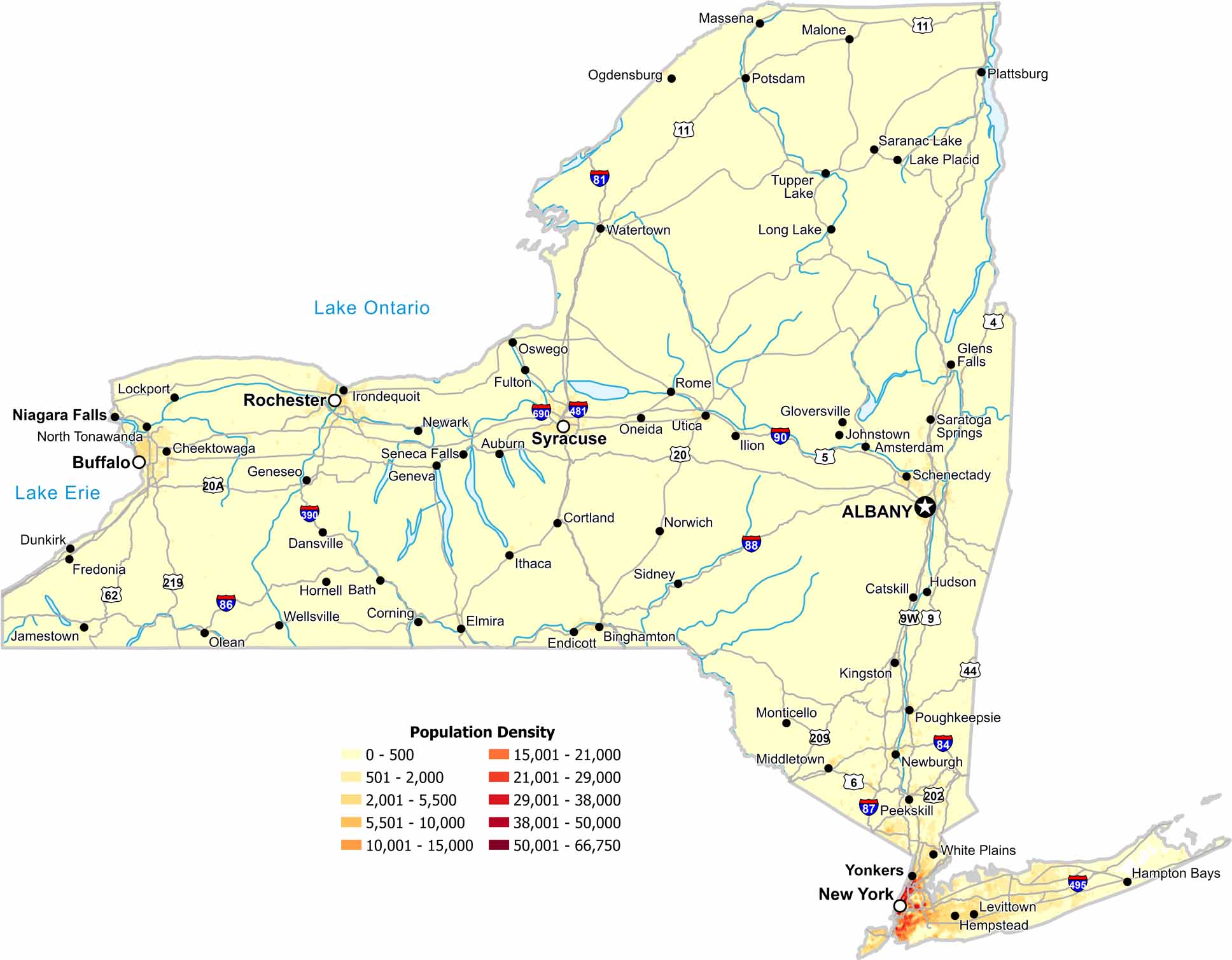
Our population density map of New York shows how geography divides the state. Density peaks around major cities, especially in the New York City area. Otherwise, most of the state is sparsely populated.

Map Information

  • Population Density Map of New York
  • Data provided by NASA SEDAC Gridded Population of the World
  • Free for personal and commercial purpose. Attribution is required. How to attribute?

On the Map

New York Location Map
State Capital: Albany Major Cities: Buffalo, New York City, Rochester, Syracuse, Yonkers Cities and Towns: Amsterdam, Auburn, Bath, Binghamton, Catskill, Cheektowaga, Corning, Cortland, Dansville, Dunkirk, Elmira, Endicott, Fredonia, Fulton, Geneseo, Geneva, Glens Falls, Gloversville, Hampton Bays, Hempstead, Hornell, Hudson, Ilion, Irondequoit, Ithaca, Jamestown, Johnstown, Kingston, Levittown, Lockport, Long Lake, Malone, Massena, Middletown, Monticello, Newark, Newburgh, Niagara Falls, North Tonawanda, Norwich, Ogdensburg, Olean, Oneida, Oswego, Peekskill, Plattsburg, Potsdam, Poughkeepsie, Rome, Saratoga Springs, Schenectady, Seneca Falls, Sidney, Tupper Lake, Utica, Watertown, Wellsville, West Point, White Plains Interstate Highways: I-81, I-84, I-86, I-87, I-88, I-90, I-95, I-190, I-278, I-287, I-290, I-295, I-390, I-481, I-490, I-495, I-587, I-590, I-678, I-684, I-690, I-695, I-787, I-790, I-890 US Routes: US-4, US-5, US-6, US-9, US-9W, US-11, US-20, US-20A, US-44, US-62, US-202, US-209, US-219

Leave a Reply

Your email address will not be published. Required fields are marked *