US Election 1812 Map
In 1812, the country was at war and deeply divided over it. Our 1812 US election map captures the results with James Madison as the winner.

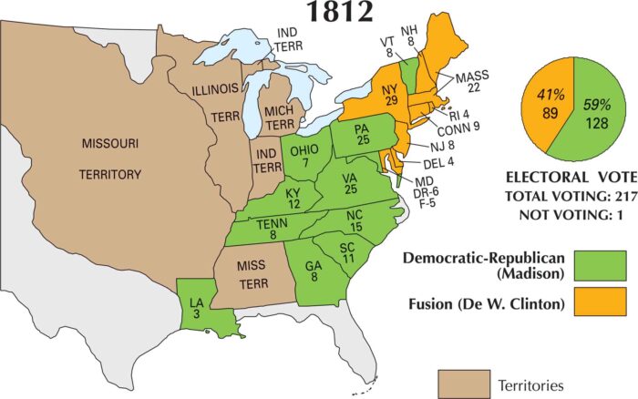
In 1812, the country was at war and deeply divided over it. Our 1812 US election map captures the results with James Madison as the winner.
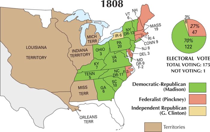
Come 1808, the Jefferson era was winding down. James Madison stepped into the spotlight. Our 1808 US election map shows Madison’s victory.
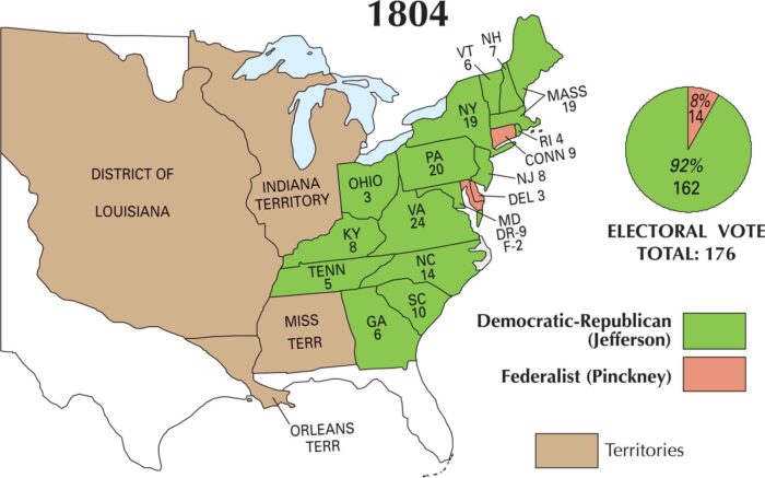
Looking at our US 1804 election map, Thomas Jefferson’s dominance is obvious. He swept nearly every state and cemented a landslide victory.
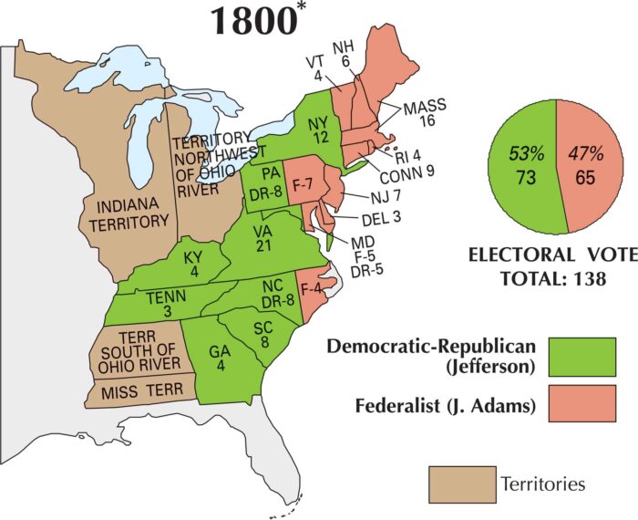
On this map, you can see how sharply the nation split. Jefferson won the election with support coming from the South and western states.
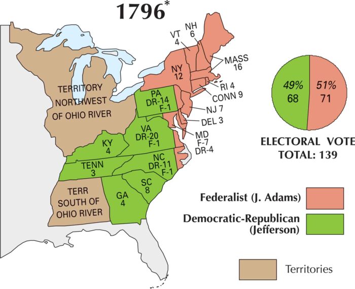
By 1796, the U.S. finally had a real political showdown. This map marks the country’s first competitive presidential race with Adams winning.
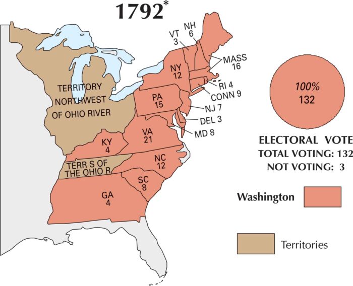
Once again, George Washington became president of the United States. Our 1792 US election map shows a country taking shape politically.
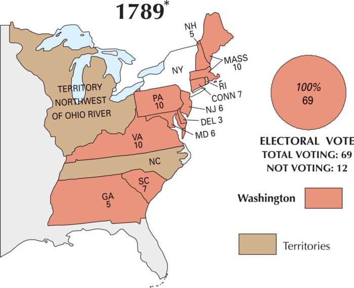
This map shows how the country was just getting started in the US election of 1789. George Washington was the clear and unanimous choice.
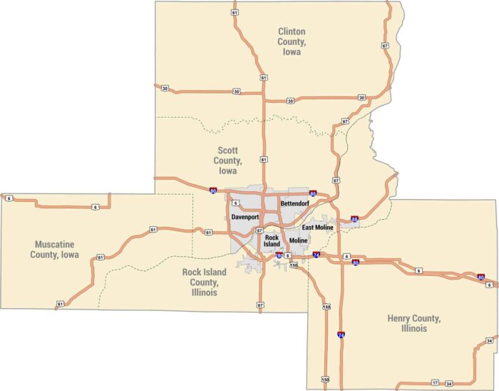
The Quad Cities sit along the Mississippi River along the Iowa-Illinois border. Our map shows Davenport, Bettendorf, Rock Island and Moline.
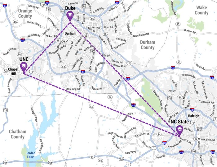
The Research Triangle is a region in North Carolina formed by Raleigh, Durham, and Chapel Hill. Our map shows the three cities in a triangle.
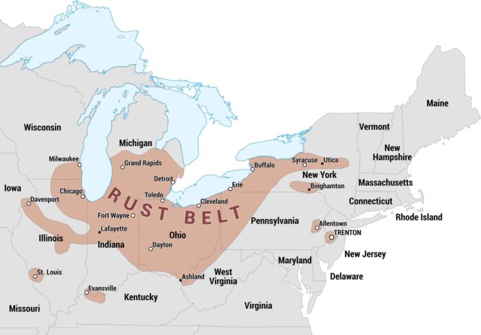
The Rust Belt was once an industrial heartland of the United States. Our map highlights the states and major cities that make up this region.
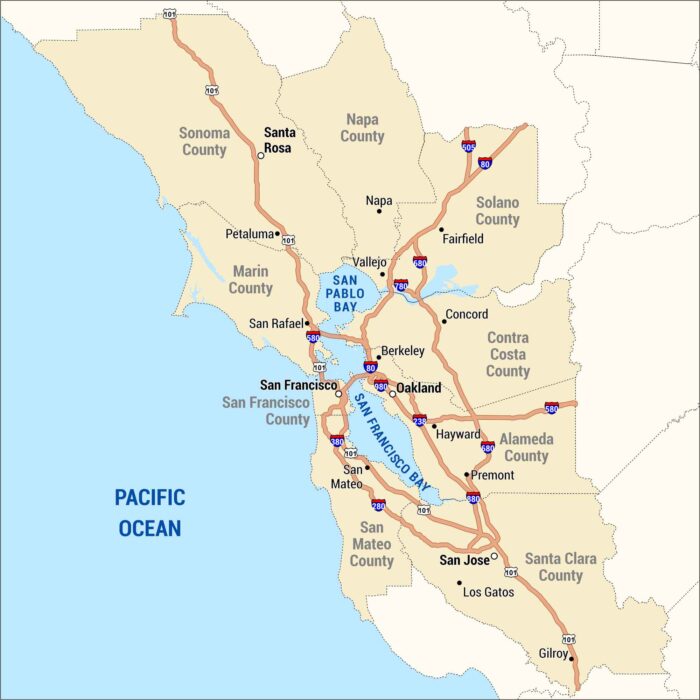
The Bay Area wraps around the water, from San Francisco to San Jose and across to Oakland. Our map shows the cities, bridges, and highways.
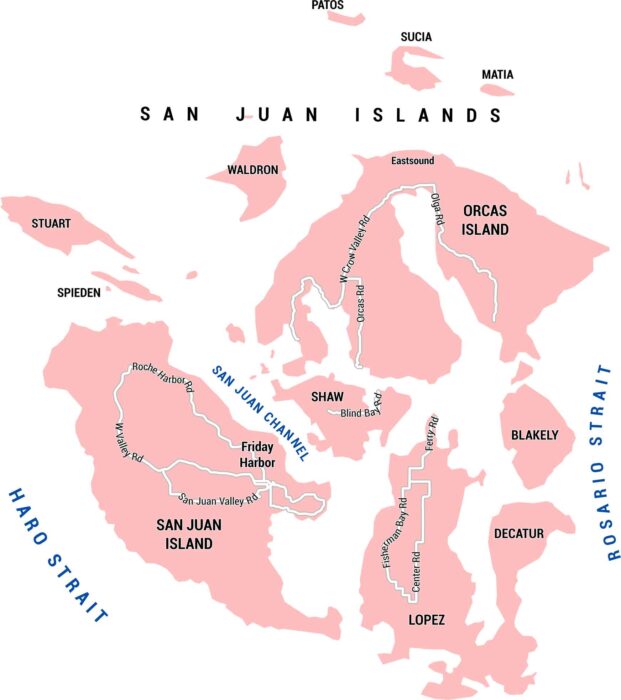
This map shows San Juan Island in Washington State with its roads, channels, and places. It’s a small place with big views of the ocean.
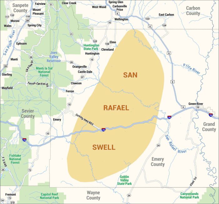
Our map of the San Rafael Swell highlights highways, rivers, and communities. Check out this geologic feature in central Utah.
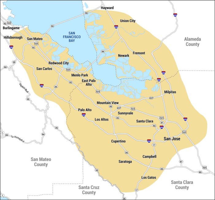
This map shows Silicon Valley along the southern end of San Francisco Bay. It includes San Jose, Mountain View, and other cities.
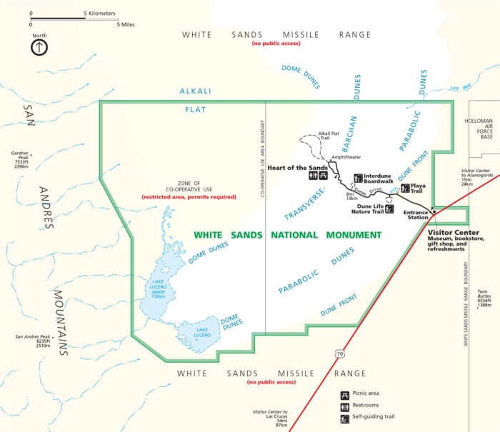
White Sands National Park kind of feels like it’s on another planet. Our map displays the dunes that stretch for miles.