San Rafael Swell Map
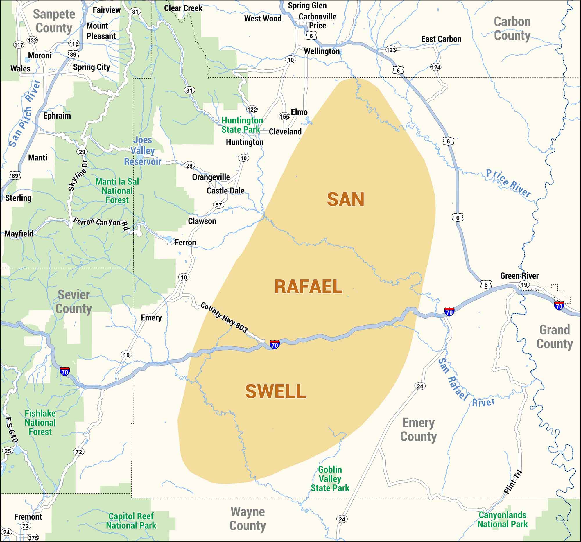
Our map of the San Rafael Swell highlights highways, rivers, and nearby communities. Check out this geologic feature along this rugged stretch in central Utah.
Map Information
On the Map
Interstates/Highways: I-70, US Hwy 6, US Hwy 19, US Hwy 89, US Hwy 191 Major Roads: State Rte 10, State Rte 24, State Rte 25, State Rte 29, State Rte 31, State Rte 72, State Rte 116, State Rte 117, State Rte 122, State Rte 123, State Rte 124, State Rte 132, State Rte 155, State Rte 375, County Hwy 803, Ferron Canyon Rd, Flint Trl, FS 640, Skyline Dr Rivers/Reservoirs: Joes Valley Reservoir, Price River, San Pitch River, San Rafael River Parks and Forests: Canyonlands National Park, Capitol Reef National Park, Fishlake National Forest, Goblin Valley State Park, Huntington State Park, Manti la Sal National Forest Counties: Carbon County, Emery County, Grand County, Sanpete County, Sevier County, Wayne CountyNatural Region Maps
Geographic landforms, wilderness zones, deserts, mountain ranges, and terrain.