Wind Cave National Park Map
Wind Cave National Park is quiet on the surface but vast below. Our map shows the rolling prairies, forested hills, and the maze of trails.

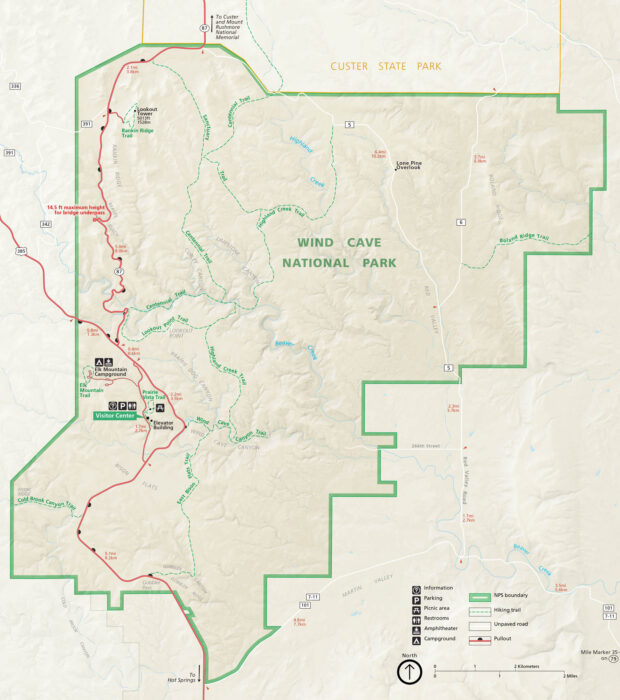
Wind Cave National Park is quiet on the surface but vast below. Our map shows the rolling prairies, forested hills, and the maze of trails.
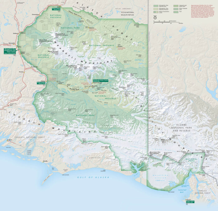
Wrangell–St. Elias is massive. It’s bigger than some countries and wilder than most. Our map lays out its glaciers, peaks, and remote roads.
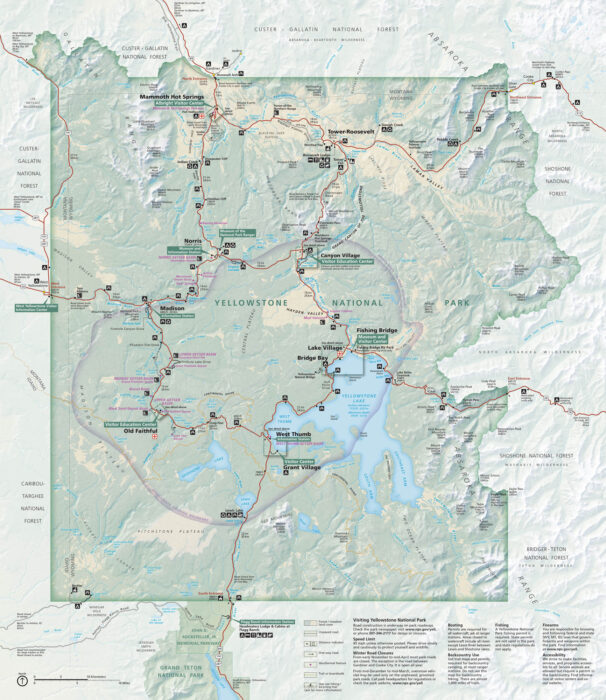
Our map Yellowstone National Park highlights its geysers, lakes, and roads through the world’s first national park.
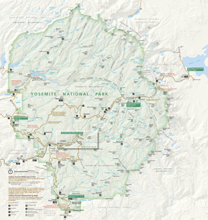
From El Capitan to Half Dome, Yosemite National Park feels larger than life. Our map follows the valleys, rivers, and forest roads.
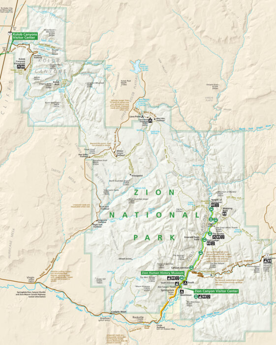
Our map of Zion National Park highlights its roads, rivers, and trails. Visitor centers are marked, along with lakes and points of interest.
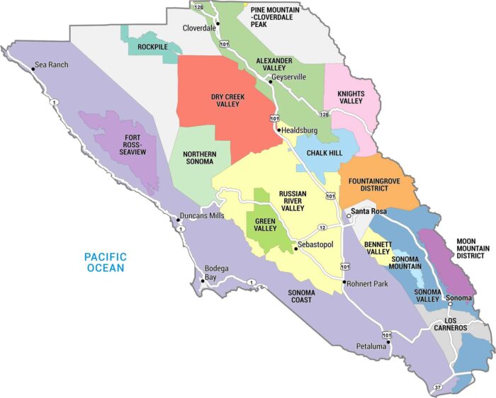
This map of Sonoma County highlights the region’s major cities, towns, and vineyard appellations in one of the country’s top wine regions.
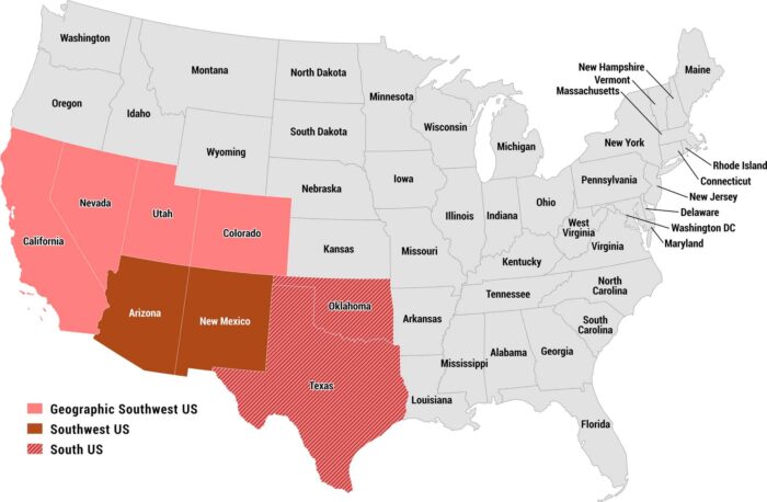
Our map of the US Southwest highlights how the region is often defined. Arizona and New Mexico form the core of the modern Southwest.
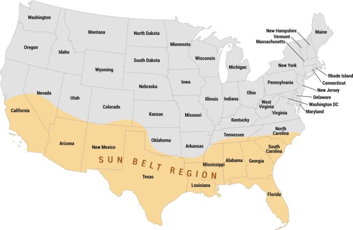
See how the Sun Belt stretches across the southern United States on our map. We show the Sun Belt highlighted in orange, coast-to-coast.
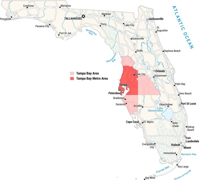
Our map shows all of Florida, with the Tampa Bay metro area marked in red and the broader Tampa Bay region in pink.
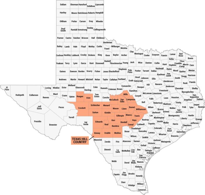
Texas Hill Country is all rolling hills. It feels rugged, calm, and unmistakably Texas. Get to know this region a bit better with our map.
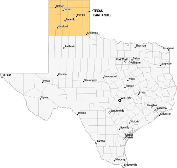
The Texas Panhandle is open land and flat as far as you can see. Our map lays out this region of Texas with major cities and small towns.
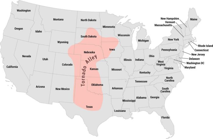
Tornado Alley cuts straight through the heart of the country. Our map shows this region from Texas up through Kansas, Oklahoma, and beyond.
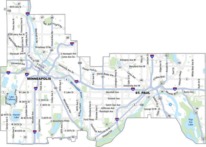
Our map of the Twin Cities lays out Minneapolis and St. Paul side by side, split by the Mississippi River. It shows main roads, lakes & parks.
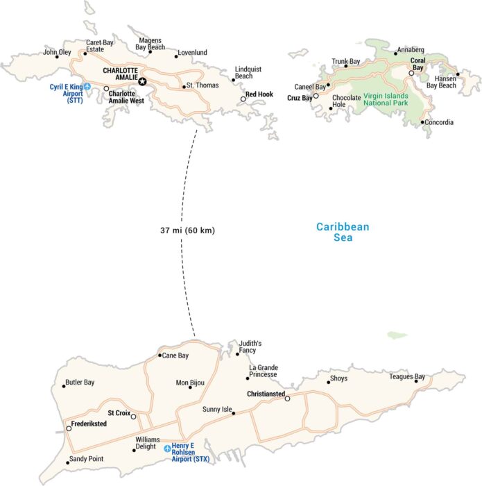
The U.S. Virgin Islands sit in the Caribbean. Our map shows highways, airports, national parks and settlements like St. Thomas and St. Croix.
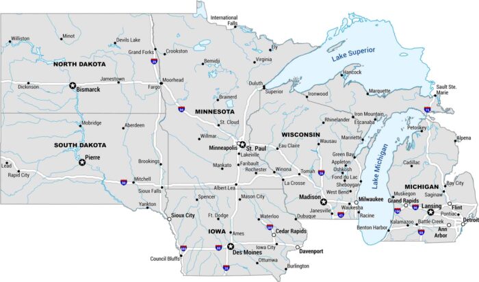
The Upper Midwest is big sky, big lakes, and long roads. Our map covers the stretch from Michigan to the Dakotas.