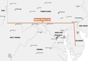
Research Triangle Map
The Research Triangle is a region in North Carolina formed by Raleigh, Durham, and Chapel Hill. Each city is home to a major university, and together they shape one of the country’s top research and tech areas. Our map shows the three cities connected in a triangle, with roads and waterways in the background.
Map Information
On the Map
Institutions: Duke (Durham), UNC (Chapel Hill), NC State (Raleigh) Counties: Chatham County, Durham County, Orange County, Wake County Interstates: I-1, I-15, I-40, I-50, I-54, I-55, I-64, I-70, I-85, I-86, I-401, I-440, I-501, I-540, I-751 Lakes: Jordan Lake Major Roads: Angier Ave, Atlantic Ave, Avent Ferry Rd, Blue Ridge Rd, Cary Pkwy, Chapel Hill Rd, Creedmoor Rd, Durham Rd, E Main St, Falls Of Neuse Rd, Fayetteville Rd, Hope Valley Rd, New Bern Ave, NW Cary Pkwy, Page Rd, Six Forks Rd, University Dr, Wade Ave, Western Blvd, Weston PkwyCultural Region Maps
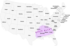
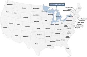
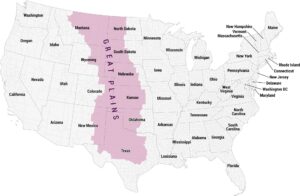
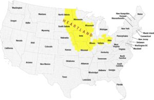
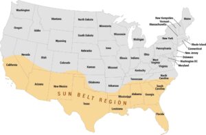
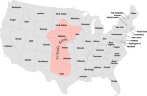
Regions defined by culture, climate patterns, history, or shared identity.