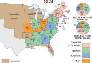
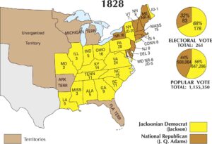
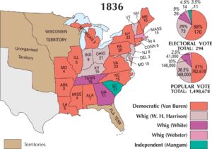
US Election 1804 Map
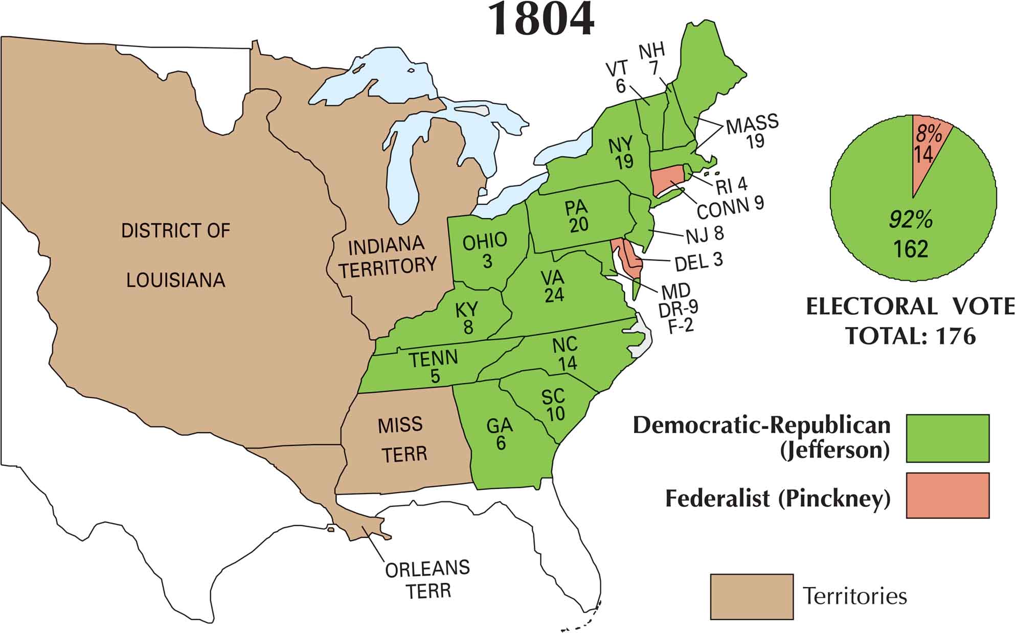
By 1804, the mood of the country had shifted. Thomas Jefferson was wildly popular after his first term, thanks in part to the Louisiana Purchase and a booming sense of national growth. Meanwhile, the Federalist Party was fading fast. Looking at this map, Jefferson’s dominance is obvious. He swept nearly every state and cemented a landslide in early American politics.
Map Information
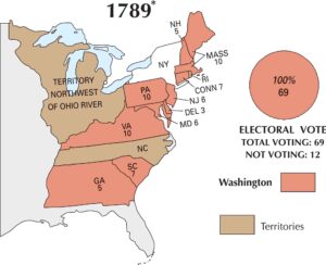
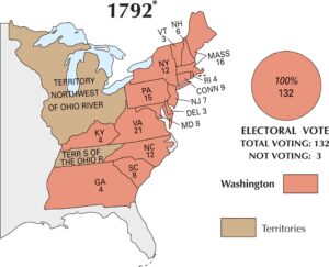
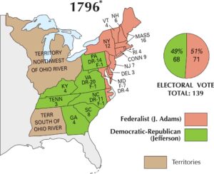
US Election Maps
Click on a map below to check out the US election map and results.


On the Map
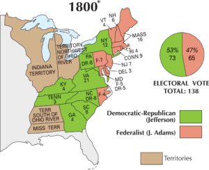
Here is the breakdown of the states and their electoral votes, showing a significant landslide for the Democratic-Republicans (Jefferson) over the Federalists (Pinckney)
States and Electoral Votes
|
State |
Total Votes |
Democratic-Republican (Jefferson) |
Federalist (Pinckney) |
|
Virginia |
24 |
24 |
0 |
|
Massachusetts |
19 |
19 |
0 |
|
New York |
19 |
19 |
0 |
|
Pennsylvania |
20 |
20 |
0 |
|
North Carolina |
14 |
14 |
0 |
|
South Carolina |
10 |
10 |
0 |
|
Maryland |
11 |
9 |
2 |
|
Connecticut |
9 |
0 |
9 |
|
New Jersey |
8 |
8 |
0 |
|
Kentucky |
8 |
8 |
0 |
|
New Hampshire |
7 |
7 |
0 |
|
Vermont |
6 |
6 |
0 |
|
Georgia |
6 |
6 |
0 |
|
Tennessee |
5 |
5 |
0 |
|
Rhode Island |
4 |
4 |
0 |
|
Delaware |
3 |
0 |
3 |
|
Ohio |
3 |
3 |
0 |
Election Summary
- Total Electoral Votes: 176
- The Winner: Thomas Jefferson (92%) with 162 votes.
- New State: Ohio appears for the first time with 3 electoral votes.
- Major Expansion: The map now features the massive District of Louisiana, following the Louisiana Purchase, along with the Orleans Territory.
- Landslide Shift: Jefferson flipped nearly the entire country, including previous Federalist strongholds like Massachusetts and New Hampshire. Only Connecticut and Delaware remained fully Federalist.