US Election 1789 Map
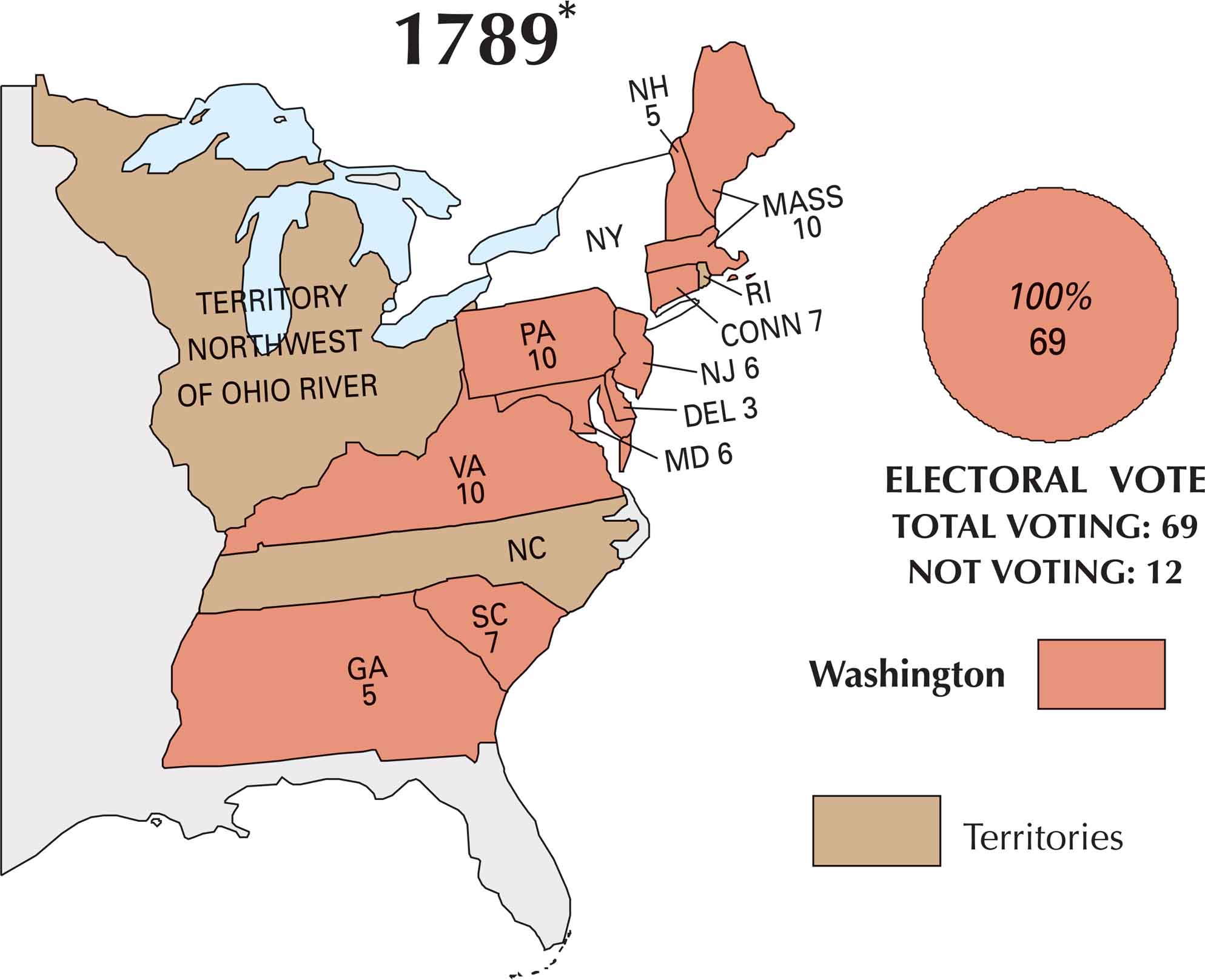
Back in 1789, the first U.S. presidential election looked nothing like what we think of today. There were no political parties. But George Washington was the clear and unanimous choice. States held elections in different ways. This map shows how the country was just getting started. Only ten states actually voted.
Map Information


On the Map
Here are the states that participated in the 1789 election and their electoral votes:
States and Electoral Votes
Election Summary
- New York (NY), North Carolina (NC), and Rhode Island (RI) are shown on the map but do not have electoral vote numbers assigned to them for this specific election.
- Total Electoral Votes Cast: 69 (100% for Washington).
- Not Voting: 12.