White Sands National Park Map
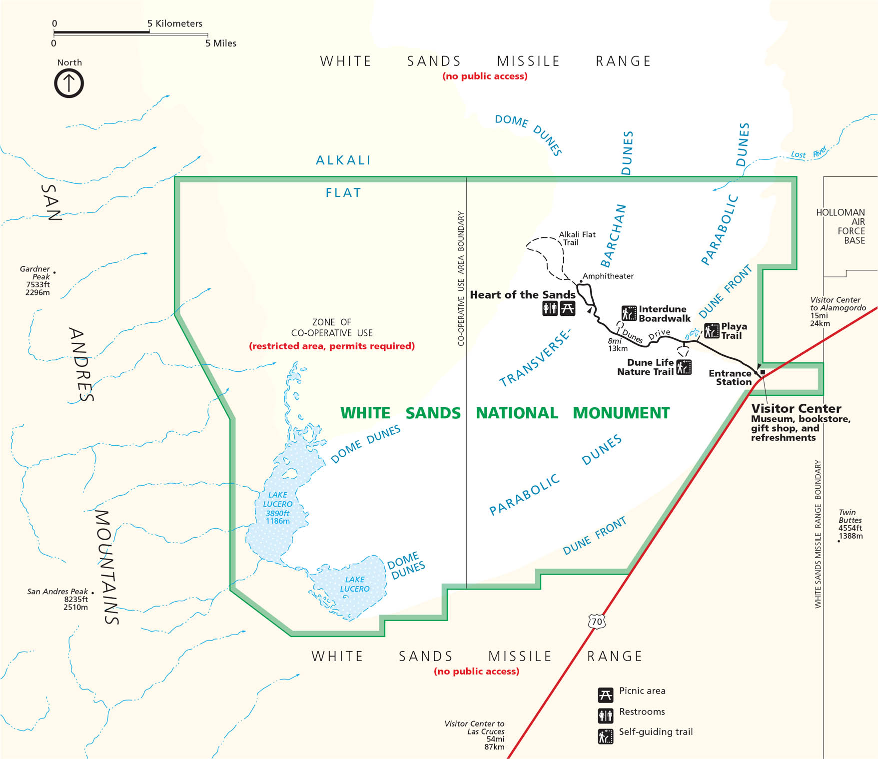
White Sands National Park kind of feels like it’s on another planet. Our map displays the dunes that stretch for miles. You’ll see roads, trails, and picnic spots among the shifting gypsum sands. Get to know White Sands National Park with our map.
Map Information
On the Map
Highways and Roads: US Hwy 70, Dunes Dr Rivers/Lakes: Lake Lucero, Lost River Parks: White Sands National Monument Cities/Towns: Alamogordo, Las Cruces Other Landmarks: Alkali Flat, Heart of the Sands, San Andres Mountains, White Sands Missile Range, Holloman Air Force Base, Gardner Peak, San Andres Peak, Twin Buttes, Interdune Boardwalk, AmphitheaterNational Park Maps
Find maps of green spaces and national parks near you.


