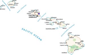
Home » State Maps » Hawaii Physical Map

Hawaii Physical Map

Hawaii Physical Map

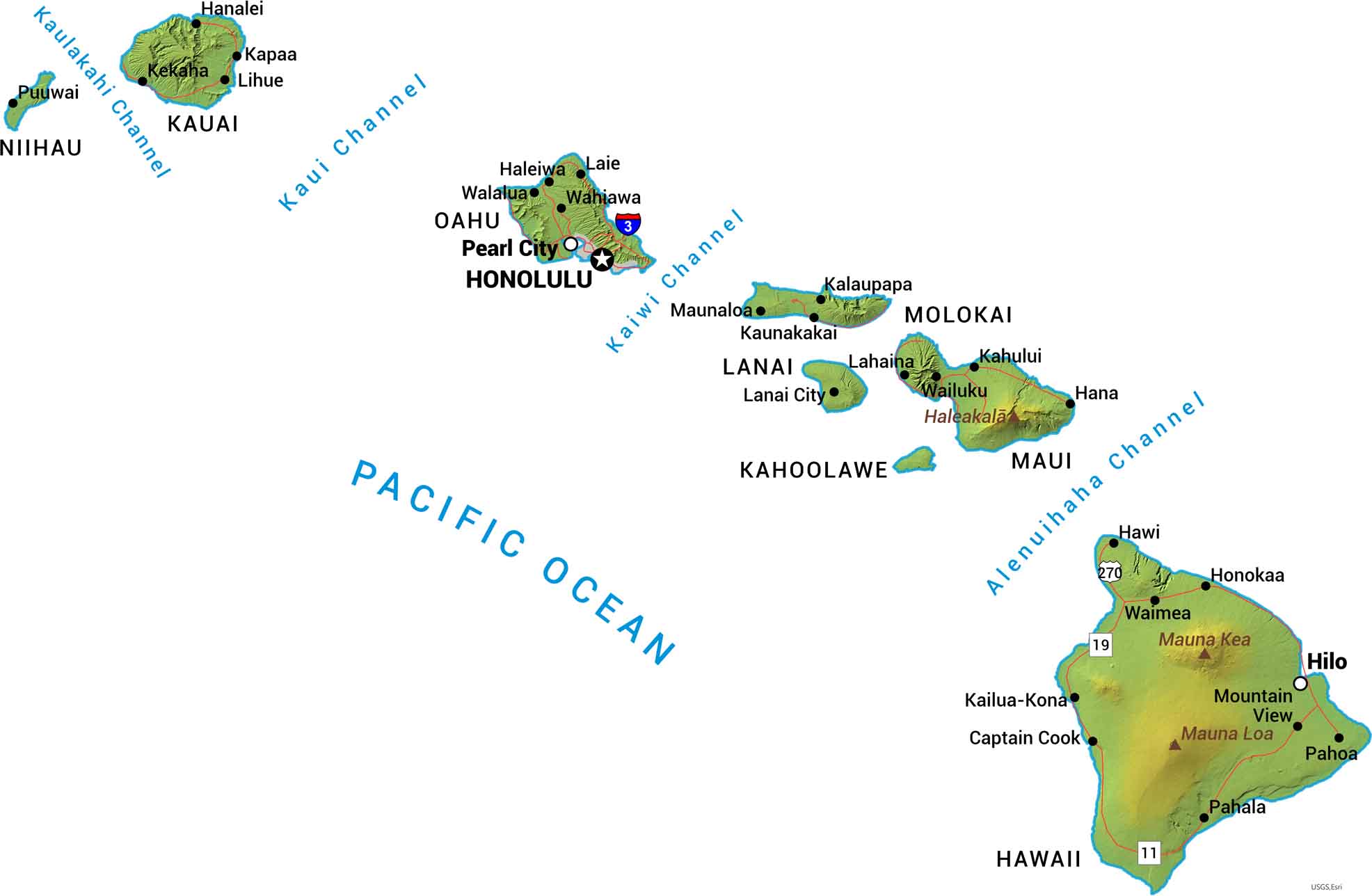
No two Hawaiian islands look the same, but they’re all built from volcanoes. Mauna Kea and Mauna Loa dominate the Big Island. Our physical map of Hawaii displays these peaks, calderas, and coastlines across the island chain.

Map Information

  • State of Hawaii
  • Physical Map of Hawaii
  • Free for personal and commercial purpose. Attribution is required. How to attribute?

On the Map

Hawaii Location Map
Peaks: Mauna Loa, Mauna Kea, Haleakala State Capital: Honolulu Major Cities: Hilo, Pearl City Cities and Towns: Captain Cook, Haleiwa, Hana, Hanalei, Hawi, Honokaa, Kahului, Kapaa, Kaunakakai, Kalaupapa, Kekaha, Kailua-Kona, Lahaina, Lanai City, Laie, Lihue, Maunaloa, Mountain View, Pahala, Pahoa, Puuwai, Wahiawa, Waialua, Waimea, Wailuku Interstate Highways: H-3 (Interstate), Highway 11, Highway 19, Highway 270 Islands: Hawaii, Kahoolawe, Kauai, Lanai, Maui, Molokai, Niihau, Oahu Rivers and Oceans: Alenuihaha Channel, Kaiwi Channel, Kaui Channel, Kaulakahi Channel, Pacific Ocean

References

  1. Shuttle Radar Topography Mission Elevation
  2. National Map TopoBuilder Application

Leave a Reply

Your email address will not be published. Required fields are marked *