West Virginia County Map
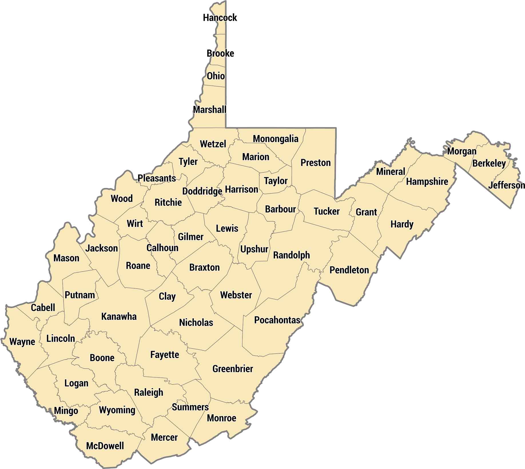
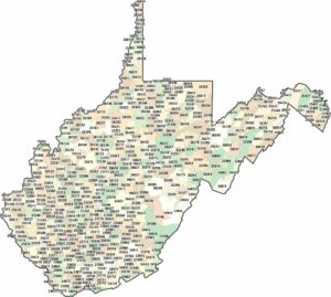
All 55 counties here are carved by mountains, hollows, and rivers running through Appalachia. The rugged terrain means county borders often follow ridgelines instead of straight survey lines. Kanawha County has Charleston, the capital city.
Map Information
On the Map
Our table below provides you with population, area, and FIPS code for each county.
|
Name |
Population 2024 |
Total Area (sq mi) |
FIPS Code |
|
Barbour County |
15,369 |
342.8 |
54-001 |
|
Berkeley County |
136,287 |
321.6 |
54-003 |
|
Boone County |
20,496 |
503.2 |
54-005 |
|
Braxton County |
12,051 |
516.3 |
54-007 |
|
Brooke County |
21,285 |
92.6 |
54-009 |
|
Cabell County |
91,489 |
288 |
54-011 |
|
Calhoun County |
5,873 |
280.7 |
54-013 |
|
Clay County |
7,689 |
343.8 |
54-015 |
|
Doddridge County |
7,615 |
320.5 |
54-017 |
|
Fayette County |
38,600 |
668.3 |
54-019 |
|
Gilmer County |
7,116 |
340.1 |
54-021 |
|
Grant County |
10,971 |
480.3 |
54-023 |
|
Greenbrier County |
31,851 |
1,024.50 |
54-025 |
|
Hampshire County |
23,793 |
644.6 |
54-027 |
|
Hancock County |
28,054 |
88 |
54-029 |
|
Hardy County |
14,335 |
584.5 |
54-031 |
|
Harrison County |
64,472 |
416.5 |
54-033 |
|
Jackson County |
27,718 |
471.6 |
54-035 |
|
Jefferson County |
61,264 |
211.7 |
54-037 |
|
Kanawha County |
173,906 |
910.9 |
54-039 |
|
Lewis County |
16,477 |
389.6 |
54-041 |
|
Lincoln County |
19,377 |
438.6 |
54-043 |
|
Logan County |
30,560 |
455.6 |
54-045 |
|
McDowell County |
17,147 |
534.9 |
54-047 |
|
Marion County |
55,649 |
311.5 |
54-049 |
|
Marshall County |
29,354 |
312.2 |
54-051 |
|
Mason County |
24,770 |
444.7 |
54-053 |
|
Mercer County |
57,524 |
420.7 |
54-055 |
|
Mineral County |
26,778 |
329.2 |
54-057 |
|
Mingo County |
21,712 |
424 |
54-059 |
|
Monongalia County |
108,697 |
365.9 |
54-061 |
|
Monroe County |
12,462 |
473.6 |
54-063 |
|
Morgan County |
17,780 |
229.6 |
54-065 |
|
Nicholas County |
24,017 |
654.4 |
54-067 |
|
Ohio County |
41,090 |
109 |
54-069 |
|
Pendleton County |
5,944 |
698.1 |
54-071 |
|
Pleasants County |
7,358 |
134.5 |
54-073 |
|
Pocahontas County |
7,653 |
941.8 |
54-075 |
|
Preston County |
34,055 |
651.4 |
54-077 |
|
Putnam County |
57,067 |
350.4 |
54-079 |
|
Raleigh County |
72,379 |
609.3 |
54-081 |
|
Randolph County |
27,190 |
1,040.00 |
54-083 |
|
Ritchie County |
8,170 |
453.7 |
54-085 |
|
Roane County |
13,540 |
483.7 |
54-087 |
|
Summers County |
11,544 |
367.7 |
54-089 |
|
Taylor County |
16,438 |
175.7 |
54-091 |
|
Tucker County |
6,573 |
421.1 |
54-093 |
|
Tyler County |
7,843 |
260.7 |
54-095 |
|
Upshur County |
23,650 |
354.8 |
54-097 |
|
Wayne County |
37,589 |
512.1 |
54-099 |
|
Webster County |
7,947 |
556.2 |
54-101 |
|
Wetzel County |
13,766 |
361.3 |
54-103 |
|
Wirt County |
4,924 |
234.8 |
54-105 |
|
Wood County |
82,757 |
376.8 |
54-107 |
|
Wyoming County |
19,964 |
501.8 |
54-109 |
West Virginia State Maps
Browse our maps of the state of West Virginia.
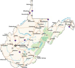


State County Maps
Click on a map below to check out county maps of each state.


