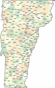
Vermont County Map

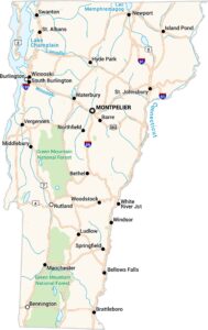
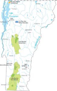
Fourteen counties make up this rural New England state located between New York and New Hampshire. The Green Mountains run right down the middle, splitting east from west. Chittenden County has Burlington on Lake Champlain, the only real city.
Map Information
On the Map
Our table below provides you with population, area, and FIPS code for each county.
|
Name |
Population 2024 |
Total Area (sq mi) |
FIPS Code |
|
Addison County |
38,047 |
807.8 |
50-001 |
|
Bennington County |
37,039 |
677.7 |
50-003 |
|
Caledonia County |
30,535 |
657.7 |
50-005 |
|
Chittenden County |
170,851 |
619.3 |
50-007 |
|
Essex County |
6,037 |
674.7 |
50-009 |
|
Franklin County |
51,066 |
692.1 |
50-011 |
|
Grand Isle County |
7,528 |
194.7 |
50-013 |
|
Lamoille County |
26,248 |
463.8 |
50-015 |
|
Orange County |
30,050 |
691.7 |
50-017 |
|
Orleans County |
27,726 |
721.2 |
50-019 |
|
Rutland County |
60,198 |
944.8 |
50-021 |
|
Washington County |
59,844 |
695.2 |
50-023 |
|
Windham County |
45,627 |
798.2 |
50-025 |
|
Windsor County |
57,697 |
977 |
50-027 |
Vermont State Maps
Explore maps from the Green Mountain State.


State County Maps
Click on a map below to check out county maps of each state.


