Map of Ohio
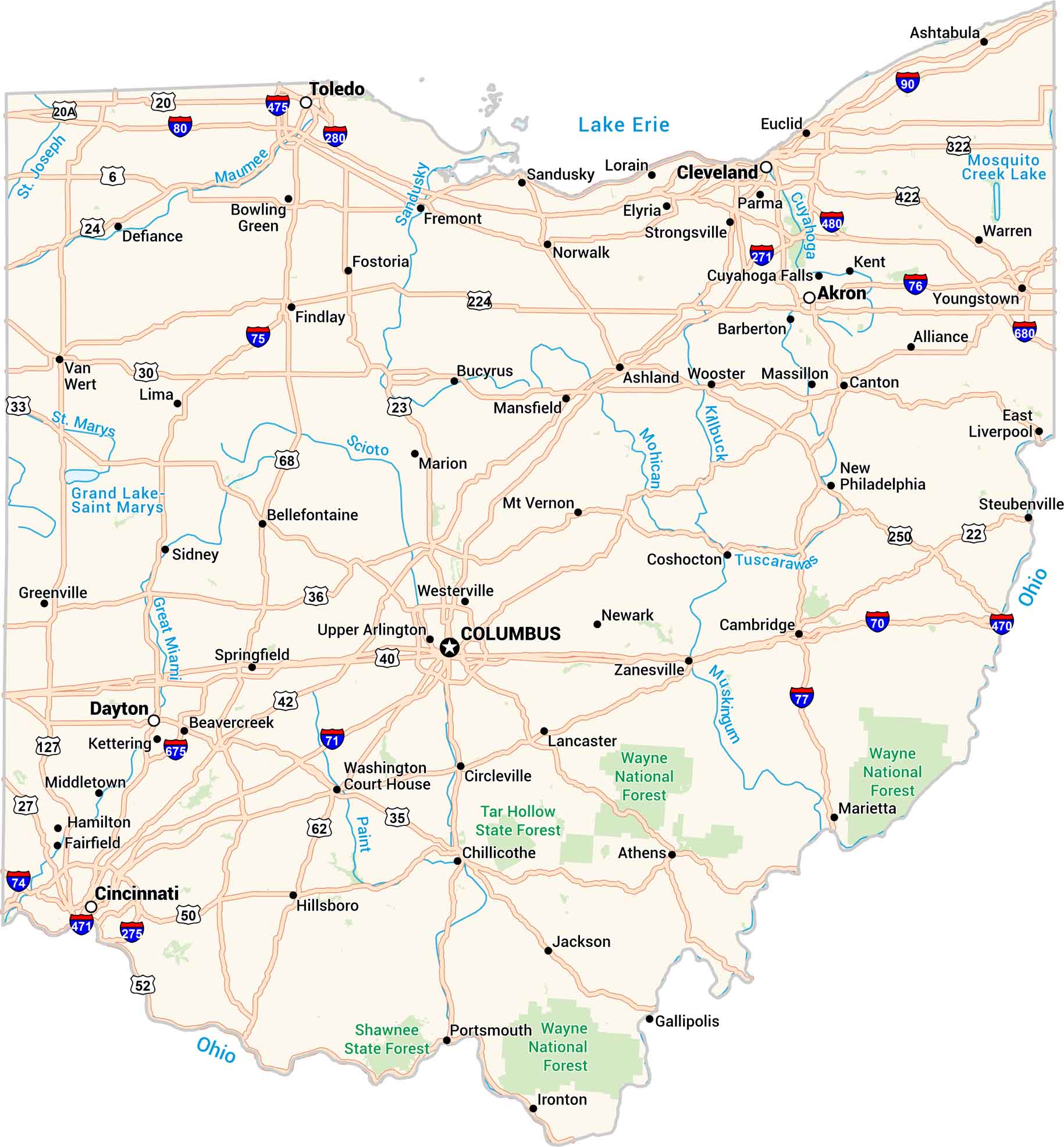
Ohio has its own rhythm. Cities, rivers, and rolling farmland are all connected by its interstates. From Cleveland’s lakefront to the quiet hills near Athens, every part of the state feels distinct but tied together. Our Ohio map lays it all out clearly. It shows how Ohio fits together.
Ohio State Maps
Check out our maps covering farmland or any of Ohio’s major cities.


Map Information
On the Map
City Maps of Ohio
Here are maps of Columbus and Ohio’s major cities


