Home » State Maps » Washington Population Map

Washington Population Map

Washington Population Density Map

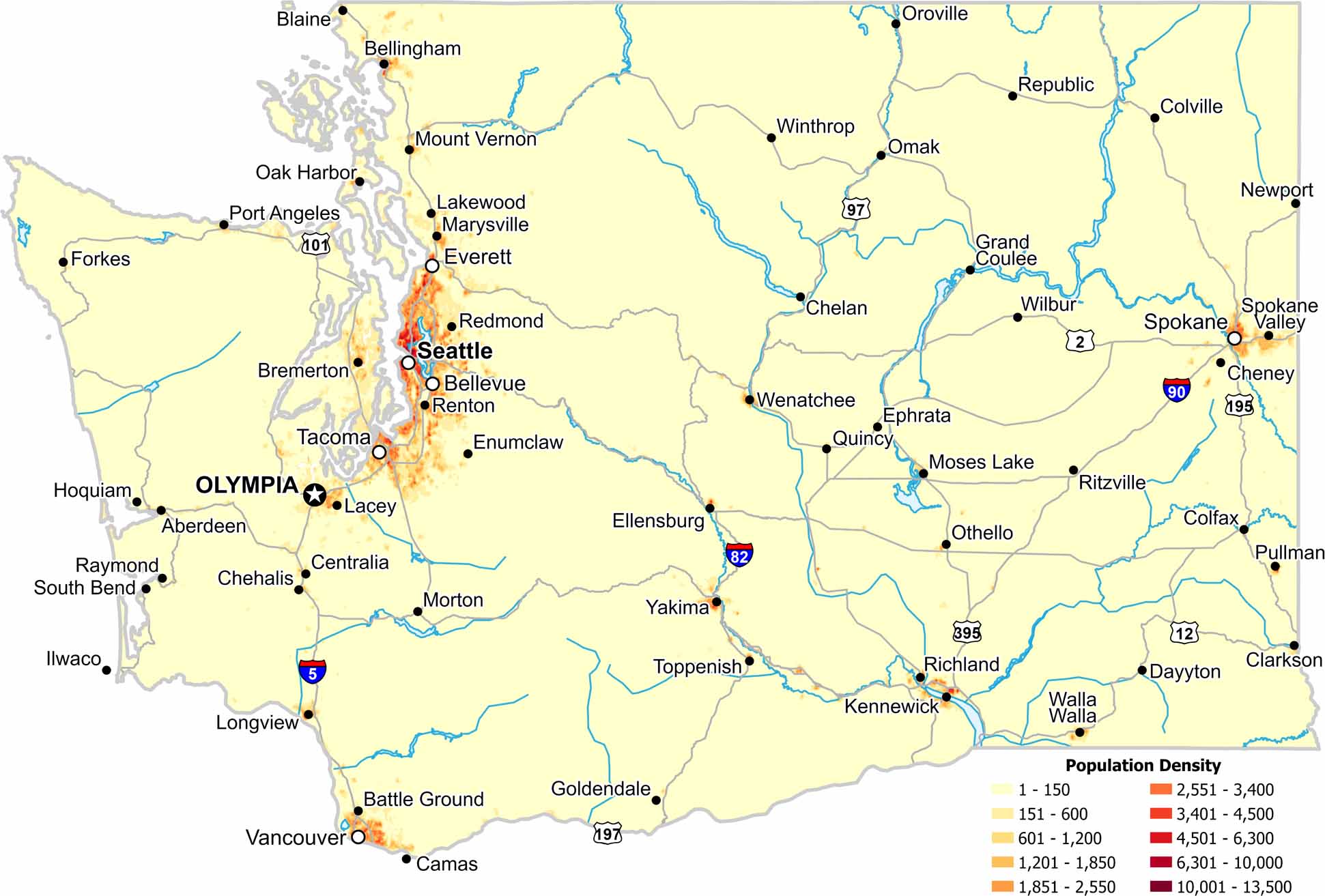
Our population density map of Washington shows a strong divide across the mountains. Western Washington holds most of the population. But the eastern regions remain sparsely populated.

Map Information

  • Population Density Map of Washington
  • Data provided by NASA SEDAC Gridded Population of the World
  • Free for personal and commercial purpose. Attribution is required. How to attribute?

On the Map

Washington Location Map
State Capital: Olympia Major Cities: Bellevue, Everett, Seattle, Spokane, Tacoma Cities and Towns: Aberdeen, Bellingham, Blaine, Bremerton, Camas, Centralia, Chehalis, Chelan, Cheney, Clarkson, Colfax, Colville, Dayton, Ellensburg, Enumclaw, Ephrata, Forkes, Goldendale, Grand Coulee, Hoquiam, Ilwaco, Kennewick, Lacey, Lakewood, Longview, Marysville, Morton, Moses Lake, Mount Vernon, Oak Harbor, Omak, Oroville, Othello, Pasco, Port Angeles, Pullman, Quincy, Raymond, Redmond, Renton, Richland, Ritzville, South Bend, Spokane Valley, Toppenish, Vancouver, Walla Walla, Wenatchee, Wilbur, Winthrop, Yakima Interstate Highways: I-5, I-82, I-90, I-205, I-405, I-705 US Routes: US-2, US-12, US-97, US-101, US-195, US-197, US-395, US-730

Leave a Reply

Your email address will not be published. Required fields are marked *