Texas Precipitation Map
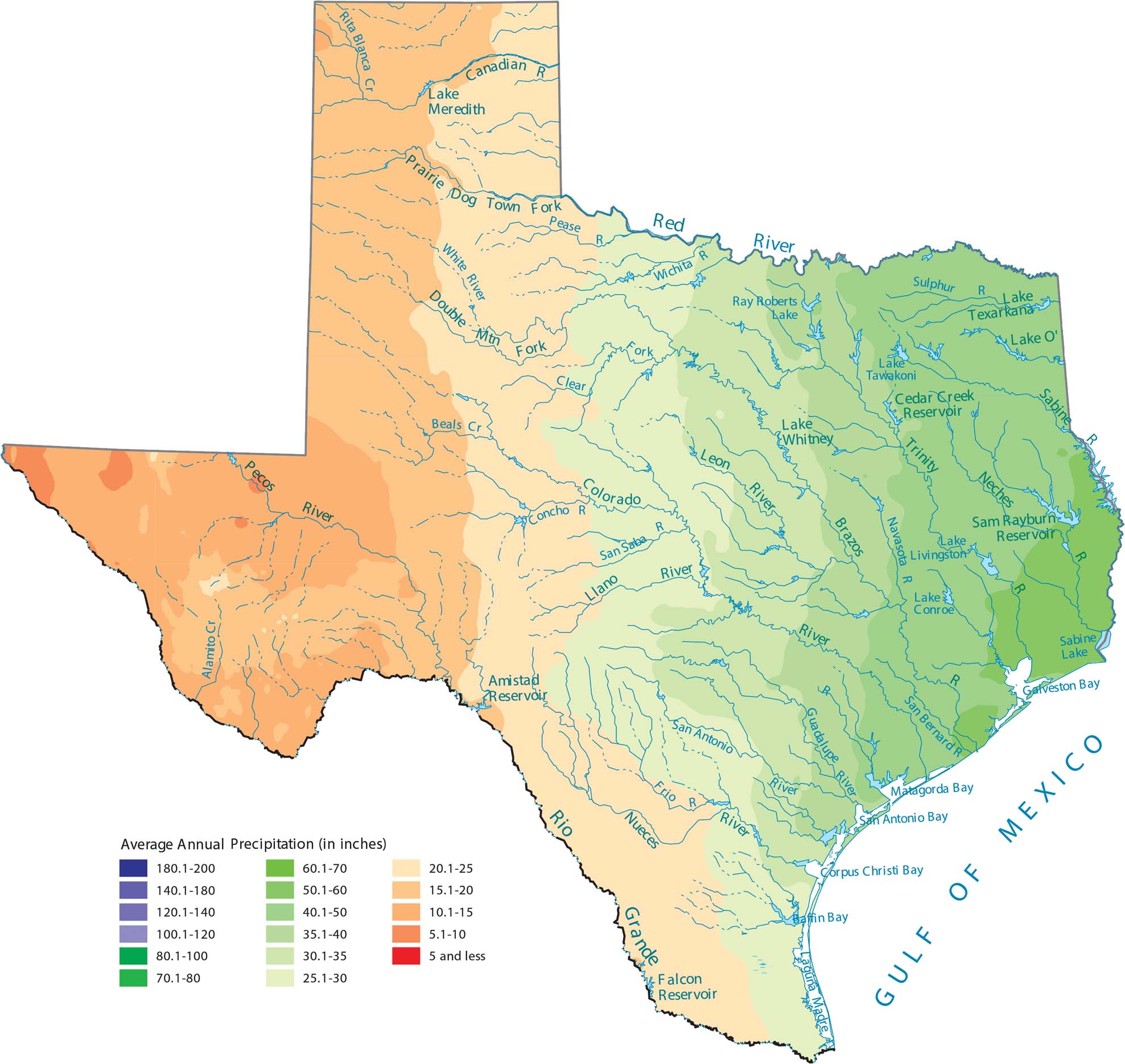
Texas shows maybe the most dramatic precipitation gradient in the country. From the super wet eastern forests to the bone-dry deserts of West Texas, its wide geography makes a difference here. As you can see on our precipitation map of Texas, distance from the Gulf Coast makes all the difference.
Map Information
State Precipitation Maps
Select any state map below to view its precipitation map.


Texas State Maps
Scan our maps of the massive southern state of Texas.


