Forest Hills Map, New York
Our map of Forest Hills shows the Queens neighborhood just north of Forest Park. We show you the main streets, parks, and highways.
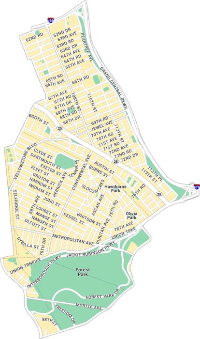
Our map of Forest Hills shows the Queens neighborhood just north of Forest Park. We show you the main streets, parks, and highways.
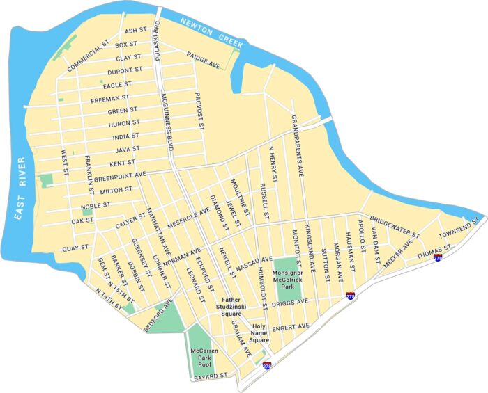
Greenpoint sits at the northern tip of Brooklyn, along the East River. This map shows its waterfront, main streets, and residential blocks.
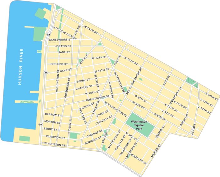
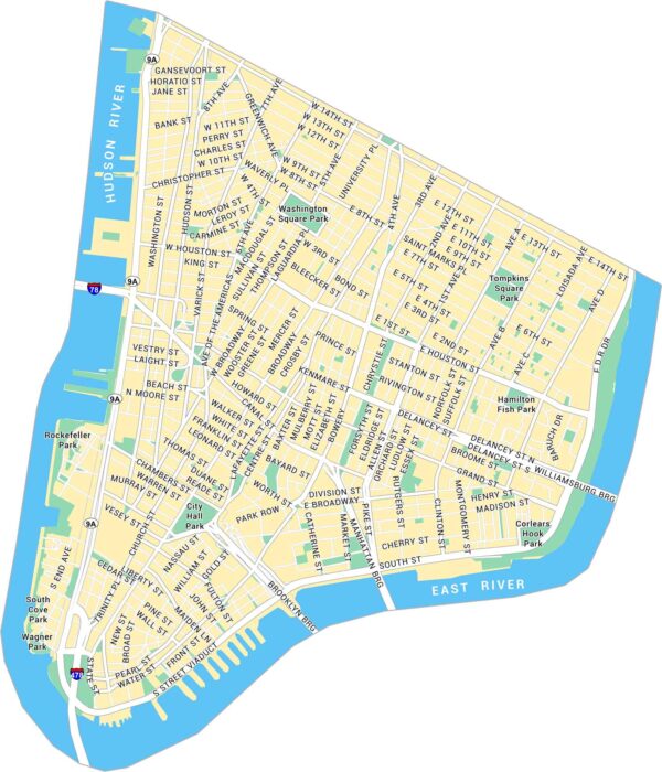
Greenwich Village sits below 14th Street in Lower Manhattan. Our map shows its narrow streets, the Hudson River and Washington Square Park.
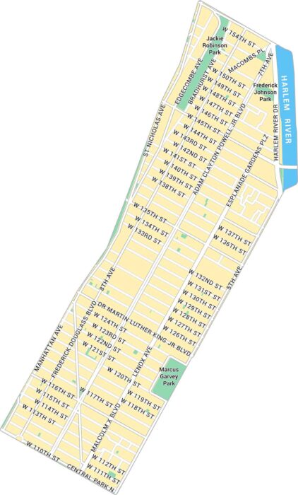
Harlem stretches across Upper Manhattan along the Harlem River. Our map shows its parks and network of busy streets.
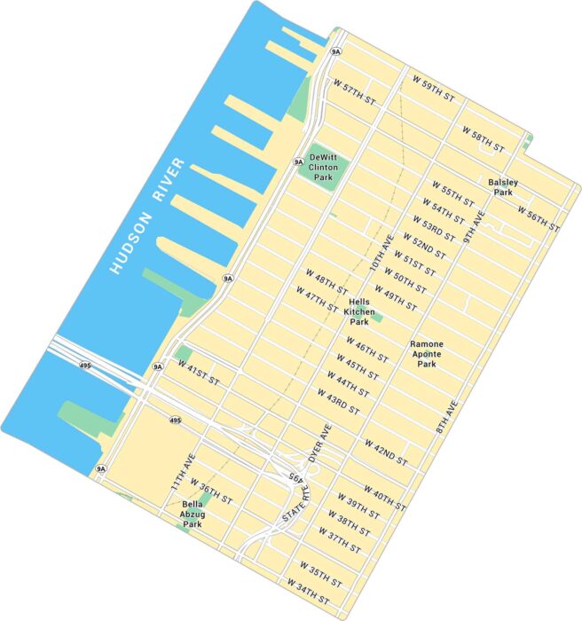
Find your way through Hell’s Kitchen with this map of Manhattan’s West Side. It shows the many avenues and parks.
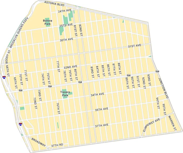
Jackson Heights sits in central Queens, between Roosevelt and Astoria Boulevard. This map shows its highways, streets and parks.
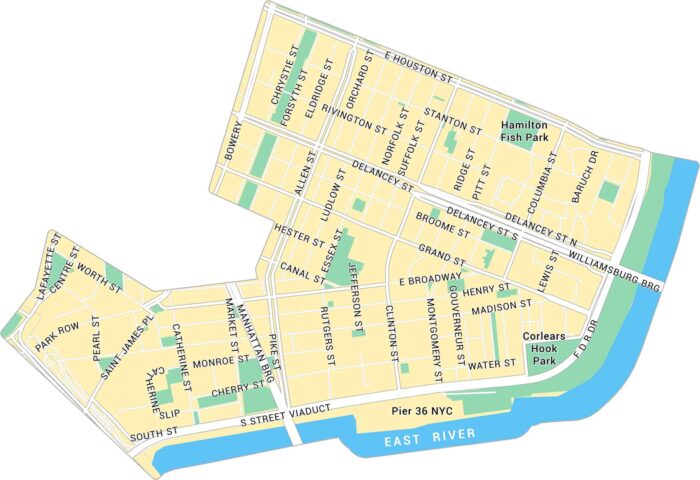
Our map of the Lower East Side shows the historic Manhattan neighborhood along the East River. It shows streets, parks, and bridges.
Lower Manhattan sits at the southern tip of New York City. Our map shows its streets, parks, and the dense mix of neighborhoods.
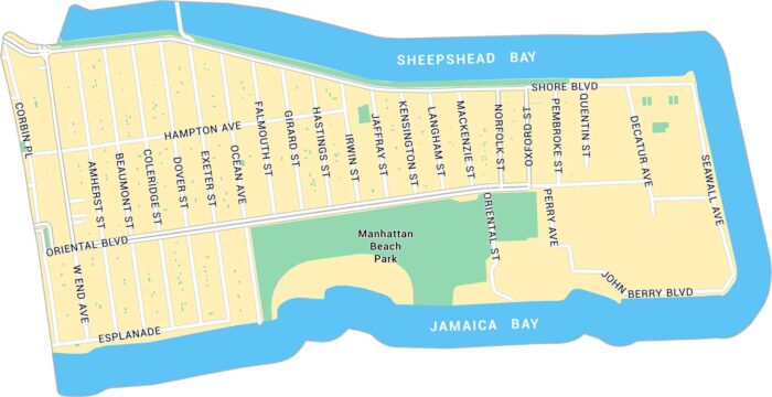
Our map of Manhattan Beach shows the small coastal neighborhood at Brooklyn’s southern edge facing the Atlantic Ocean.
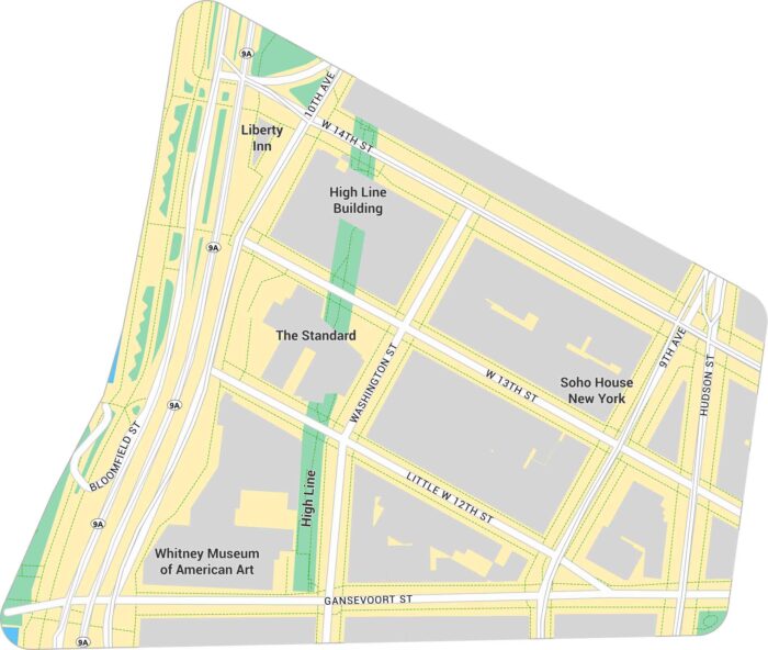
The Meatpacking District sits on Manhattan’s west side. Our map shows its road network, the High Line, and access to the Hudson River.
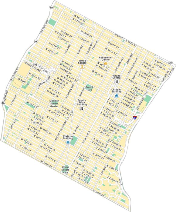
Our map of Midtown shows the heart of Manhattan between 14th and 59th Streets. It highlights major avenues, landmarks, and parks.
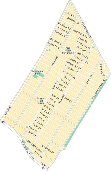
Our map of Park Slope shows this NYC neighborhood that stretches along Prospect Park. It includes main roads and green spaces.
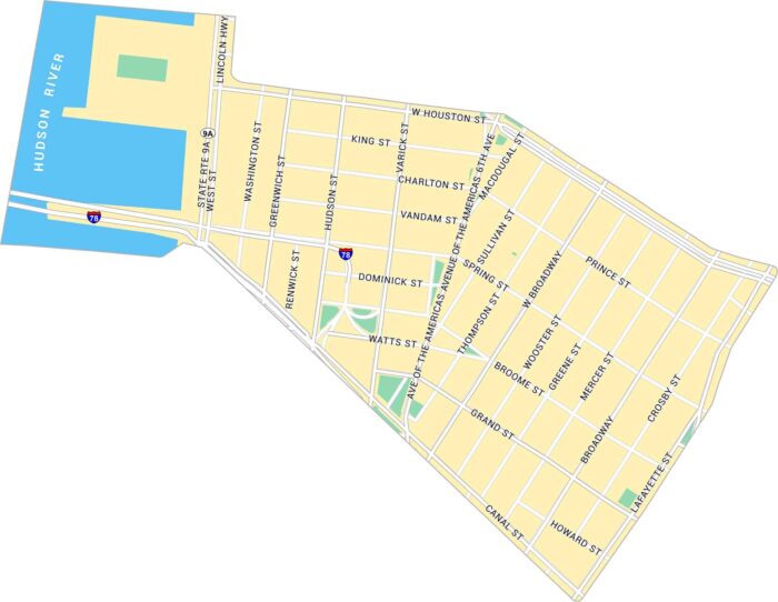
SoHo is stylish, busy, and always changing. Our SoHo map highlights shows its parks and roads from Houston and Canal Streets.
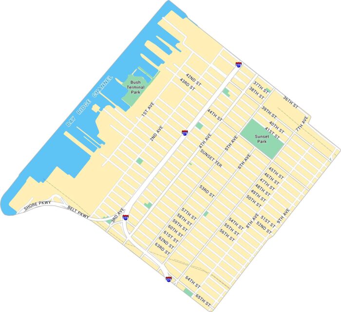
Sunset Park sits on Brooklyn’s western edge, overlooking New York Harbor. Our map shows its streets, green parkland, and waterfront.
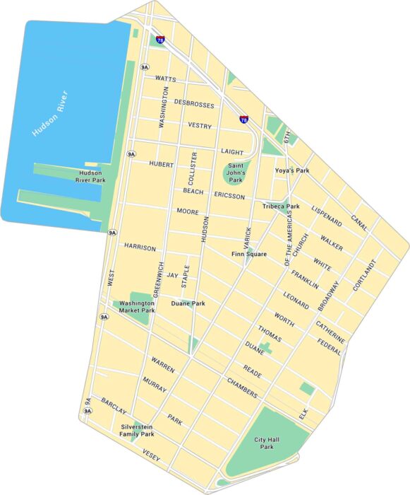
Tribeca is one of New York’s most distinct neighborhoods. Our map of Tribeca highlights its major roads, nearby piers, and parks.