New York Zip Code Map
New York zip codes change fast. Our New York zip code map shows tight clusters in the city and much larger areas upstate. No state shows greater zip code density contrast than this one.
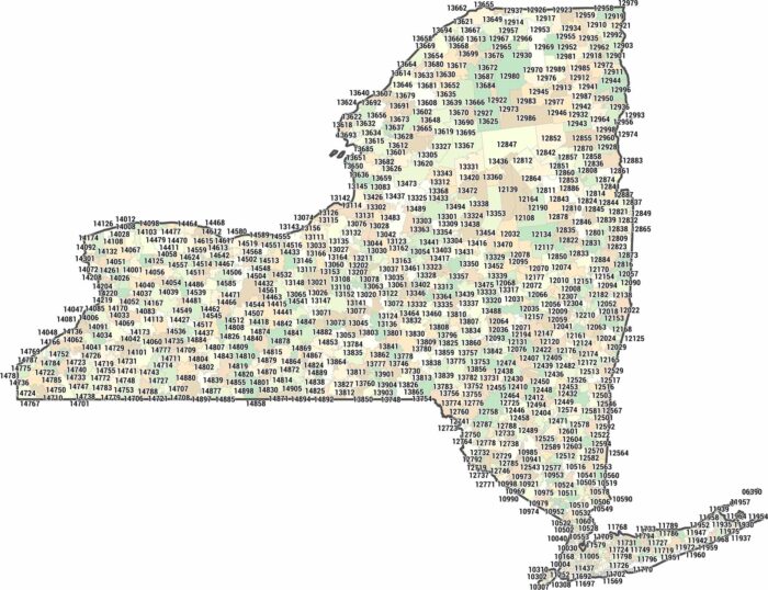
New York zip codes change fast. Our New York zip code map shows tight clusters in the city and much larger areas upstate. No state shows greater zip code density contrast than this one.
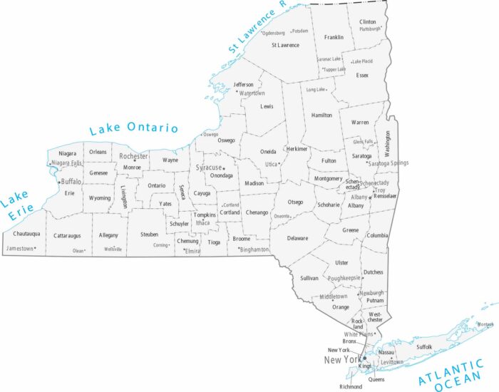
Spanning from the Atlantic to the Great Lakes, our map of New York identifies its 62 counties and major cities like New York City and Albany.
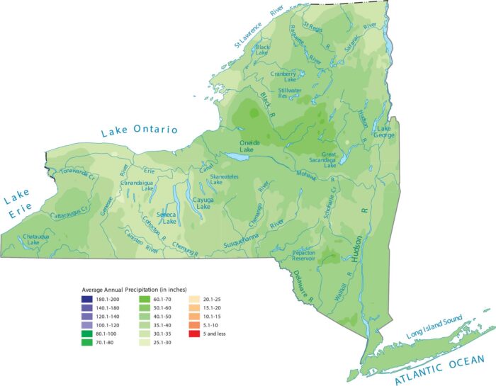
Our precipitation map of New York reveals how the Adirondack and Catskill Mountains create pockets of heavier rainfall.
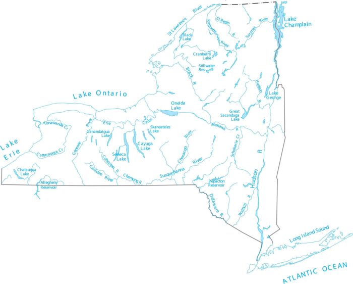
Get around New York’s waterways with our lakes and rivers map. Our map features the Hudson River, the Finger Lakes, and Lake Champlain.
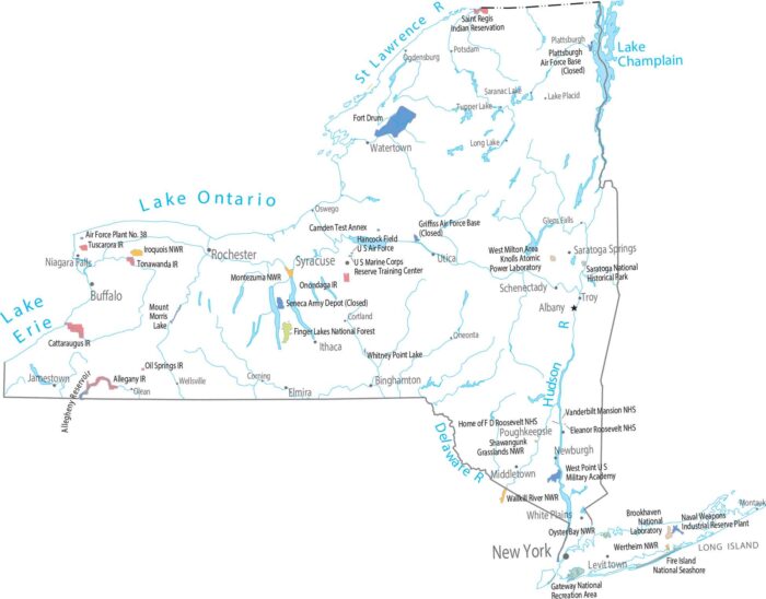
Surprisingly, there are no national parks in New York. But it does have one national forest by the name of Finger Lakes National Forest.
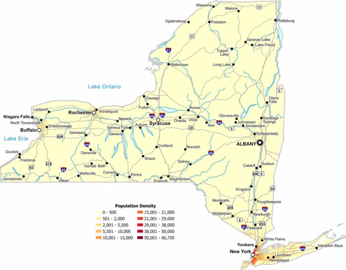
Our population density map of New York shows how geography divides the state. Density peaks in the southern New York City region.
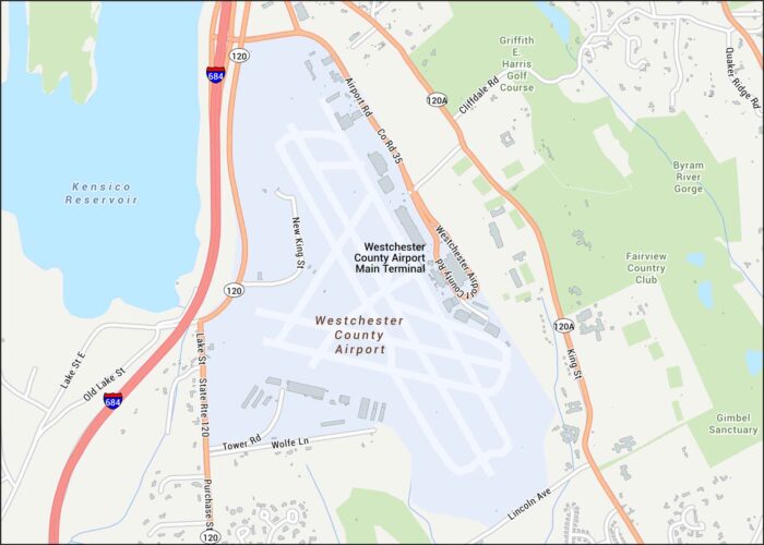
Here’s our map of Westchester County Airport showing the main terminal, runways and access via Route 120 and I-684.
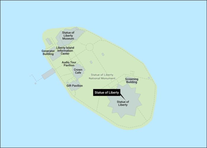
Here’s our map of Liberty Island showing the statue, ferry landing, and walkways. The Statue of Liberty stands in New York Harbor.
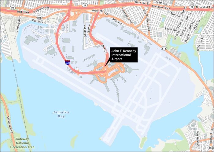
JFK Airport welcomes millions yearly. Located in Queens, New York, it’s a major international hub. Our map shows runways, highways and Jamaica Bay. Map Information On the Map Interstates/Highways: I-678, State Rte 27, State Rte 878, JFK Expy Major Roads: Southern Pkwy, Belt Pkwy, Nassau Expy, S Conduit Ave, N Conduit Ave, Guy R Brewer…
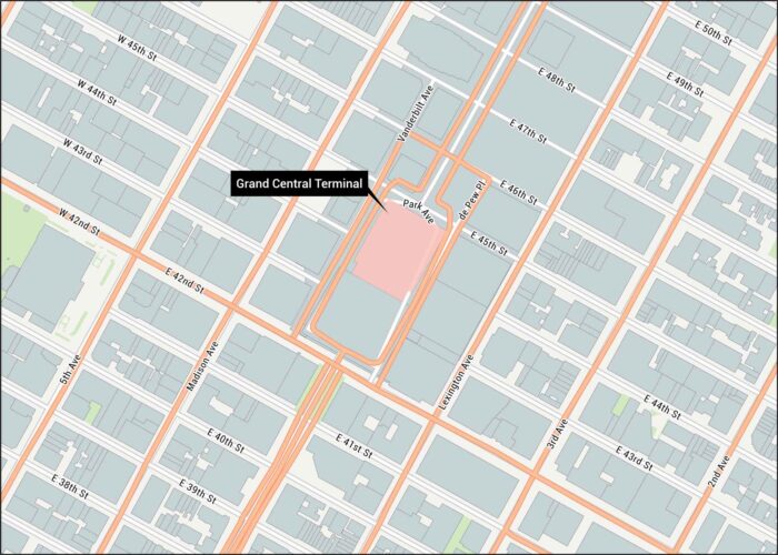
Step inside history with our Grand Central Terminal map. Our map highlights its location in in Midtown Manhattan with all of its streets.
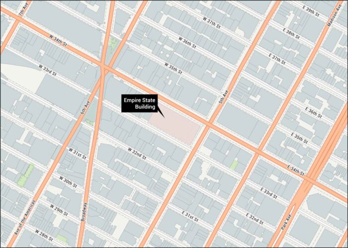
Visit the Empire. Located in Midtown Manhattan, our map shows all the nearby streets so you can get here safe and sound.
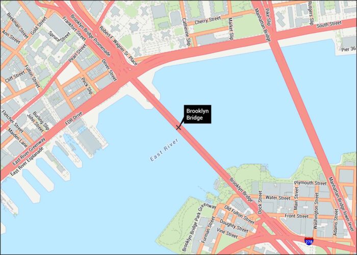
Explore our detailed Brooklyn Bridge map. Our map shows roads, highways, walkways piers and of course, the East River.
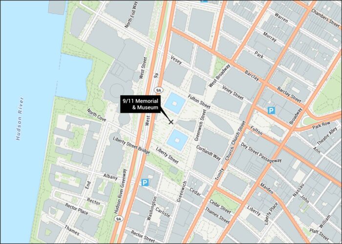
Our map shows the 9/11 Memorial and Museum layout in Lower Manhattan. The twin reflecting pools mark where the towers once stood.
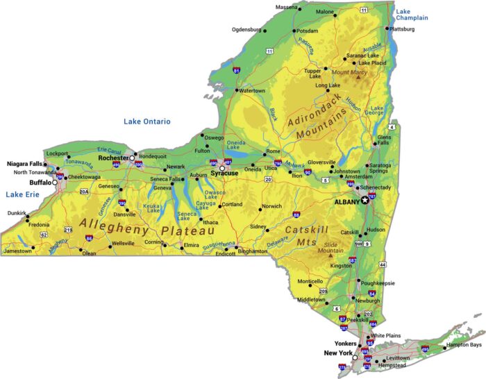
Our physical map of New York shows more than NYC. The Adirondack Mountains rise in the northeast, while the Catskills hold the southeast.
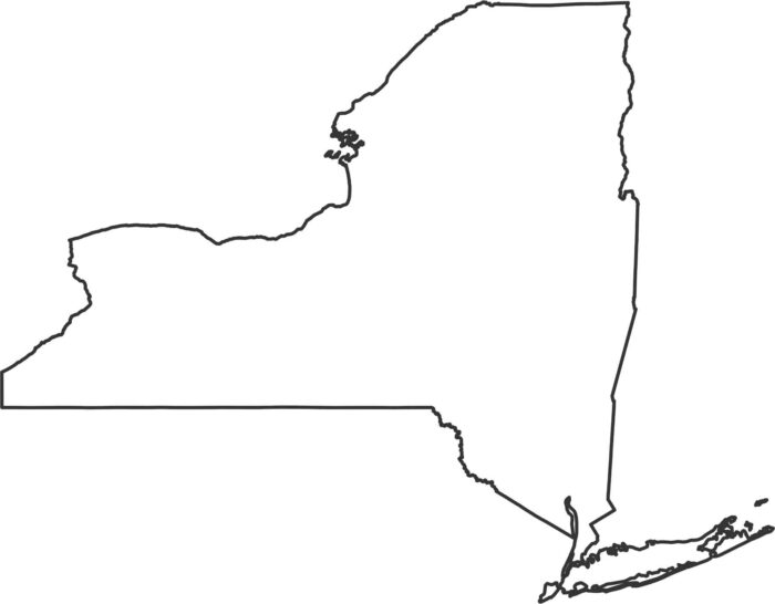
New York stretches from the Great Lakes all the way to the Atlantic. Our New York outline map highlights its borders showing the state shape.