Eagle Rock Map, Los Angeles
Discover Eagle Rock with our map, showing the Los Angeles neighborhood located between the Pasadena Hills and Glendale.
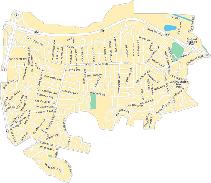
Discover Eagle Rock with our map, showing the Los Angeles neighborhood located between the Pasadena Hills and Glendale.
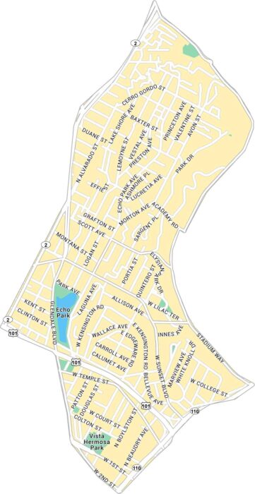
Get to know Echo Park with our map of Los Angeles neighborhood. It highlights Echo Park Lake, main streets, and residential roads.
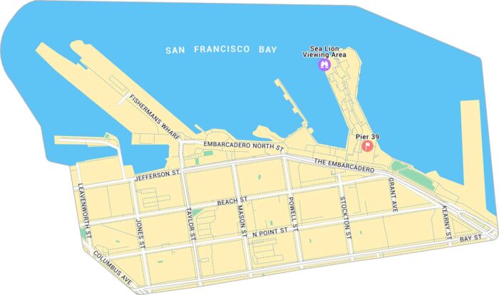
Our map of Fisherman’s Wharf shows the waterfront district on San Francisco’s northern edge with its roads, piers and sea lion viewing area.
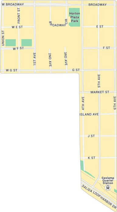
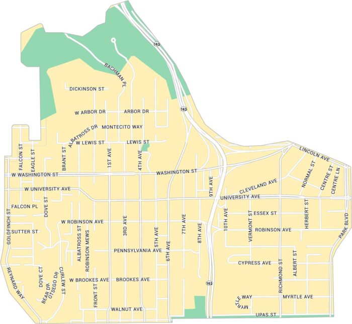
Our map of the Gaslamp Quarter shows the downtown San Diego district just north of the harbor. It’s a busy stretch packed with energy.
Hillcrest sits just north of Balboa Park, close to the center of San Diego. Our map lays out its highways, parks, and tight grid of streets.
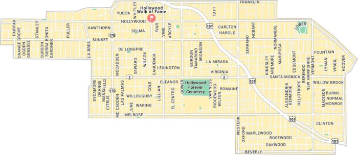
Hollywood sits in the heart of Los Angeles, cut through by Sunset and Hollywood Boulevard. Our map shows its main streets and highways.
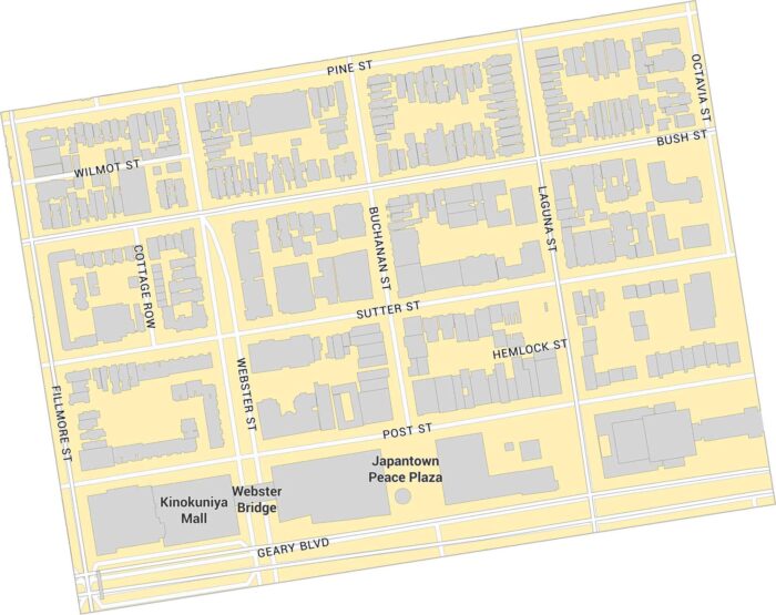
Japantown sits in central San Francisco, just west of Van Ness Avenue. This map shows its main plaza, surrounding streets, and nearby parks.
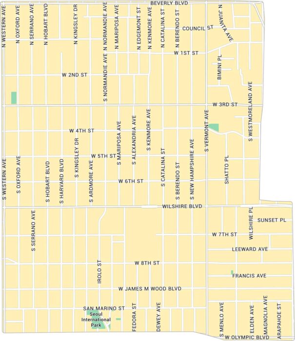
Koreatown sits just west of downtown Los Angeles. From Wilshire to 3rd Street, this map lays out major boulevards and nearby parks.
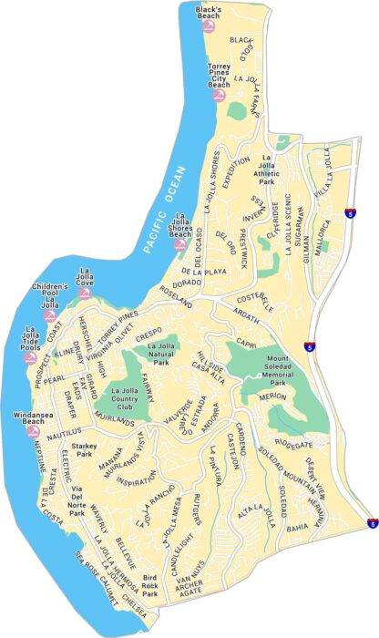
North of downtown San Diego, La Jolla stretches along coves facing the Pacific. The map shows its winding streets, beaches, and parks.
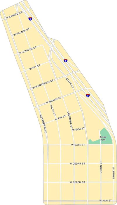
Our map of Little Italy shows this neighborhood just north of downtown San Diego. You’ll find its main streets, close to the waterfront area.
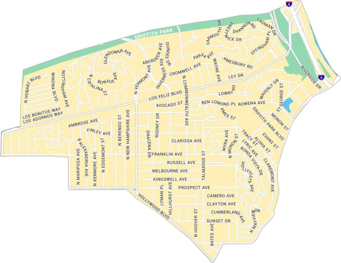
Explore Los Feliz with our map, showing this LA neighborhood at the base of Griffith Park. Follow its main streets and green spaces.
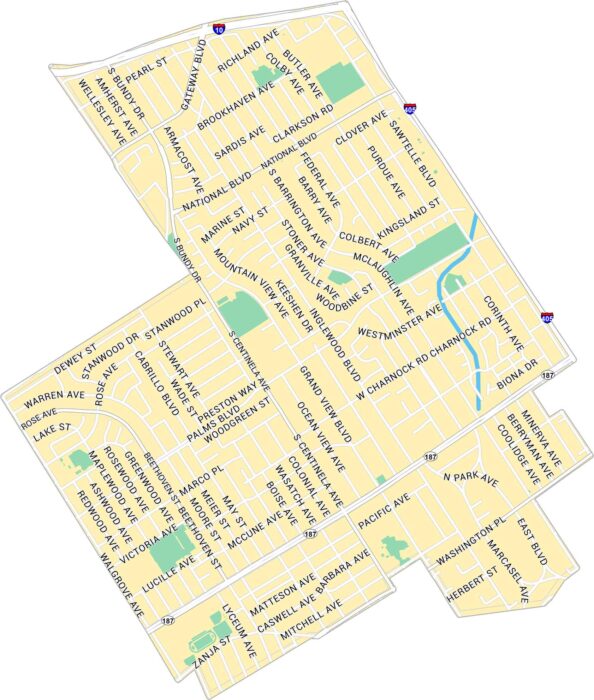
Our map of Mar Vista shows the Westside neighborhood. It highlights main streets, local parks, and nearby routes to the beach.
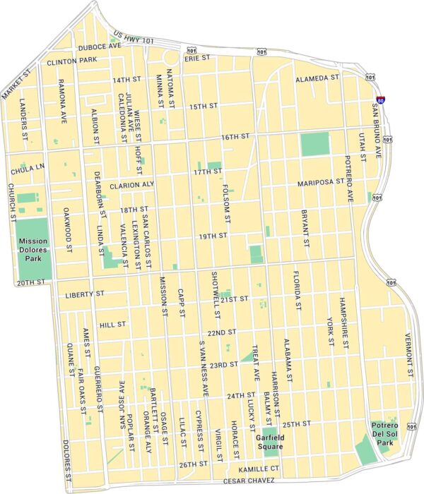
Our map of the Mission District shows the neighborhood in central San Francisco. You’ll find major streets and parks such as Dolores Park.
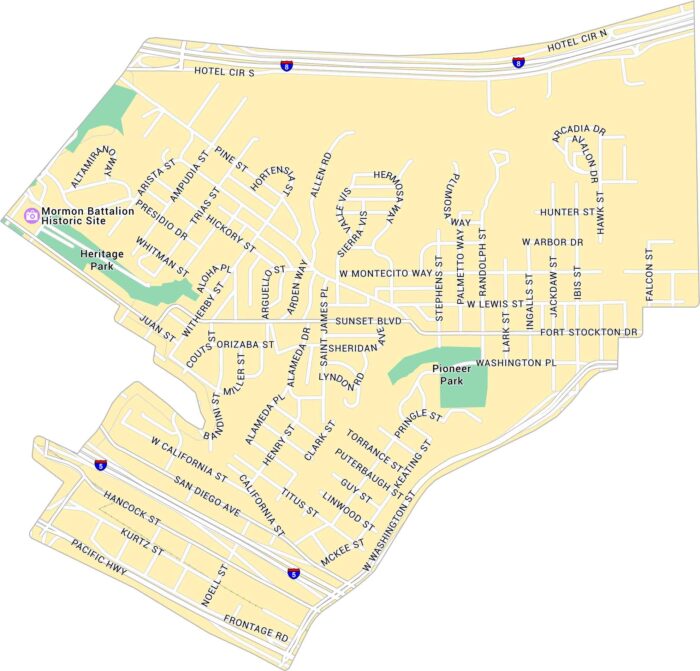
Our map of Mission Hills shows the hillside neighborhood just north of downtown San Diego. It highlights highways, main streets and parks.
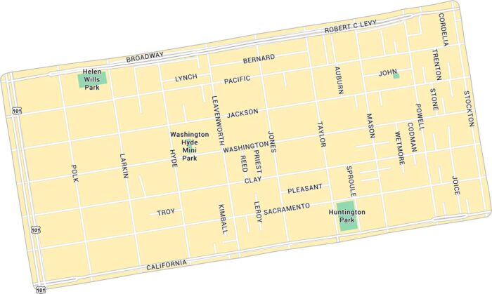
Our map of Nob Hill shows the central San Francisco neighborhood set high above downtown. It includes streets, parks, and more.