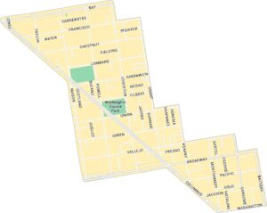
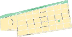
Nob Hill Map, San Francisco
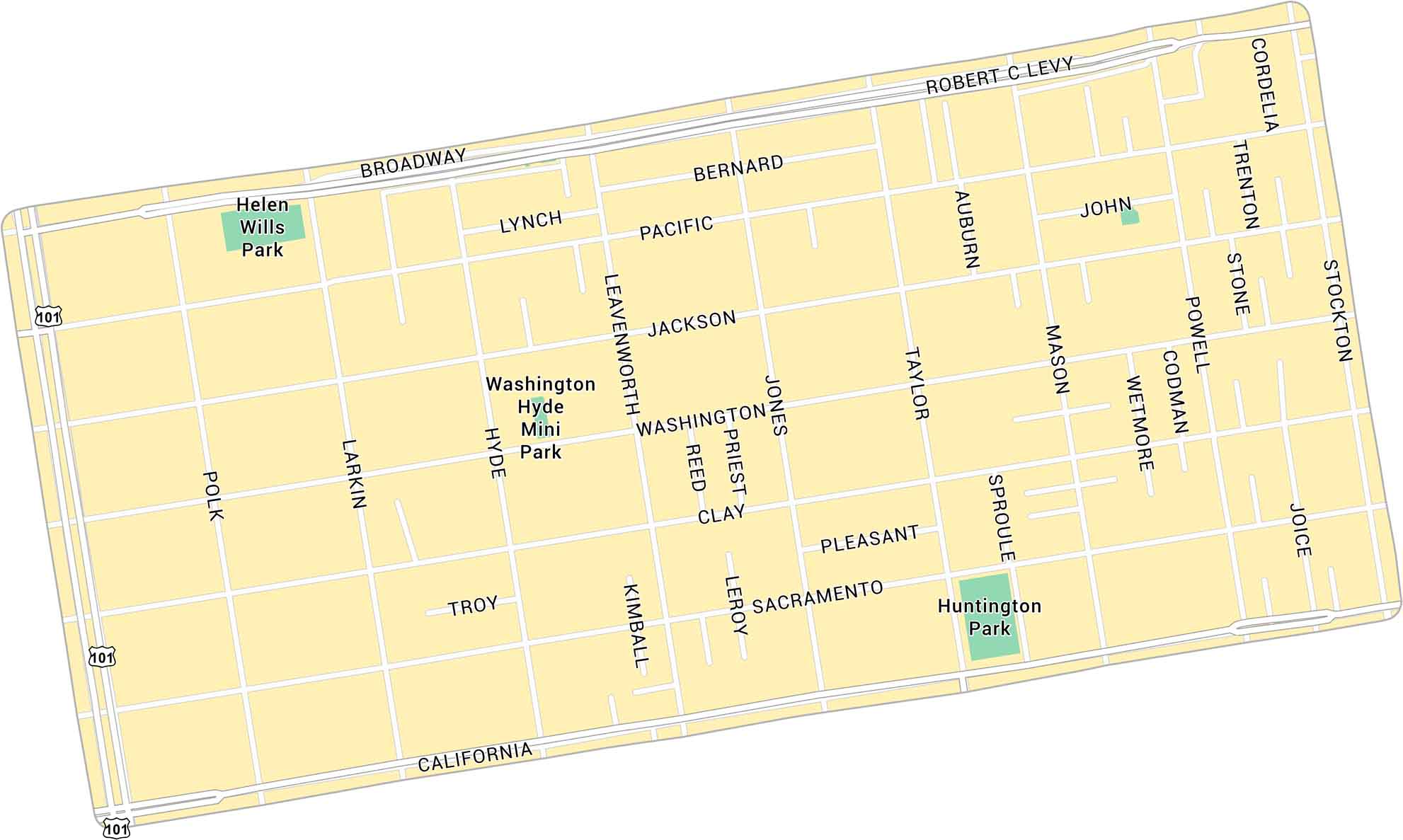
Our map of Nob Hill shows this central San Francisco neighborhood set high above downtown. It includes steep streets, nearby parks, and major routes crossing the hill. It’s a well-known area in San Francisco with sweeping city views.
Map Information
On the Map
Highways: US Hwy 101 Major Roads: California St, Broadway, Polk St, Larkin St, Hyde St, Leavenworth St, Jones St, Taylor St, Mason St, Powell St, Stockton St, Sacramento St, Clay St, Washington St, Jackson St, Pacific St, Bernard, Lynch, Robert C Levy, Cordelia Parks: Huntington Park, Helen Wills Park, Washington Hyde Mini ParkSan Francisco Neighborhood Maps
See our neighborhood maps for a closer look of the city.
California City Maps
Here are detailed maps of California


