North Beach Map, San Francisco
Our map of North Beach shows this lively neighborhood. It outlines key streets and open spaces around Washington Square.
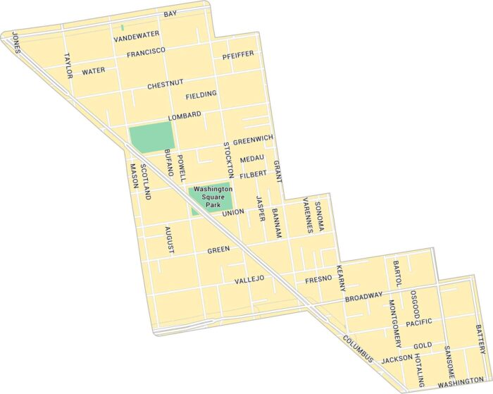
Our map of North Beach shows this lively neighborhood. It outlines key streets and open spaces around Washington Square.
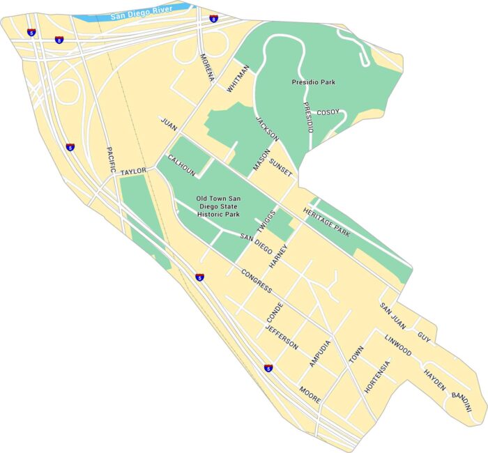
Old Town San Diego sits just north of downtown, near the junction of Interstates 5 and 8. Our map shows its streets, parks, and landmarks.
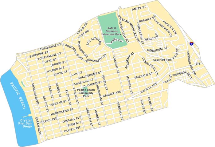
Our map of Pacific Beach shows the coastal neighborhood stretching along the San Diego shoreline. It includes streets, parks and Crystal Pier.
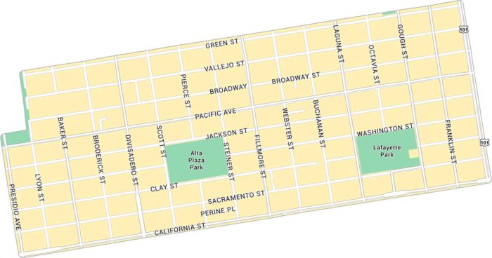
Our map of Pacific Heights shows the hilly neighborhood overlooking San Francisco Bay. It highlights main streets and parks.
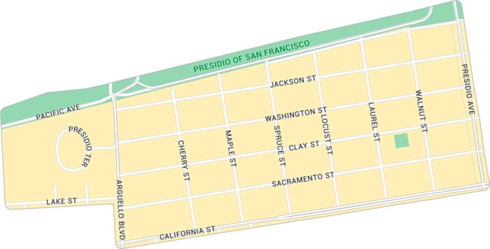
Our map of Presidio Heights shows a peaceful neighborhood bordering the Presidio. It includes major streets and nearby green spaces.
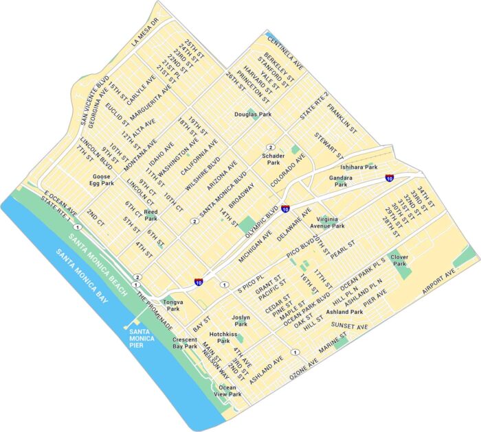
Santa Monica stretches along the Pacific Ocean. Our map shows its downtown roads, the famous pier, and Ocean Avenue running beside the coast.
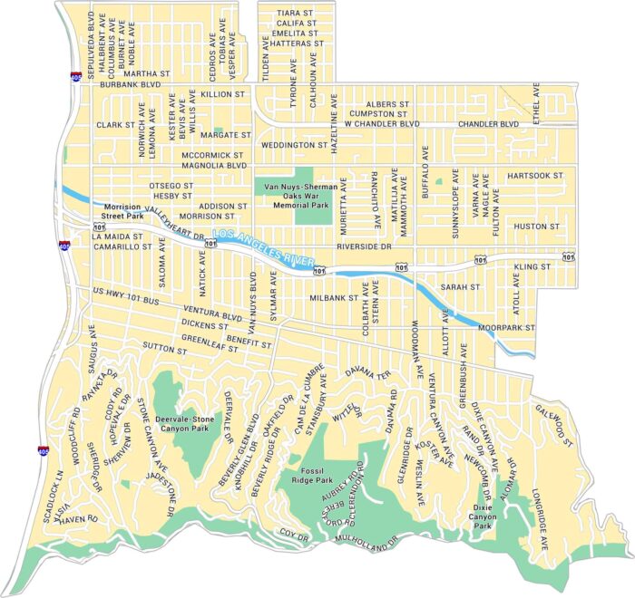
Sherman Oaks sits in the heart of the San Fernando Valley. Our Sherman Oaks map highlights its streets, Ventura Boulevard, and nearby parks.
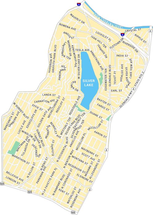
Silver Lake is one of Los Angeles’ most defining neighborhoods. Our map shows the parks, highways and lively stretches of Sunset Boulevard.
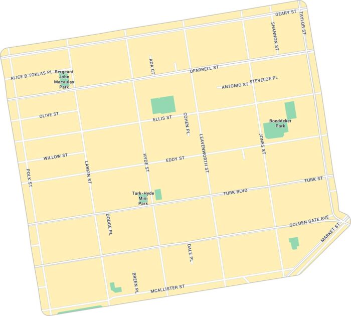
The Tenderloin is a gritty neighborhood near downtown San Francisco. Our map of Tenderloin highlights its streets and parks.
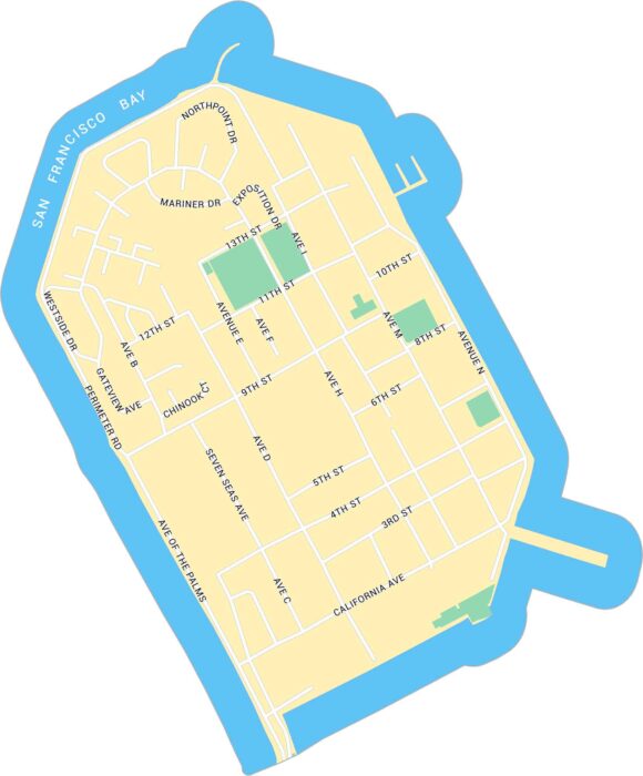
Treasure Island sits in the middle of San Francisco Bay. Our map shows this man-made island including its streets and surrounding parks.
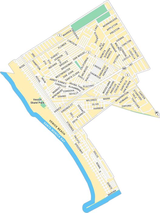
Venice feels like its own world by Santa Monica Bay. Our map of Venice highlights Venice Beach, parks and its streets.
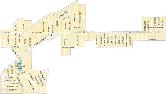
West Hollywood buzzes with character. Our map of West Hollywood shows Sunset Boulevard, Melrose Avenue, and its residential streets.
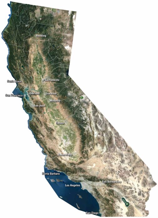
Our satellite map shows cities like San Diego and San Francisco along the coast. The Sierra Nevada rises east, while deserts cover the south.
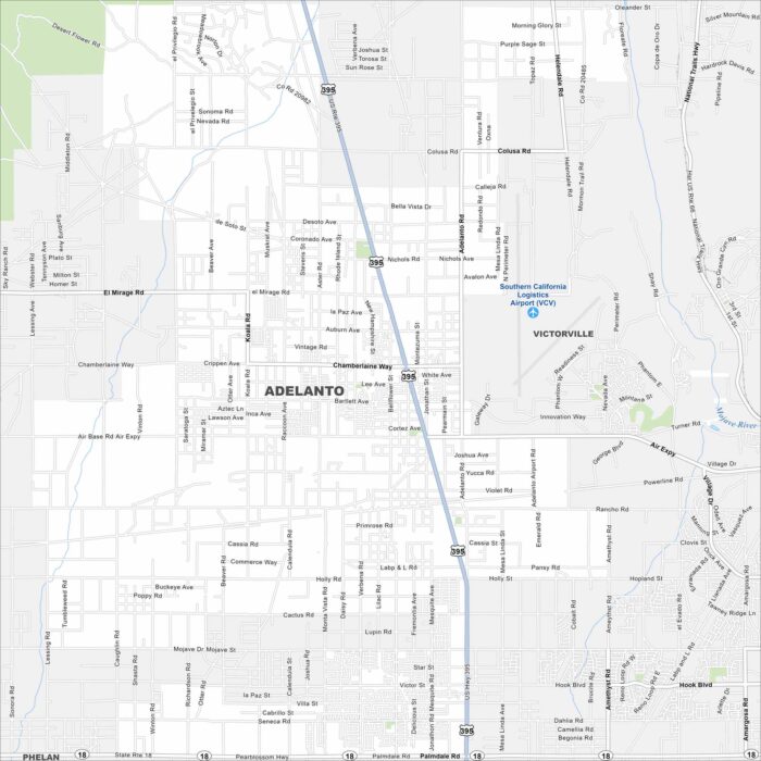
Adelanto spreads across the Mojave Desert. Its wide roads and highways cut through open land. Our map highlights its desert setting.
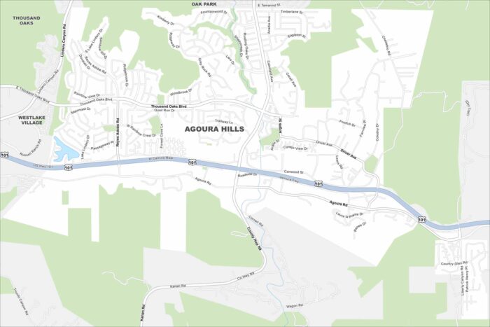
Winding canyon roads and freeway routes are main features Agoura Hills. Our map shows these types of road as well as natural features.