New York County Map
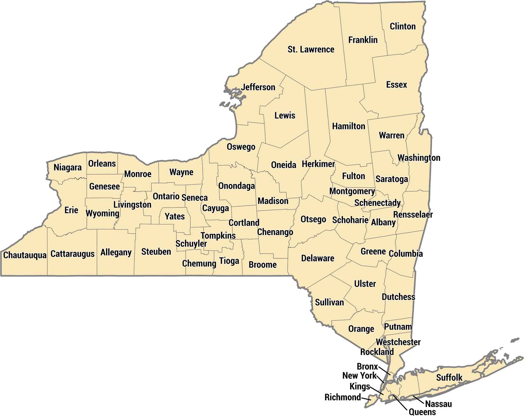
With 62 counties, New York stretches from Manhattan to Niagara Falls. The five boroughs of NYC are actually five separate counties packed with millions. Upstate counties like Hamilton and Essex are Adirondack wilderness with more trees than people.
Map Information
On the Map
Our table below provides you with population, area, and FIPS code for each county.
|
Name |
Population 2024 |
Total Area (sq mi) |
FIPS Code |
|
Albany County |
319,964 |
533.3 |
36-001 |
|
Allegany County |
47,299 |
1,034.40 |
36-003 |
|
Bronx County |
1,384,724 |
57.4 |
36-005 |
|
Broome County |
196,397 |
715.5 |
36-007 |
|
Cattaraugus County |
75,475 |
1,322.50 |
36-009 |
|
Cayuga County |
74,567 |
863.7 |
36-011 |
|
Chautauqua County |
124,105 |
1,500.20 |
36-013 |
|
Chemung County |
81,115 |
410.8 |
36-015 |
|
Chenango County |
45,776 |
898.6 |
36-017 |
|
Clinton County |
77,871 |
1,117.50 |
36-019 |
|
Columbia County |
60,299 |
648.2 |
36-021 |
|
Cortland County |
45,945 |
501.5 |
36-023 |
|
Delaware County |
44,191 |
1,467.40 |
36-025 |
|
Dutchess County |
299,963 |
825.3 |
36-027 |
|
Erie County |
950,602 |
1,226.80 |
36-029 |
|
Essex County |
36,744 |
1,916.30 |
36-031 |
|
Franklin County |
47,086 |
1,697.40 |
36-033 |
|
Fulton County |
52,073 |
532.9 |
36-035 |
|
Genesee County |
57,604 |
495.3 |
36-037 |
|
Greene County |
46,903 |
658 |
36-039 |
|
Hamilton County |
5,082 |
1,807.80 |
36-041 |
|
Herkimer County |
59,585 |
1,458.00 |
36-043 |
|
Jefferson County |
113,140 |
1,857.30 |
36-045 |
|
Kings County |
2,617,631 |
96.8 |
36-047 |
|
Lewis County |
26,570 |
1,289.90 |
36-049 |
|
Livingston County |
61,561 |
640.3 |
36-051 |
|
Madison County |
67,072 |
661.3 |
36-053 |
|
Monroe County |
752,202 |
1,366.70 |
36-055 |
|
Montgomery County |
49,648 |
410.3 |
36-057 |
|
Nassau County |
1,392,438 |
453.5 |
36-059 |
|
New York County |
1,660,664 |
33.7 |
36-061 |
|
Niagara County |
209,570 |
1,139.70 |
36-063 |
|
Oneida County |
228,347 |
1,257.60 |
36-065 |
|
Onondaga County |
469,812 |
805.6 |
36-067 |
|
Ontario County |
113,012 |
662.5 |
36-069 |
|
Orange County |
411,767 |
838.6 |
36-071 |
|
Orleans County |
39,686 |
817.4 |
36-073 |
|
Oswego County |
118,305 |
1,312.10 |
36-075 |
|
Otsego County |
60,524 |
1,015.80 |
36-077 |
|
Putnam County |
98,409 |
246.2 |
36-079 |
|
Queens County |
2,316,841 |
178 |
36-081 |
|
Rensselaer County |
160,749 |
665.4 |
36-083 |
|
Richmond County |
498,212 |
102.3 |
36-085 |
|
Rockland County |
348,144 |
199.3 |
36-087 |
|
St. Lawrence County |
106,198 |
2,821.30 |
36-089 |
|
Saratoga County |
240,360 |
843.8 |
36-091 |
|
Schenectady County |
162,261 |
209.4 |
36-093 |
|
Schoharie County |
30,151 |
626.3 |
36-095 |
|
Schuyler County |
17,121 |
342.3 |
36-097 |
|
Seneca County |
32,650 |
390.4 |
36-099 |
|
Steuben County |
92,015 |
1,404.10 |
36-101 |
|
Suffolk County |
1,535,909 |
2,373.10 |
36-103 |
|
Sullivan County |
80,450 |
996.7 |
36-105 |
|
Tioga County |
47,574 |
522.9 |
36-107 |
|
Tompkins County |
105,602 |
491.5 |
36-109 |
|
Ulster County |
182,977 |
1,160.80 |
36-111 |
|
Warren County |
65,288 |
931.6 |
36-113 |
|
Washington County |
59,839 |
845.9 |
36-115 |
|
Wayne County |
90,757 |
1,383.00 |
36-117 |
|
Westchester County |
1,006,447 |
500 |
36-119 |
|
Wyoming County |
39,588 |
596.3 |
36-121 |
|
Yates County |
24,387 |
375.8 |
36-123 |
New York State Maps
Find state maps of the Empire State.


State County Maps
Click on a map below to check out county maps of each state.


