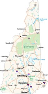
New Hampshire Physical Map
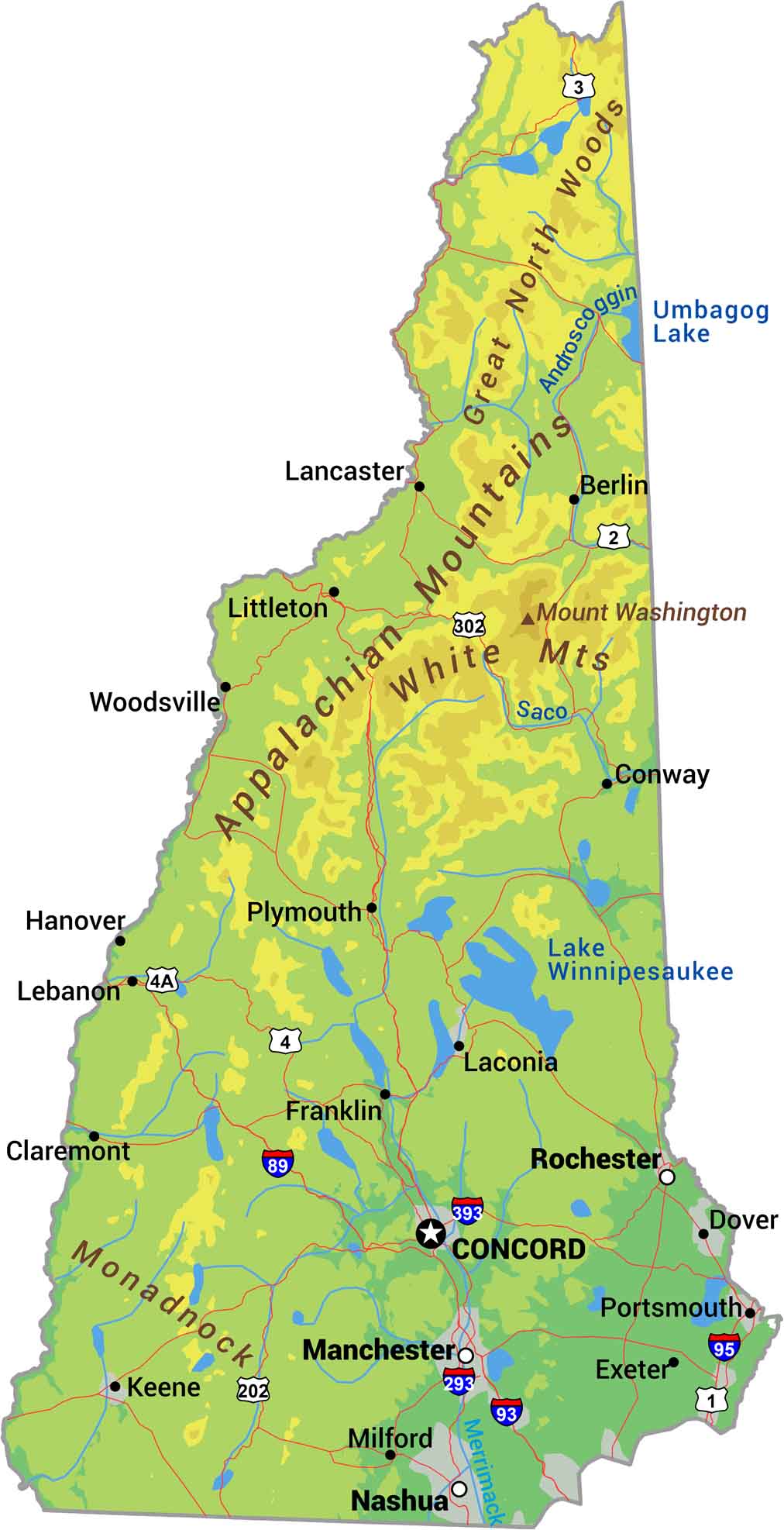
This is why New Hampshire feels vertical. The White Mountains cover the north with Mount Washington hitting 6,288 feet. It’s actually the highest peak in the Northeast. South of the mountains, the land drops through lakes region and rolling hills toward the coast. Our New Hampshire physical map shows its rugged terrain.
Map Information
On the Map
Physical State Maps
Select any state map below to view its physical map.


New Hampshire State Maps
Select one of our maps of the Granite State.