Home » State Maps » Michigan Population Map

Michigan Population Map

Michigan Population Density Map

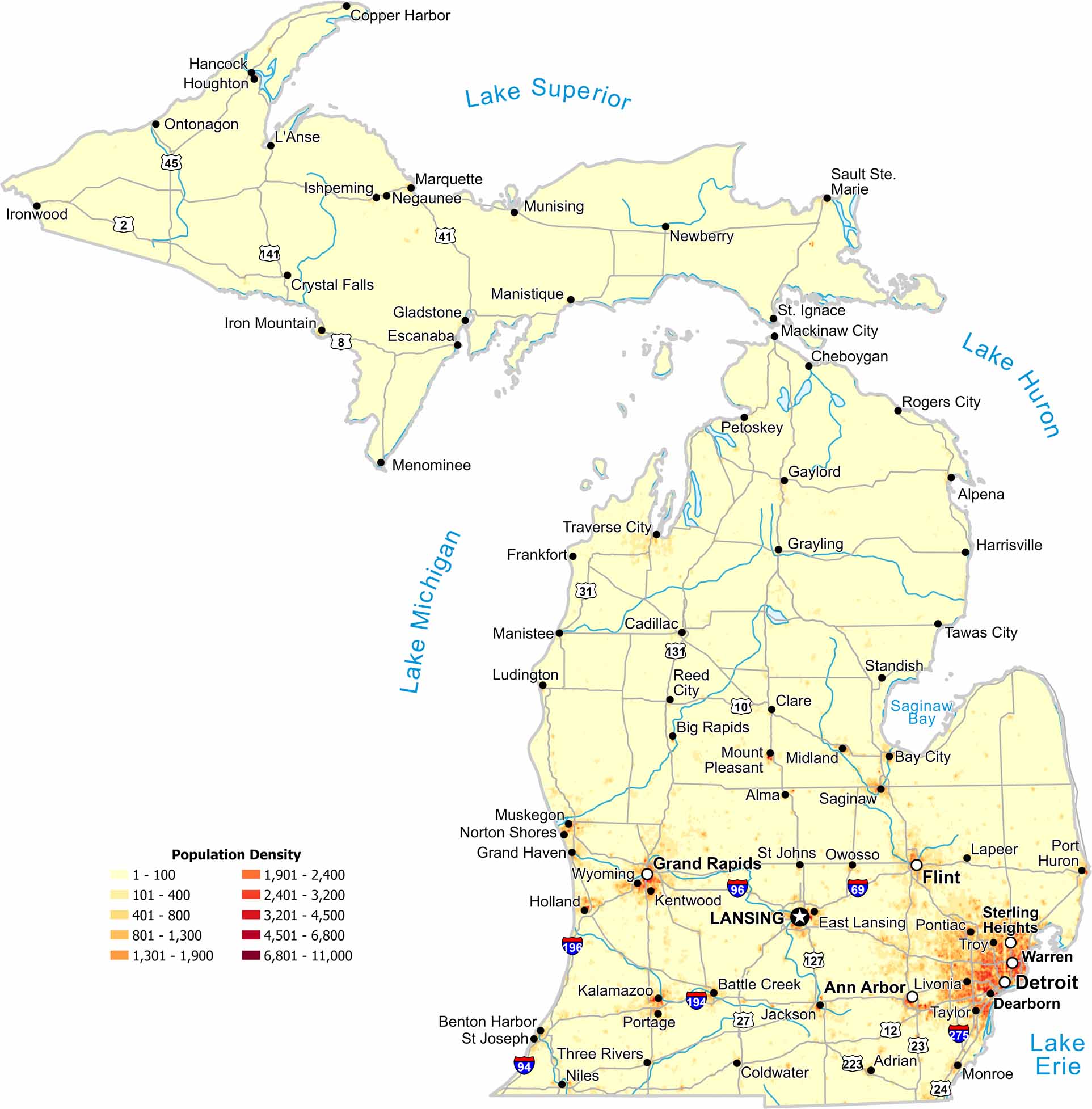
Our population density map of Michigan shows a sharp north–south contrast. Population clusters near Detroit and along lake shores. But the northern region is much more sparse in comparison.

Map Information

  • Population Density Map of Michigan
  • Data provided by NASA SEDAC Gridded Population of the World
  • Free for personal and commercial purpose. Attribution is required. How to attribute?

On the Map

Michigan Location Map
State Capital: Lansing Major Cities: Ann Arbor, Detroit, Flint, Grand Rapids, Sterling Heights, Warren Cities and Towns: Adrian, Alma, Alpena, Battle Creek, Bay City, Benton Harbor, Big Rapids, Cadillac, Cheboygan, Clare, Coldwater, Copper Harbor, Crystal Falls, Dearborn, East Lansing, Escanaba, Frankfort, Gaylord, Gladstone, Grand Haven, Grayling, Hancock, Harrisville, Holland, Houghton, Iron Mountain, Ironwood, Ishpeming, Jackson, Kalamazoo, Kentwood, L’Anse, Lapeer, Livonia, Ludington, Mackinaw City, Manistee, Manistique, Marquette, Menominee, Midland, Monroe, Mount Pleasant, Munising, Muskegon, Negaunee, Newberry, Niles, Norton Shores, Ontonagon, Owosso, Petoskey, Pontiac, Port Huron, Portage, Reed City, Rogers City, Saginaw, Sault Ste. Marie, St Johns, St Joseph, St. Ignace, Standish, Tawas City, Taylor, Three Rivers, Traverse City, Troy, Wyoming Interstate Highways: I-69, I-75, I-94, I-96, I-194, I-196, I-275, I-475, I-696 US Routes: US-2, US-10, US-23, US-27, US-31, US-41, US-45, US-127, US-131, US-141

Leave a Reply

Your email address will not be published. Required fields are marked *