Downtown Denver Map
Here’s our map of Downtown Denver with a view of the city’s core. We’ve marked buildings, parks, major roads, and highways.
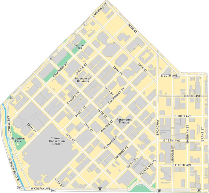
Here’s our map of Downtown Denver with a view of the city’s core. We’ve marked buildings, parks, major roads, and highways.
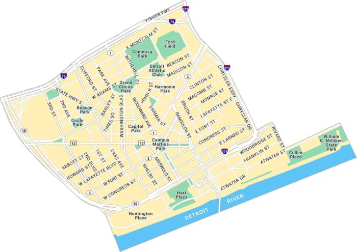
Our map of Downtown Detroit shows the streets along the river and around Campus Martius Park. The Detroit River forms the southern edge.
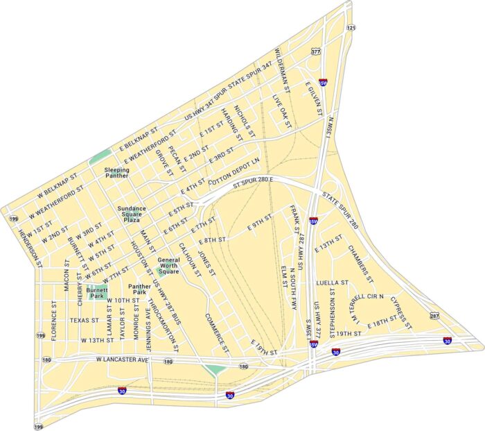
Explore Downtown Fort Worth with this detailed map. You can spot Sundance Square and all the streets leading toward the Stockyards.
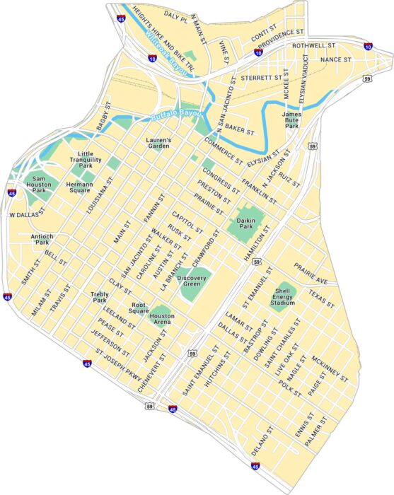
This map of Downtown Houston shows freeways and light rail lines. From Discovery Green to Buffalo Bayou, you can see it all on our map.
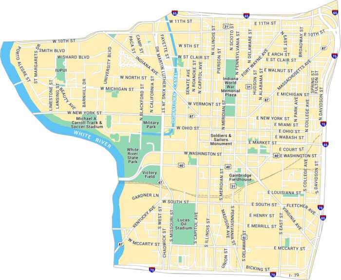
Our map of Downtown Indianapolis highlights Lucas Oil Stadium and attractions. City streets, sporting venues and parks are all clear to see.
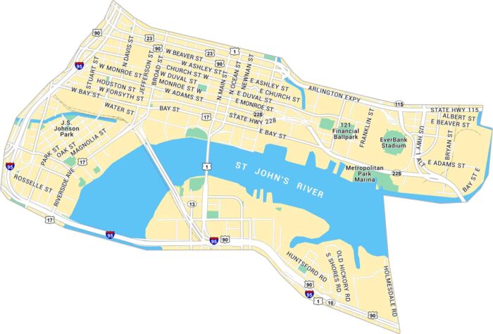
Here’s our map of Downtown Jacksonville running along the St. Johns River. It shows the bridges, parks, and downtown blocks.
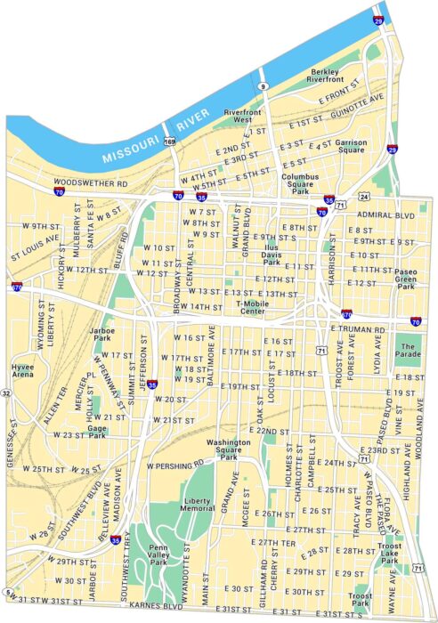
Our map of Downtown Kansas City shows this neighborhood set along the Missouri River. You’ll see parks, highways, and local routes.
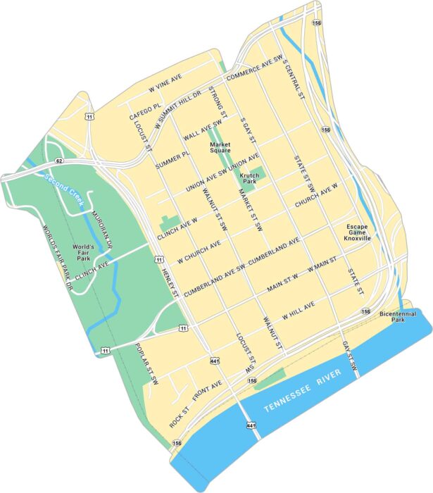
Our map of Downtown Knoxville shows the area around Market Square and the Tennessee River. It lays out main streets, parks, and routes.
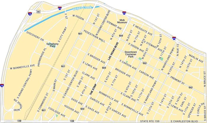
Get to know Downtown Las Vegas with our map that shows the Strip and Fremont Street. It includes the main roads, parks and highways.
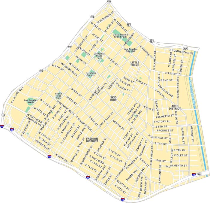
Our map of Downtown Los Angeles shows this big, loud center of LA. It includes the main roads, parks, and streets to the Arts District.
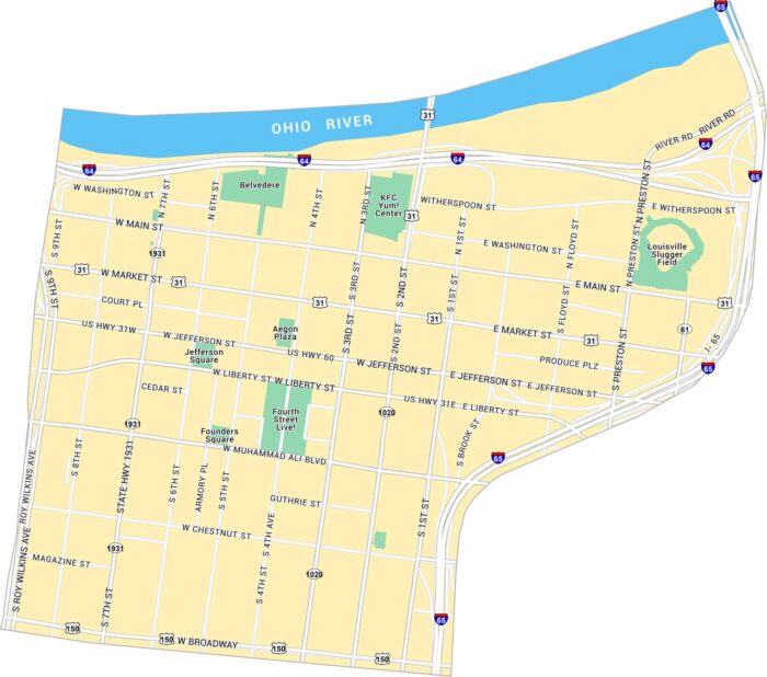
Our map of Downtown Louisville shows the area along the Ohio River, centered on Main and Market Streets. It has parks, bridges, and streets.
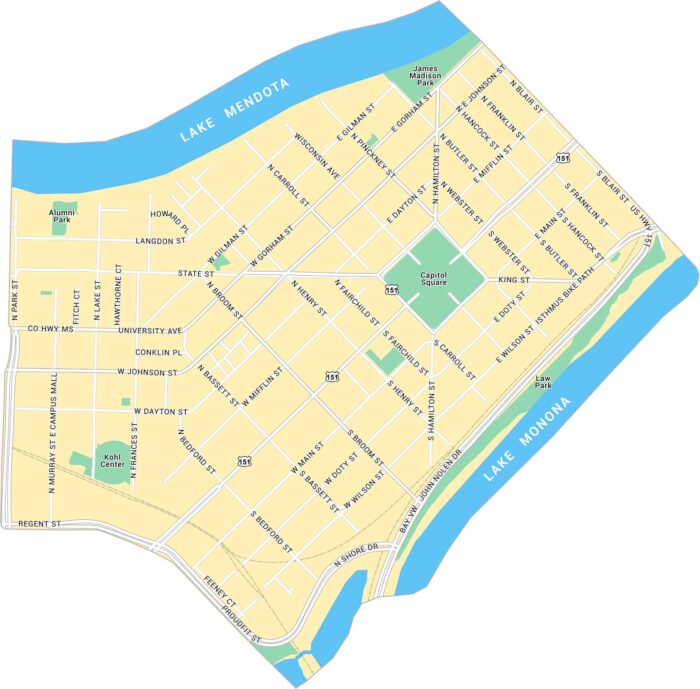
Our map of Downtown Madison shows the isthmus between Lake Mendota and Lake Monona. It lays out the Capitol Square, main streets, and parks.
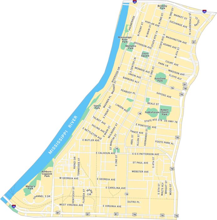
Learn more about Downtown Memphis with our road map. You’ll see the stretch along the Mississippi River and Beale Street.
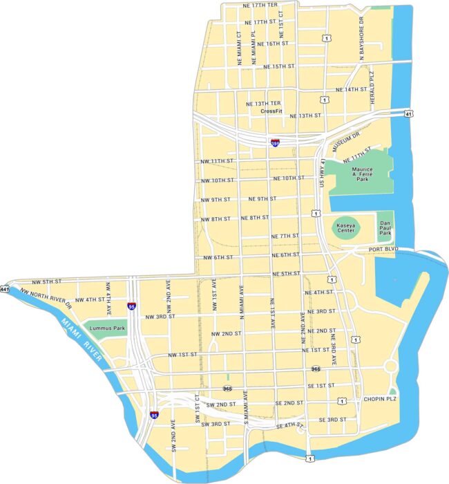
Our map of Downtown Miami shows the waterfront core along Biscayne Bay. It shows main streets, parks and the Miami River on the west side.
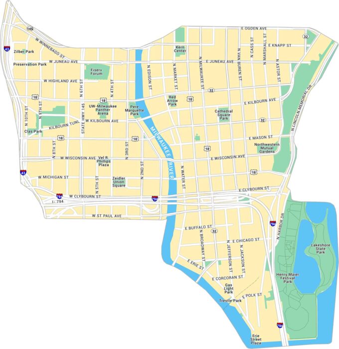
Downtown Milwaukee sits where the Milwaukee River meets Lake Michigan. Our map shows the riverwalk, main streets, and parks along the water.