Downtown Memphis Map
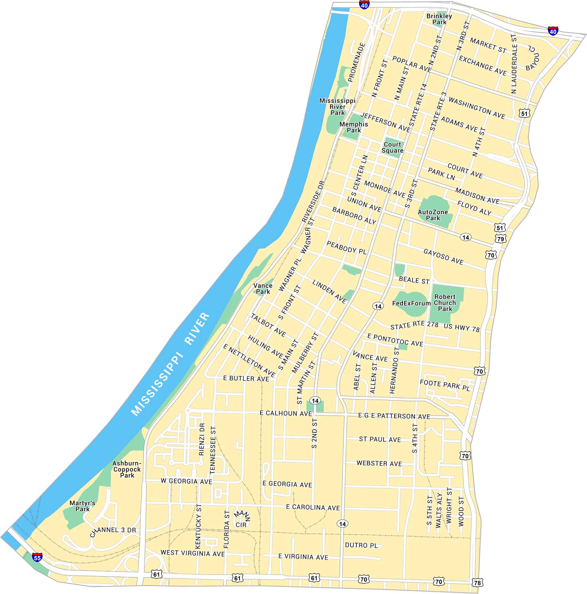
Learn more about Downtown Memphis with our road map. You’ll see the stretch along the Mississippi River and Beale Street. It lays out main roads, parks, and its bridges.
Map Information
On the Map
Interstates/Highways: I-40, I-55, US Hwy 51, US Hwy 61, US Hwy 70, US Hwy 78, US Hwy 79, State Rte 3, State Rte 14 Major Roads: Riverside Dr, Front St, Main St, 2nd St, 3rd St, 4th St, Union Ave, Madison Ave, Poplar Ave, Beale St, ML King Ave, Georgia Ave, Vance Ave, Linden Ave, Jefferson Ave, Adams Ave, Washington Ave, Market St, Exchange Ave, Monroe Ave Major Rivers: Mississippi River Parks: Mississippi River Park, Memphis Park, Court Square, Vance Park, Robert Church Park, Foote Park Pl, Ashburn-Coppock Park, Martyr’s Park, Brinkley Park Landmarks: Promenade, AutoZone Park, FedExForumCity Maps of Tennessee
Explore our Tennessee map collection


