Downtown Jacksonville Map
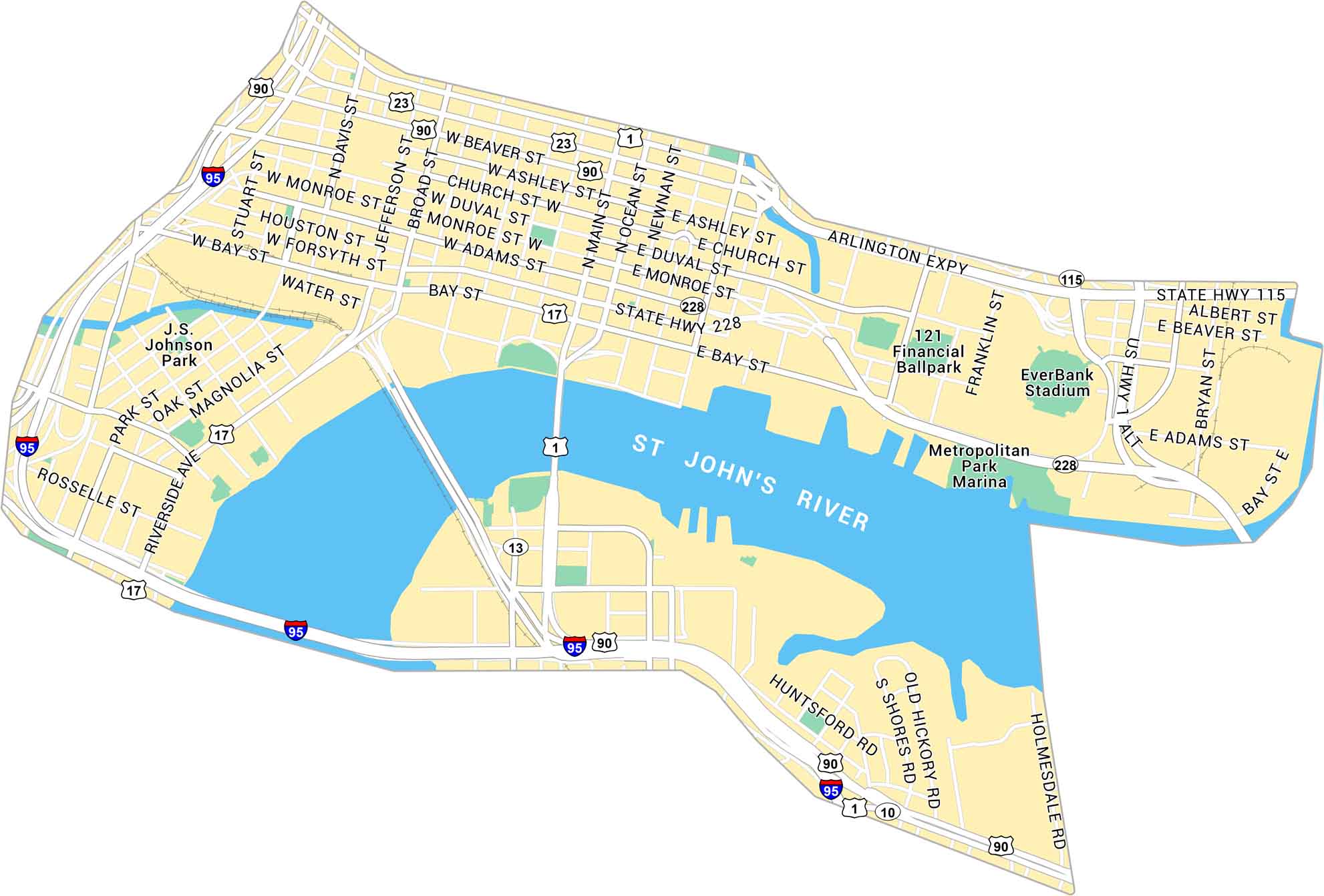
Here’s our map of Downtown Jacksonville running along the St. Johns River. It shows the bridges, parks, and downtown blocks. We’ve also included its NFL stadium and ballpark on our map too.
Map Information
On the Map
Interstates/Highways: I-95, US Hwy 1, US Hwy 90, US Hwy 17, US Hwy 1 Alt, State Hwy 115, State Hwy 228, State Rte 23, State Rte 13, State Rte 10 Major Roads: Arlington Expy, Bay St, Water St, Riverside Ave, Main St, Broad St, Jefferson St, Davis St, Ocean St, Newnan St, Ashley St, Church St, Duval St, Monroe St, Adams St, Forsyth St, Houston St, Beaver St, Bryan St, Albert St Major Rivers: St John’s River Parks: J.S. Johnson Park, Metropolitan Park Marina Landmarks: EverBank Stadium, 121 Financial BallparkFlorida City Maps
Chart your course through Miami and Florida’s cities


