Downtown Milwaukee Map
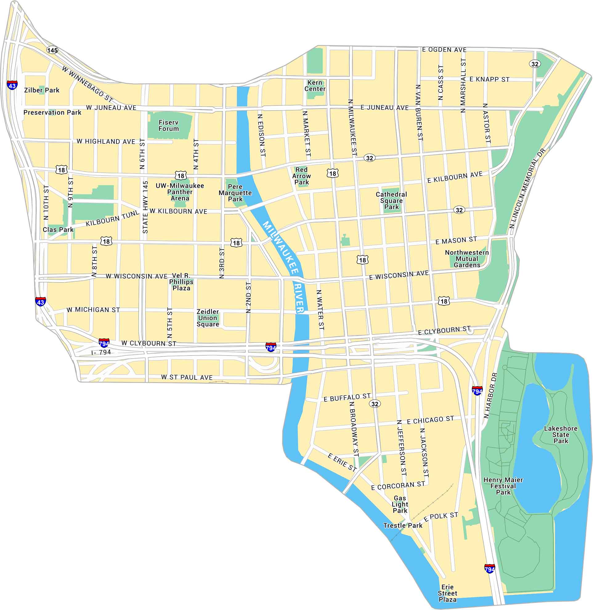
Downtown Milwaukee sits where the Milwaukee River meets Lake Michigan. Our map shows the riverwalk, main streets, and nearby parks along the water. It’s a clean, connected center with plenty of open views and easy paths.
Map Information
Milwaukee Neighborhood Maps
See our neighborhood maps for a closer look of the city.
On the Map
Interstates/Highways: I-43, I-794, US Hwy 18, State Hwy 145, State Hwy 32 Major Roads: Wisconsin Ave, Kilbourn Ave, Water St, Broadway, Milwaukee St, Jefferson St, Jackson St, Van Buren St, Cass St, Marshall St, Astor St, Juneau Ave, Highland Ave, State St, Wells St, Michigan St, Clybourn St, St Paul Ave, Winnebago St, Ogden Ave Major Rivers: Milwaukee River Parks: Lakeshore State Park, Henry Maier Festival Park, Northwestern Mutual Gardens, Cathedral Square Park, Red Arrow Park, Pere Marquette Park, Zeidler Union Square, Clas Park, Preservation Park, Zilber Park, Gas Light Park, Trestle Park Landmarks: Fiserv Forum, UW-Milwaukee Panther Arena, Kern Center, Vel R. Phillips Plaza, Erie Street PlazaCity Maps of Wisconsin
See our Wisconsin maps designed for clarity.


