Beverly Hills Map, Los Angeles
Here’s our map of Beverly Hills, the glamorous pocket west of Los Angeles. It lays out Rodeo Drive, Sunset Boulevard, and its roads.
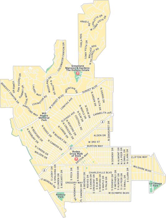
Here’s our map of Beverly Hills, the glamorous pocket west of Los Angeles. It lays out Rodeo Drive, Sunset Boulevard, and its roads.
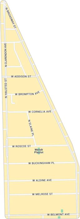
Our map of Boystown highlights the lively stretch around North Halsted in Chicago. It includes neighborhood streets and local parks.
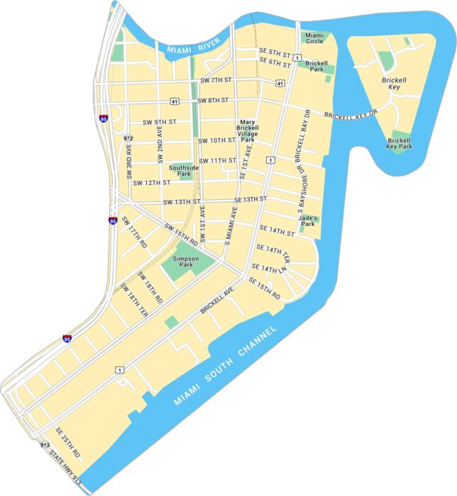
Take a look at our map of Brickell, Miami’s sleek financial hub along Biscayne Bay. You’ll find main roads, Brickell Key and local parks.
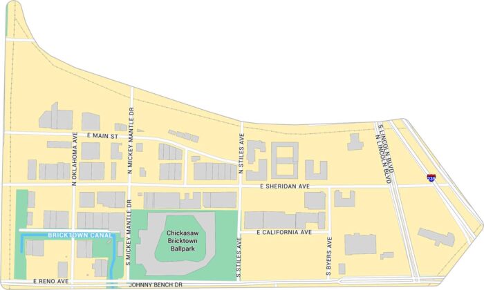
Our map of Bricktown shows the streets, warehouses, and nightlife district. It highlights the Bricktown Canal and Chickasaw Ballpark.
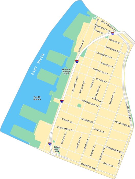
Here’s our map of Brooklyn Heights, situated along the East River. It includes Interstate 278, Brooklyn Bridge Park and local routes.
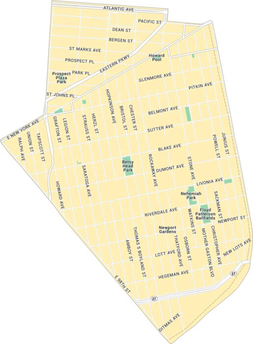
Our map of Brownsville lays out this historic Brooklyn neighborhood in clear detail. It shows major avenues and nearby parks.
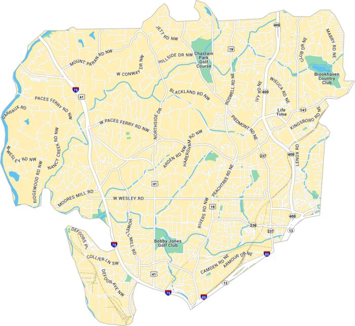
This map of Buckhead highlights Atlanta’s upscale core neighborhood. It shows Peachtree Road, Interstate 75 and its plethora of golf courses.
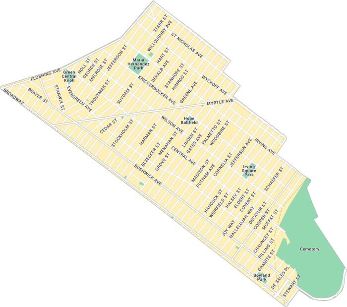
Our map of Bushwick shows its network of streets across this creative stretch of northern Brooklyn. It includes local parks, roads, etc.
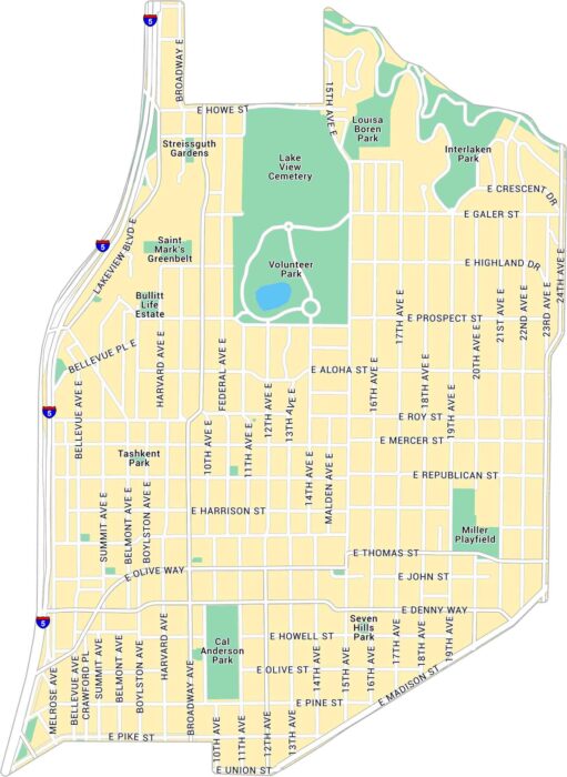
Our map of Capitol Hill highlights one of Seattle’s most exciting neighborhoods. You’ll find the main streets and local parks.
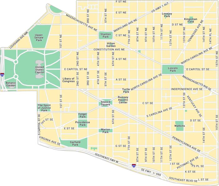
Our map of Capitol Hill focuses on the streets surrounding the U.S. Capitol. It includes major roads, parks, and the major attractions.
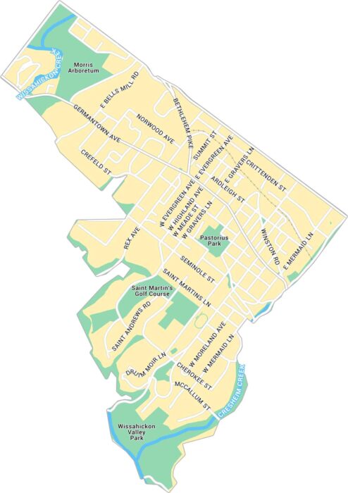
Our map of Chestnut Hill highlights the business district in northwest Philadelphia. You’ll also find local parks and city streets.
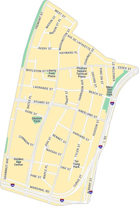
Take a look at our map of Chinatown, one of Boston’s most historic neighborhoods. It details the compact streets, highways, and parks.
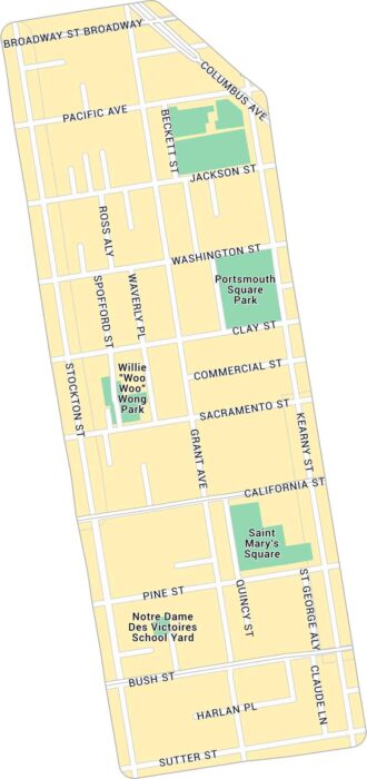
Our map of Chinatown in San Francisco highlights the narrow streets. It shows main routes and local parks.
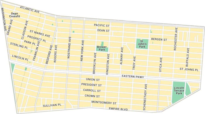
Here’s our map of Crown Heights covering this lively part of central Brooklyn. You’ll see main avenues and local parks.
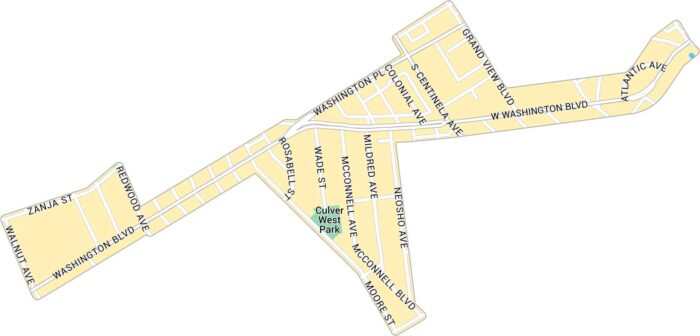
Our map of Culver West shows the streets and parks tucked into the west side of Culver City. It includes neighborhood roads and green spaces.