Brickell Map, Miami
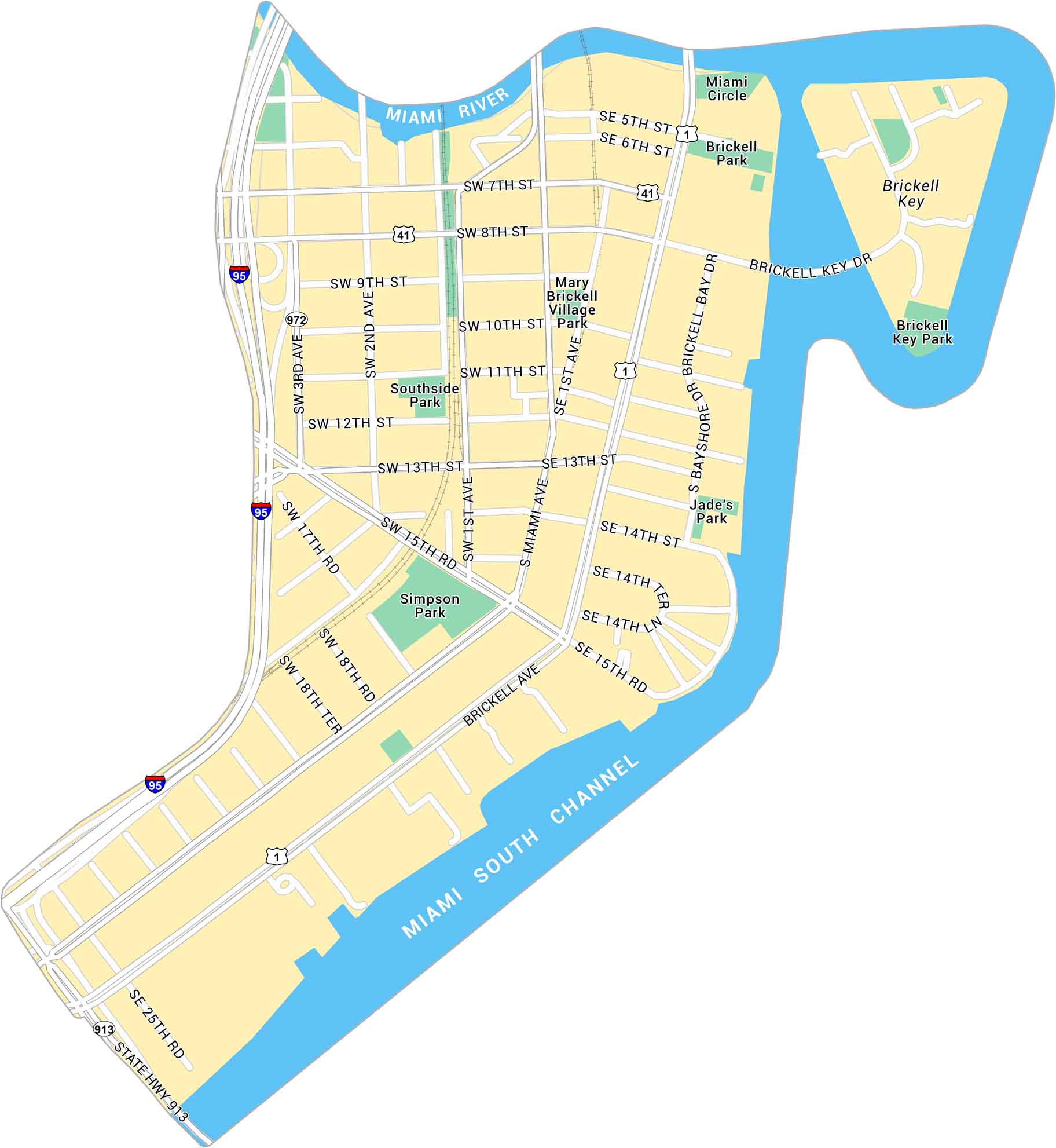
Take a look at our map of Brickell, Miami’s sleek financial hub along Biscayne Bay. You’ll find main roads, Brickell Key and local parks.
Map Information
Miami Neighborhood Maps
See our neighborhood maps for a closer look of the city.

On the Map
Interstates/Highways: I-95, US Hwy 1, State Rte 41, State Rte 972, State Hwy 913 Major Roads: Brickell Ave, Brickell Key Dr, Bayshore Dr, Brickell Bay Dr, Miami Ave, 1st Ave, 2nd Ave, 3rd Ave, 13th St, 7th St, 8th St, 9th St, 10th St, 11th St, 12th St, 5th St, 6th St, 15th Rd, 17th Rd, 18th Rd Channels/Rivers: Miami River, Miami South Channel Parks: Simpson Park, Southside Park, Brickell Park, Brickell Key Park, Mary Brickell Village Park, Jade’s Park Landmarks: Miami Circle, Brickell KeyFlorida City Maps
Chart your course through Miami and Florida’s cities


