Delmarva Peninsula Map
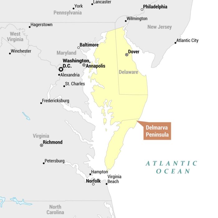
See the Delmarva Peninsula with our map. The peninsula gets its name from the three states that share it – Delaware, Maryland, and Virginia.
See the Delmarva Peninsula with our map. The peninsula gets its name from the three states that share it – Delaware, Maryland, and Virginia.
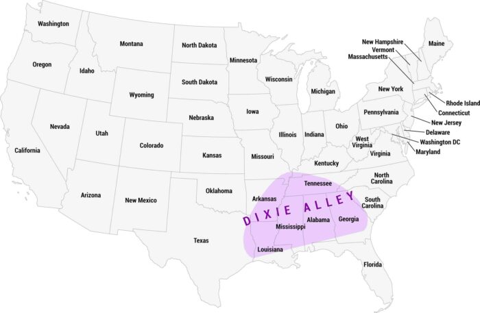
Dixie Alley is a region of the southern United States prone to deadly tornadoes. It’s especially dangerous due to its higher population.
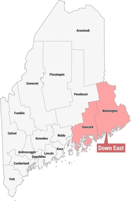
Check out our county map of Maine showing the Down East region in pink. This region is across the eastern portion of the state.
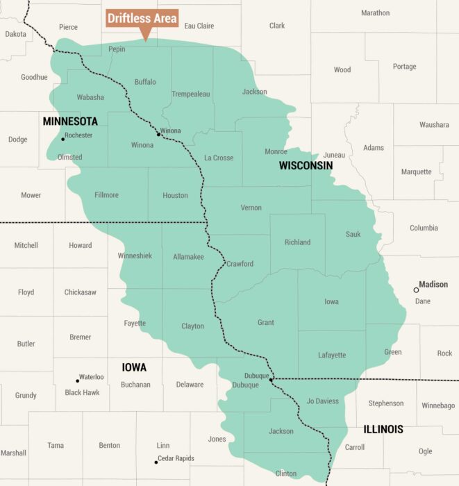
Here’s a county map highlighting the Driftless Area. This is a distinctive unglaciated region spanning four states in the upper Midwest.
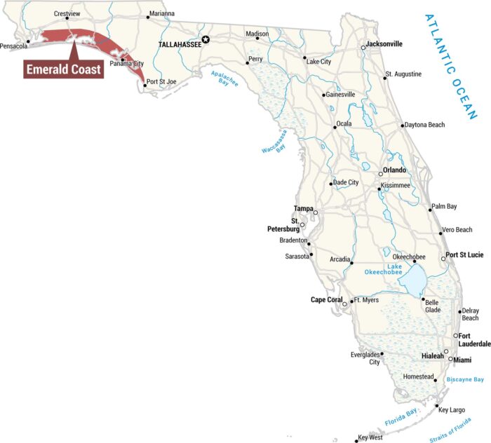
Our map displays the Emerald Coast along the northwestern Panhandle coastline. This region stretches along the Gulf Coast.
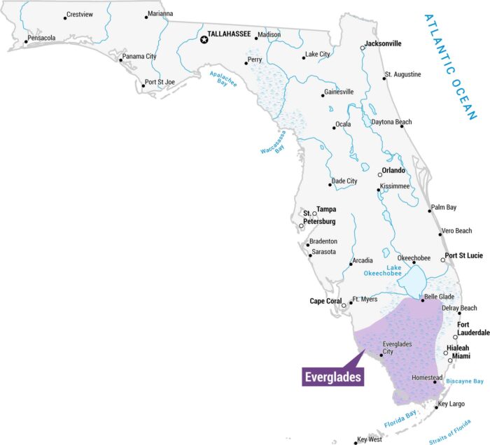
Get to know the Everglades with our Florida state map. You’ll find it in the southern tip of the state through the Florida Keys.
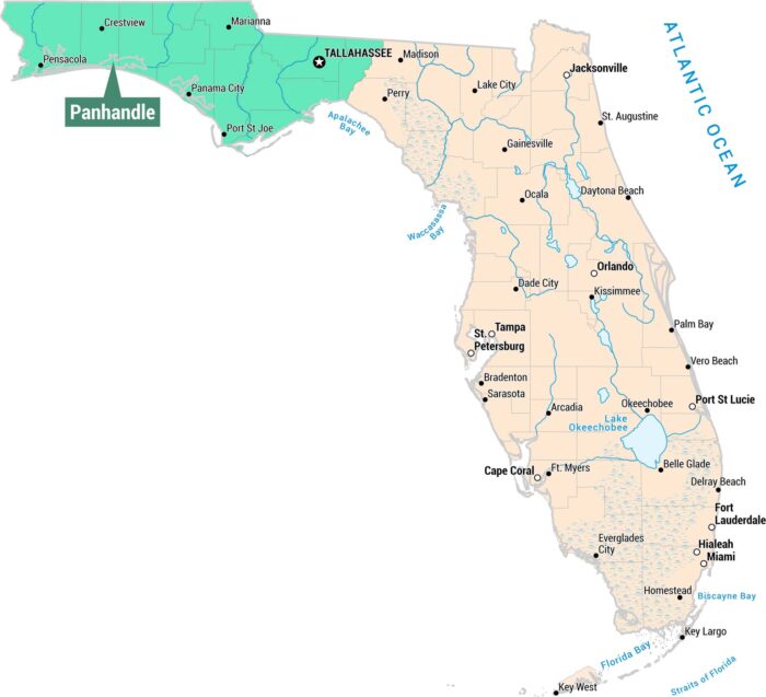
As you can see, our map displays the Panhandle region in the northwestern portion of Florida. We’ve included cities, waterways, and bays.
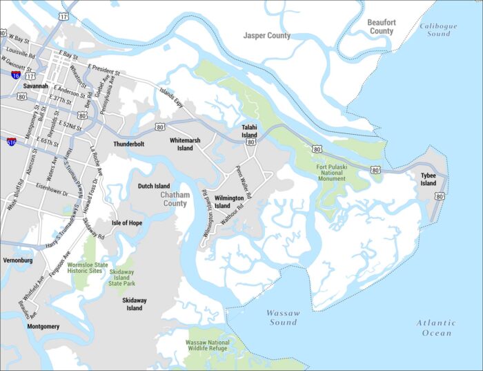
See our detailed map of the Golden Isles region centered on Savannah, Georgia and its barrier islands, coastal waterways, and marshlands.
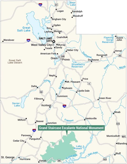
Here’s our Grand Staircase Escalante National Monument map in teal. It’s located in the southern portion of Utah.
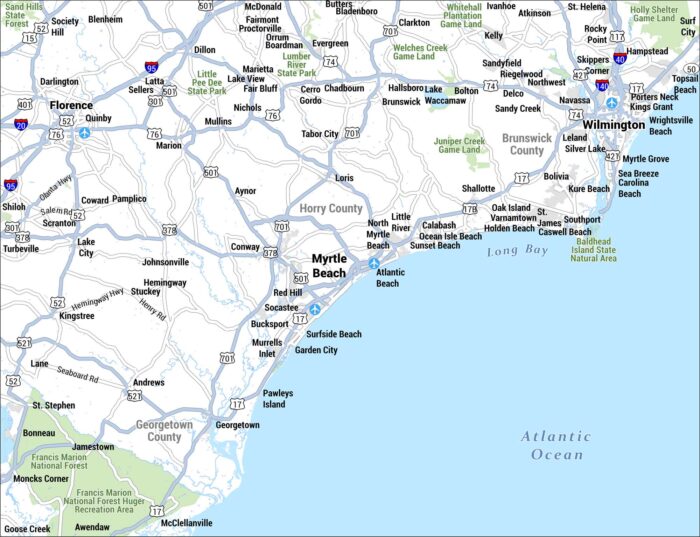
This is a detailed street-level map of the Grand Strand region on the South Carolina and North Carolina coastline, centered on Myrtle Beach.
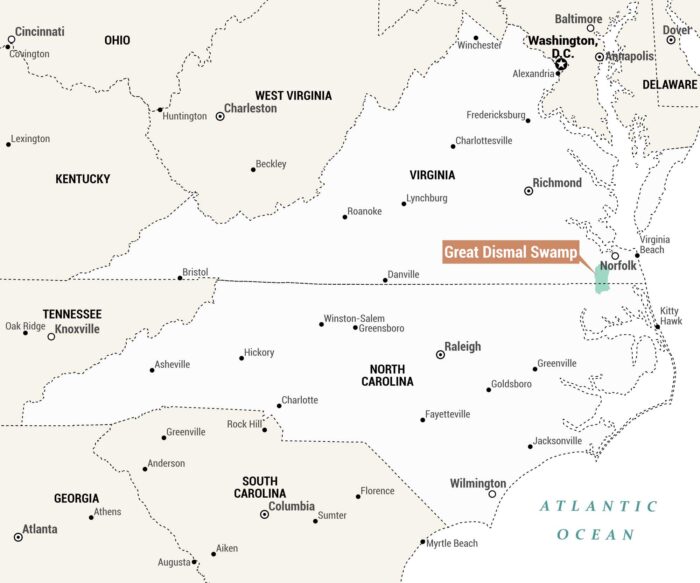
The Great Dismal Swamp is situated on the Virginia-North Carolina border near Norfolk and Virginia Beach. Our map shows this feature in teal.
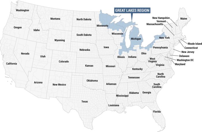
This map highlights the Great Lakes Region in blue, identified by a labeled callout box at the top. We’re showing all other states in gray.
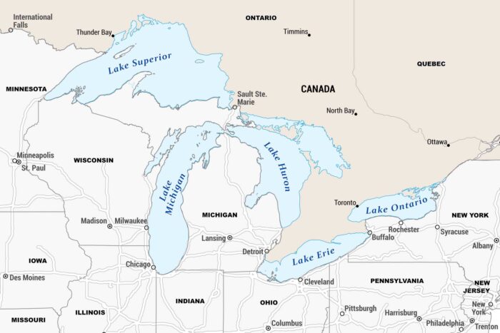
Our map is centered on the Great Lakes, showcasing all five lakes spanning the US-Canada border with states, provinces and major cities.

Our map displays the Great Plains in pink. In general, this region stretches in a north-to-south band through the center of the country.
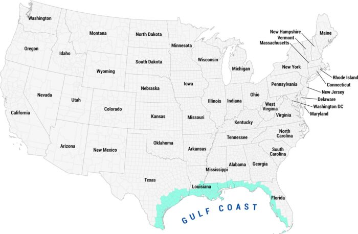
See our Gulf Coast map highlighted in teal along the southern coastline. This region sweeps from Texas and down through Florida.