Grand Staircase Map
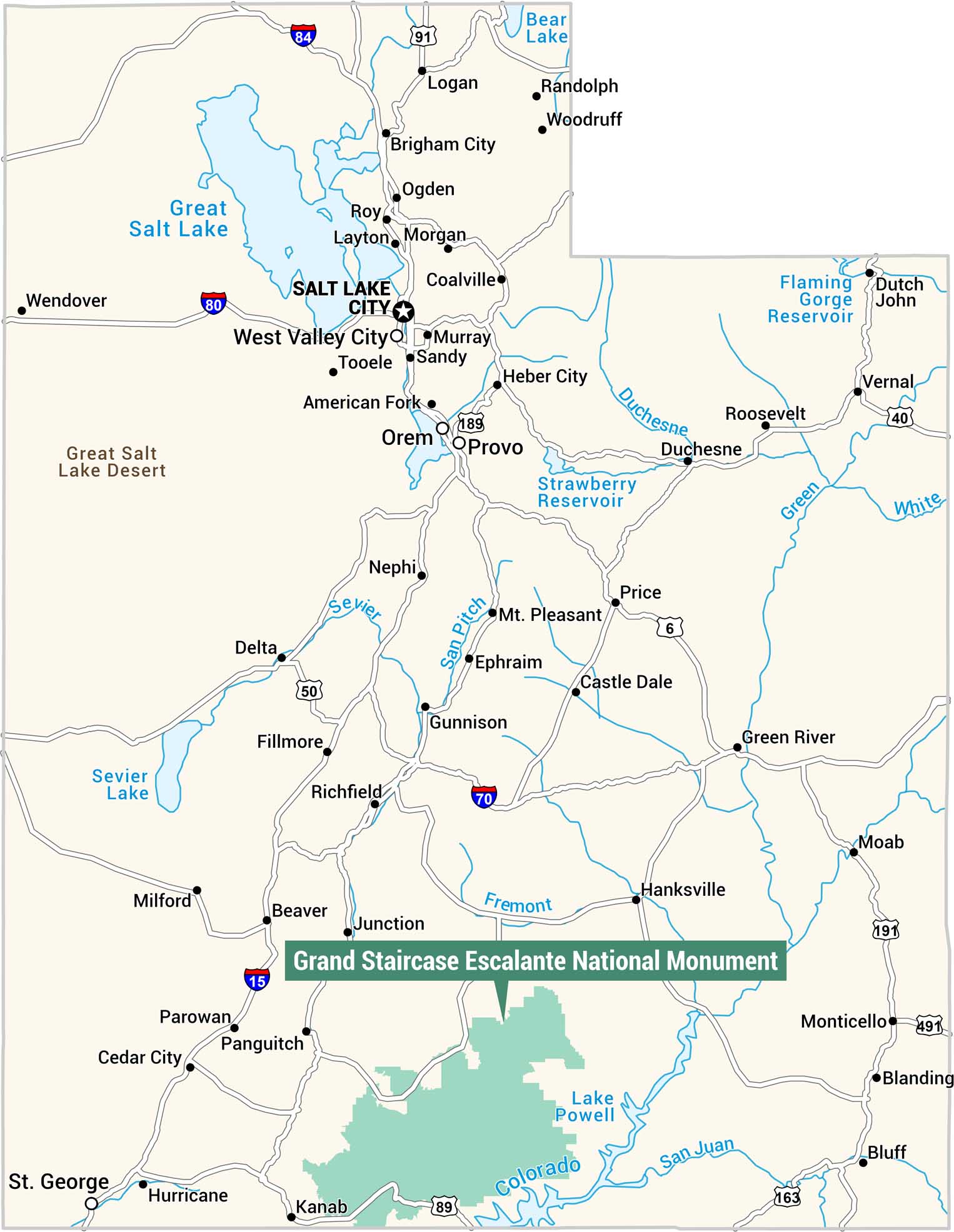
Here’s our Grand Staircase Escalante National Monument map in teal. It’s located in the southern portion of the state, near the Arizona border. We also include cities, highways, rivers, and lakes in the state of Utah.
Map Information
On the Map
Nearest Cities: Kanab, Panguitch, Hanksville, Escalante, Junction Highways: I-15, I-70, I-80, I-84, US-6, US-40, US-50, US-89, US-163, US-191, US-491, UT-189 Other Cities: Salt Lake City, West Valley City, Provo, Orem, Ogden, Layton, Roy, Sandy, Murray, American Fork, Tooele, Heber City, Logan, Brigham City, Morgan, Coalville, Wendover, Nephi, Delta, Fillmore, Richfield, Gunnison, Ephraim, Mt. Pleasant, Castle Dale, Price, Green River, Moab, Monticello, Blanding, Bluff, Beaver, Milford, Parowan, Cedar City, St. George, Hurricane, Vernal, Roosevelt, Duchesne, Randolph, Woodruff, Dutch John Major Rivers: Sevier, San Pitch, Duchesne, Fremont, Green, White, Colorado, San Juan Lakes/Reservoirs: Great Salt Lake, Bear Lake, Strawberry Reservoir, Flaming Gorge Reservoir, Sevier Lake, Lake PowellReferences
Natural Region Maps
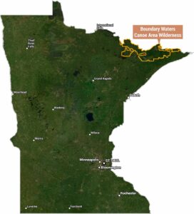
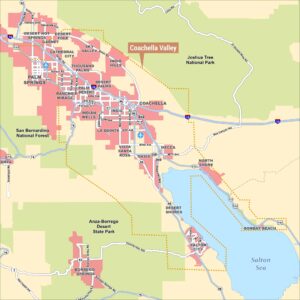
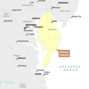
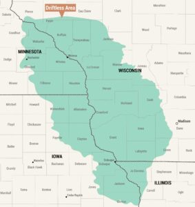
Geographic landforms, wilderness zones, deserts, mountain ranges, and terrain.